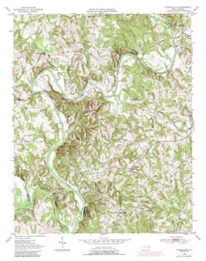
Churchland Topo Map North Carolina
To zoom in, hover over the map of Churchland
USGS Topo Quad 35080g4 - 1:24,000 scale
| Topo Map Name: | Churchland |
| USGS Topo Quad ID: | 35080g4 |
| Print Size: | ca. 21 1/4" wide x 27" high |
| Southeast Coordinates: | 35.75° N latitude / 80.375° W longitude |
| Map Center Coordinates: | 35.8125° N latitude / 80.4375° W longitude |
| U.S. State: | NC |
| Filename: | o35080g4.jpg |
| Download Map JPG Image: | Churchland topo map 1:24,000 scale |
| Map Type: | Topographic |
| Topo Series: | 7.5´ |
| Map Scale: | 1:24,000 |
| Source of Map Images: | United States Geological Survey (USGS) |
| Alternate Map Versions: |
Churchland NC 1950, updated 1973 Download PDF Buy paper map Churchland NC 1950, updated 1980 Download PDF Buy paper map Churchland NC 1950, updated 1987 Download PDF Buy paper map Churchland NC 1951 Download PDF Buy paper map Churchland NC 1977, updated 1979 Download PDF Buy paper map Churchland NC 2000, updated 2003 Download PDF Buy paper map Churchland NC 2010 Download PDF Buy paper map Churchland NC 2013 Download PDF Buy paper map Churchland NC 2016 Download PDF Buy paper map |
1:24,000 Topo Quads surrounding Churchland
> Back to 35080e1 at 1:100,000 scale
> Back to 35080a1 at 1:250,000 scale
> Back to U.S. Topo Maps home
Churchland topo map: Gazetteer
Churchland: Bends
Horseshoe Neck elevation 223m 731′Churchland: Crossings
Clicks Ferry (historical) elevation 193m 633′Ives Ferry (historical) elevation 191m 626′
Churchland: Dams
Forest Lake Dam elevation 210m 688′Plantation Lake Dam elevation 213m 698′
Staley Lake Dam elevation 223m 731′
Churchland: Parks
Daniel Boone State Park elevation 212m 695′Churchland: Populated Places
Churchland elevation 255m 836′Clinton elevation 202m 662′
Jubilee elevation 241m 790′
Jubilee Acres elevation 243m 797′
Martins Store elevation 228m 748′
Petersville elevation 228m 748′
Churchland: Reservoirs
Forest Lake elevation 210m 688′Plantation Lake elevation 213m 698′
Staley Lake elevation 223m 731′
Churchland: Streams
Cody Creek elevation 193m 633′Dutchman Creek elevation 193m 633′
Dykers Creek elevation 200m 656′
Farabee Creek elevation 190m 623′
Gobble Creek elevation 195m 639′
Hartley Creek elevation 206m 675′
Lick Run elevation 197m 646′
Mill Creek elevation 194m 636′
No Creek elevation 195m 639′
Peeler Creek elevation 194m 636′
Reedy Creek elevation 194m 636′
Sandy Creek elevation 206m 675′
Second Creek elevation 191m 626′
Simerson Creek elevation 190m 623′
Swan Creek elevation 194m 636′
Tanyard Creek elevation 192m 629′
Churchland digital topo map on disk
Buy this Churchland topo map showing relief, roads, GPS coordinates and other geographical features, as a high-resolution digital map file on DVD:
South Carolina, Western North Carolina & Northeastern Georgia
Buy digital topo maps: South Carolina, Western North Carolina & Northeastern Georgia


