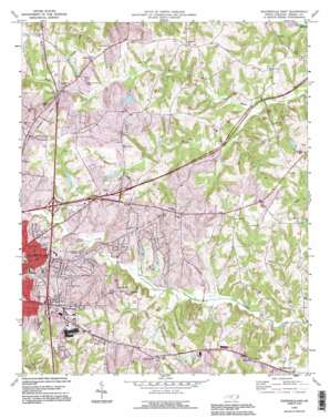
Statesville East Topo Map North Carolina
To zoom in, hover over the map of Statesville East
USGS Topo Quad 35080g7 - 1:24,000 scale
| Topo Map Name: | Statesville East |
| USGS Topo Quad ID: | 35080g7 |
| Print Size: | ca. 21 1/4" wide x 27" high |
| Southeast Coordinates: | 35.75° N latitude / 80.75° W longitude |
| Map Center Coordinates: | 35.8125° N latitude / 80.8125° W longitude |
| U.S. State: | NC |
| Filename: | o35080g7.jpg |
| Download Map JPG Image: | Statesville East topo map 1:24,000 scale |
| Map Type: | Topographic |
| Topo Series: | 7.5´ |
| Map Scale: | 1:24,000 |
| Source of Map Images: | United States Geological Survey (USGS) |
| Alternate Map Versions: |
Statesville East NC 1969, updated 1973 Download PDF Buy paper map Statesville East NC 1993, updated 1995 Download PDF Buy paper map Statesville East NC 2002, updated 2005 Download PDF Buy paper map Statesville East NC 2010 Download PDF Buy paper map Statesville East NC 2013 Download PDF Buy paper map Statesville East NC 2016 Download PDF Buy paper map |
1:24,000 Topo Quads surrounding Statesville East
> Back to 35080e1 at 1:100,000 scale
> Back to 35080a1 at 1:250,000 scale
> Back to U.S. Topo Maps home
Statesville East topo map: Gazetteer
Statesville East: Dams
Brookdale Lake Dam elevation 259m 849′Crawford Dam elevation 254m 833′
Hatfield Association Lake Dam elevation 263m 862′
Hawthorne Dam Lower elevation 253m 830′
Hawthorne Dam Upper elevation 250m 820′
Martin Dam elevation 260m 853′
Statesville Flour Mill Dam elevation 257m 843′
William L Walker Dam elevation 252m 826′
Wilson Brothers Dam Number One elevation 250m 820′
Wilson Brothers Dam Number Two elevation 256m 839′
Statesville East: Populated Places
Baymount Meadows elevation 267m 875′Bellwood elevation 266m 872′
Belmont elevation 279m 915′
Berkshire Hills elevation 266m 872′
Broadview elevation 261m 856′
Brookgreen elevation 264m 866′
Brookmeade elevation 254m 833′
Camelot Acres elevation 283m 928′
Cedar Hills elevation 277m 908′
Cloaninger elevation 266m 872′
Dal-Wan Heights elevation 250m 820′
Danbury Forest elevation 283m 928′
East Brook elevation 257m 843′
Eastfield Estates elevation 261m 856′
Eastover Acres elevation 250m 820′
Eastside elevation 258m 846′
Elmwood elevation 256m 839′
Foxcroft Apartments elevation 279m 915′
Glenn Echo elevation 264m 866′
Green Acres elevation 264m 866′
Ian Joy Acres elevation 256m 839′
Iredell Heights elevation 284m 931′
Matthew (historical) elevation 248m 813′
Meadow View elevation 270m 885′
Mitchell Aire elevation 260m 853′
Nelly Green Estates elevation 261m 856′
Old Farm elevation 242m 793′
Ourdell elevation 266m 872′
Shannon Acres elevation 252m 826′
Sherwood Forest elevation 284m 931′
Signal Hill Apartments elevation 266m 872′
Valley Stream elevation 262m 859′
Wildwood Park elevation 272m 892′
Statesville East: Reservoirs
Brookdale Lake elevation 259m 849′Hatfield Association Lake elevation 263m 862′
Hawthorne Lake elevation 253m 830′
Noname elevation 252m 826′
Wilson Brothers Lake Number One elevation 250m 820′
Wilson Brothers Lake Number Two elevation 256m 839′
Statesville East: Streams
Beaver Creek elevation 221m 725′Statesville East digital topo map on disk
Buy this Statesville East topo map showing relief, roads, GPS coordinates and other geographical features, as a high-resolution digital map file on DVD:
South Carolina, Western North Carolina & Northeastern Georgia
Buy digital topo maps: South Carolina, Western North Carolina & Northeastern Georgia


