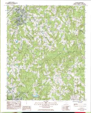
Clover Topo Map South Carolina
To zoom in, hover over the map of Clover
USGS Topo Quad 35081a2 - 1:24,000 scale
| Topo Map Name: | Clover |
| USGS Topo Quad ID: | 35081a2 |
| Print Size: | ca. 21 1/4" wide x 27" high |
| Southeast Coordinates: | 35° N latitude / 81.125° W longitude |
| Map Center Coordinates: | 35.0625° N latitude / 81.1875° W longitude |
| U.S. State: | SC |
| Filename: | o35081a2.jpg |
| Download Map JPG Image: | Clover topo map 1:24,000 scale |
| Map Type: | Topographic |
| Topo Series: | 7.5´ |
| Map Scale: | 1:24,000 |
| Source of Map Images: | United States Geological Survey (USGS) |
| Alternate Map Versions: |
Clover SC 1985, updated 1985 Download PDF Buy paper map Clover SC 2011 Download PDF Buy paper map Clover SC 2014 Download PDF Buy paper map |
1:24,000 Topo Quads surrounding Clover
> Back to 35081a1 at 1:100,000 scale
> Back to 35080a1 at 1:250,000 scale
> Back to U.S. Topo Maps home
Clover topo map: Gazetteer
Clover: Airports
Bethel-Lake Wylie Airport elevation 217m 711′Clover: Bridges
John B Harvey Bridge elevation 189m 620′Clover: Dams
Belton Pond Dam D-3660 elevation 224m 734′South Carolina Noname 46005 D-3678 Dam elevation 223m 731′
South Carolina Noname 46008 D-3659 Dam elevation 217m 711′
South Carolina Noname 46023 D-3658 Dam elevation 218m 715′
Clover: Populated Places
Bethel (historical) elevation 220m 721′Clover elevation 258m 846′
English Gardens elevation 199m 652′
Lincoln Estates elevation 229m 751′
Poplar Acres elevation 216m 708′
Clover: Post Offices
Clover Post Office elevation 255m 836′Clover: Reservoirs
Fishing Creek Watershed Dam Number One elevation 217m 711′Clover: Streams
Calabash Branch elevation 193m 633′Camp Run elevation 189m 620′
Grist Branch elevation 187m 613′
Johnson Branch elevation 198m 649′
Morris Branch elevation 203m 666′
Rock Branch elevation 191m 626′
Walker Branch elevation 208m 682′
Clover digital topo map on disk
Buy this Clover topo map showing relief, roads, GPS coordinates and other geographical features, as a high-resolution digital map file on DVD:
South Carolina, Western North Carolina & Northeastern Georgia
Buy digital topo maps: South Carolina, Western North Carolina & Northeastern Georgia


