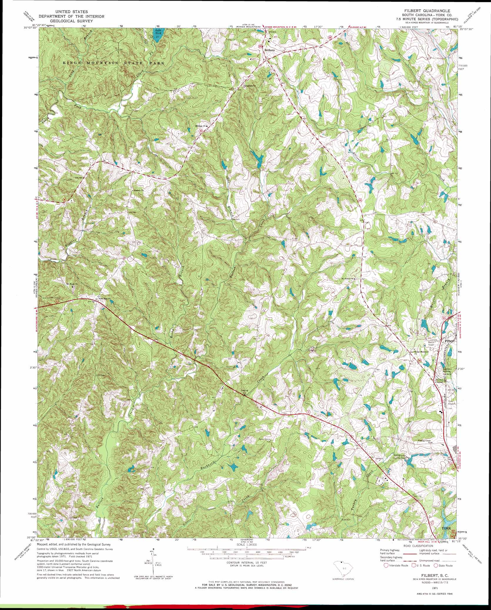
Filbert Topo Map South Carolina
To zoom in, hover over the map of Filbert
USGS Topo Quad 35081a3 - 1:24,000 scale
| Topo Map Name: | Filbert |
| USGS Topo Quad ID: | 35081a3 |
| Print Size: | ca. 21 1/4" wide x 27" high |
| Southeast Coordinates: | 35° N latitude / 81.25° W longitude |
| Map Center Coordinates: | 35.0625° N latitude / 81.3125° W longitude |
| U.S. State: | SC |
| Filename: | o35081a3.jpg |
| Download Map JPG Image: | Filbert topo map 1:24,000 scale |
| Map Type: | Topographic |
| Topo Series: | 7.5´ |
| Map Scale: | 1:24,000 |
| Source of Map Images: | United States Geological Survey (USGS) |
| Alternate Map Versions: |
Filbert SC 1971, updated 1973 Download PDF Buy paper map Filbert SC 2011 Download PDF Buy paper map Filbert SC 2014 Download PDF Buy paper map |
1:24,000 Topo Quads surrounding Filbert
Shelby |
Waco |
Bessemer City |
Gastonia North |
Mount Holly |
Blacksburg North |
Grover |
Kings Mountain |
Gastonia South |
Belmont |
Blacksburg South |
Kings Creek |
Filbert |
Clover |
Lake Wylie |
Wilkinsville |
Hickory Grove |
Sharon |
Tirzah |
Rock Hill West |
Kelton |
Lockhart |
Armenia |
Lowrys |
Edgemoor |
> Back to 35081a1 at 1:100,000 scale
> Back to 35080a1 at 1:250,000 scale
> Back to U.S. Topo Maps home
Filbert topo map: Gazetteer
Filbert: Airports
York Airport elevation 235m 770′Filbert: Dams
South Carolina Noname 46002 D-3640 Dam elevation 201m 659′South Carolina Noname 46003 D-1215 Dam elevation 195m 639′
South Carolina Noname 46006 D-1227 Dam elevation 210m 688′
South Carolina Noname 46030 D-3642 Dam elevation 223m 731′
Spring Lake Country Club Dam D-1226 elevation 214m 702′
Warlick Pond Dam D-3641 elevation 216m 708′
Filbert: Populated Places
Beersheba elevation 218m 715′Bethany elevation 250m 820′
Filbert elevation 244m 800′
Zadok (historical) elevation 241m 790′
Filbert: Reservoirs
Adams Lake elevation 195m 639′Lake York elevation 201m 659′
Smiths Pond elevation 223m 731′
Upper York Reservoir elevation 210m 688′
Filbert: Streams
Gin Branch elevation 179m 587′Long Branch elevation 184m 603′
Rocky Branch elevation 163m 534′
Filbert: Summits
Kings Mountain Church elevation 246m 807′Filbert digital topo map on disk
Buy this Filbert topo map showing relief, roads, GPS coordinates and other geographical features, as a high-resolution digital map file on DVD:
South Carolina, Western North Carolina & Northeastern Georgia
Buy digital topo maps: South Carolina, Western North Carolina & Northeastern Georgia