Kings Creek Topo Map South Carolina
To zoom in, hover over the map of Kings Creek
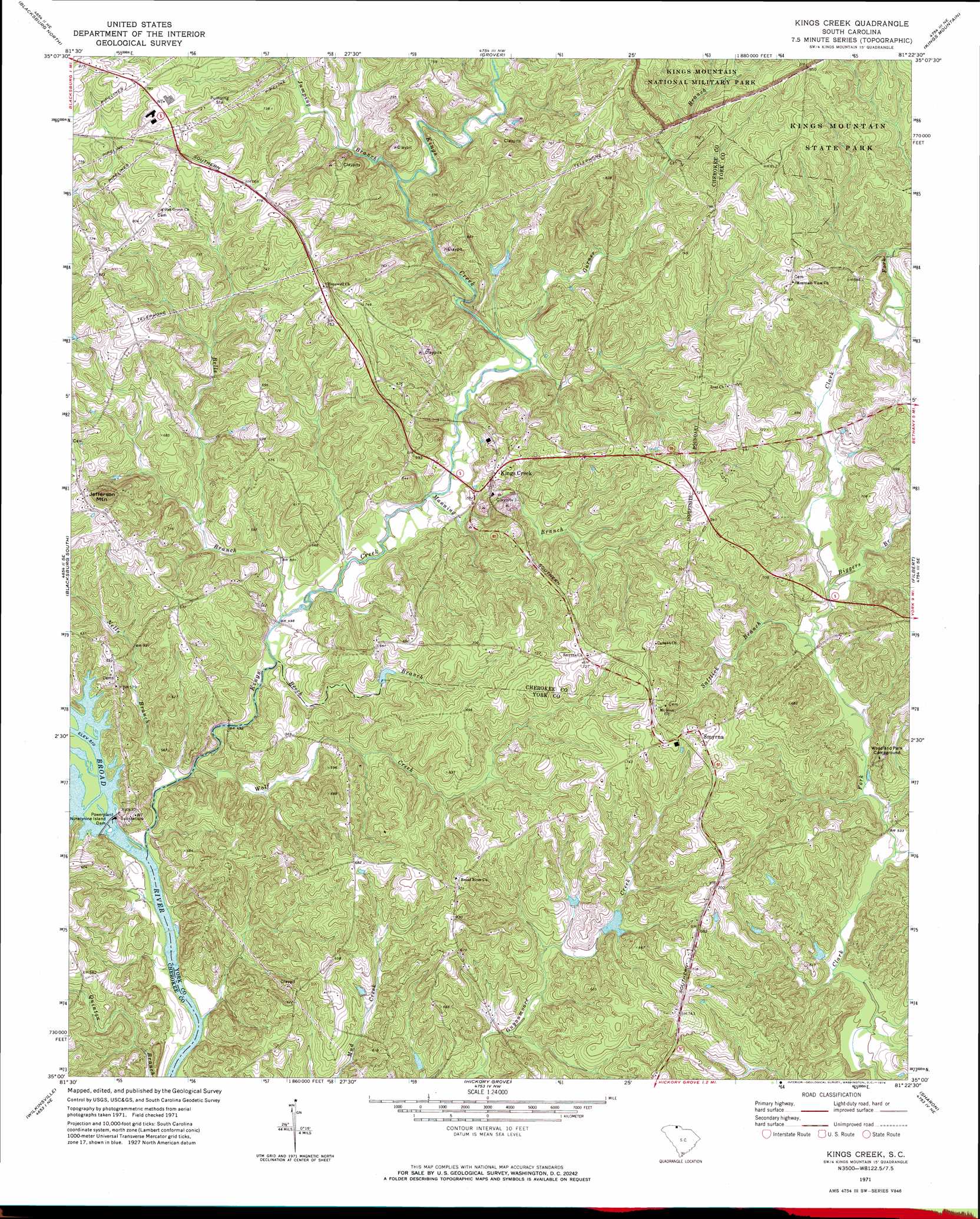
USGS Topo Quad 35081a4 - 1:24,000 scale
| Topo Map Name: | Kings Creek |
| USGS Topo Quad ID: | 35081a4 |
| Print Size: | ca. 21 1/4" wide x 27" high |
| Southeast Coordinates: | 35° N latitude / 81.375° W longitude |
| Map Center Coordinates: | 35.0625° N latitude / 81.4375° W longitude |
| U.S. State: | SC |
| Filename: | o35081a4.jpg |
| Download Map JPG Image: | Kings Creek topo map 1:24,000 scale |
| Map Type: | Topographic |
| Topo Series: | 7.5´ |
| Map Scale: | 1:24,000 |
| Source of Map Images: | United States Geological Survey (USGS) |
| Alternate Map Versions: |
Kings Creek SC 1971, updated 1974 Download PDF Buy paper map Kings Creek SC 1971, updated 1974 Download PDF Buy paper map Kings Creek SC 2011 Download PDF Buy paper map Kings Creek SC 2014 Download PDF Buy paper map |
1:24,000 Topo Quads surrounding Kings Creek
Boiling Springs North |
Shelby |
Waco |
Bessemer City |
Gastonia North |
Boiling Springs South |
Blacksburg North |
Grover |
Kings Mountain |
Gastonia South |
Gaffney |
Blacksburg South |
Kings Creek |
Filbert |
Clover |
Pacolet Mills |
Wilkinsville |
Hickory Grove |
Sharon |
Tirzah |
Jonesville |
Kelton |
Lockhart |
Armenia |
Lowrys |
> Back to 35081a1 at 1:100,000 scale
> Back to 35080a1 at 1:250,000 scale
> Back to U.S. Topo Maps home
Kings Creek topo map: Gazetteer
Kings Creek: Crossings
Bordens Ferry (historical) elevation 131m 429′Island Ferry (historical) elevation 131m 429′
Kings Creek: Dams
Modler Pond Dam D-3420 elevation 178m 583′Ninetynine Island Dam elevation 131m 429′
Ninety-Nine Islands Dam elevation 131m 429′
South Carolina Noname 46001 D-3638 Dam elevation 181m 593′
Kings Creek: Mines
Dixon Gold Mine elevation 198m 649′Southern Gold Mine elevation 183m 600′
Kings Creek: Populated Places
Kings Creek elevation 184m 603′Piedmont Springs elevation 205m 672′
Smyrna elevation 232m 761′
Wilburn (historical) elevation 234m 767′
Kings Creek: Reservoirs
Blackwell Lake elevation 181m 593′Ninety-Nine Island Reservoir elevation 131m 429′
Kings Creek: Streams
Beech Branch elevation 146m 479′Bells Branch elevation 147m 482′
Biggers Branch elevation 167m 547′
Dry Branch elevation 152m 498′
Garner Branch elevation 163m 534′
Jumping Branch elevation 176m 577′
Kings Creek elevation 133m 436′
Manning Branch elevation 154m 505′
Nells Branch elevation 134m 439′
Saltlick Branch elevation 163m 534′
Smith Creek elevation 130m 426′
Wolf Creek elevation 133m 436′
Kings Creek: Summits
Jefferson Mountain elevation 261m 856′Kings Creek digital topo map on disk
Buy this Kings Creek topo map showing relief, roads, GPS coordinates and other geographical features, as a high-resolution digital map file on DVD:
South Carolina, Western North Carolina & Northeastern Georgia
Buy digital topo maps: South Carolina, Western North Carolina & Northeastern Georgia