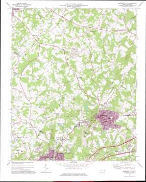
Bessemer City Topo Map North Carolina
To zoom in, hover over the map of Bessemer City
USGS Topo Quad 35081c3 - 1:24,000 scale
| Topo Map Name: | Bessemer City |
| USGS Topo Quad ID: | 35081c3 |
| Print Size: | ca. 21 1/4" wide x 27" high |
| Southeast Coordinates: | 35.25° N latitude / 81.25° W longitude |
| Map Center Coordinates: | 35.3125° N latitude / 81.3125° W longitude |
| U.S. State: | NC |
| Filename: | o35081c3.jpg |
| Download Map JPG Image: | Bessemer City topo map 1:24,000 scale |
| Map Type: | Topographic |
| Topo Series: | 7.5´ |
| Map Scale: | 1:24,000 |
| Source of Map Images: | United States Geological Survey (USGS) |
| Alternate Map Versions: |
Bessemer City NC 1973, updated 1976 Download PDF Buy paper map Bessemer City NC 1976, updated 1978 Download PDF Buy paper map Bessemer City NC 1993, updated 1996 Download PDF Buy paper map Bessemer City NC 2002, updated 2003 Download PDF Buy paper map Bessemer City NC 2010 Download PDF Buy paper map Bessemer City NC 2013 Download PDF Buy paper map Bessemer City NC 2016 Download PDF Buy paper map |
1:24,000 Topo Quads surrounding Bessemer City
> Back to 35081a1 at 1:100,000 scale
> Back to 35080a1 at 1:250,000 scale
> Back to U.S. Topo Maps home
Bessemer City topo map: Gazetteer
Bessemer City: Airports
Rhynes Airport elevation 243m 797′Bessemer City: Dams
Lagoon A Dam elevation 265m 869′Lagoon D Dam elevation 289m 948′
Long Creek Dam elevation 251m 823′
Martin Marietta Holding Lake Dam elevation 280m 918′
Sellers Lake Dam elevation 280m 918′
Storage Area Number Two Dam elevation 234m 767′
Bessemer City: Parks
Tryon County Courthouse Historical Site elevation 276m 905′Washington Park elevation 270m 885′
Bessemer City: Populated Places
Bessemer City elevation 275m 902′Perry elevation 302m 990′
Sandy Plains elevation 293m 961′
Sunnyside elevation 263m 862′
Tryon elevation 303m 994′
Vantine elevation 284m 931′
Bessemer City: Post Offices
Bessemer City Post Office elevation 271m 889′Bessemer City: Reservoirs
Bessemer City Reservoir elevation 251m 823′Lagoon A elevation 265m 869′
Lagoon D elevation 289m 948′
Martin Marietta Holding Lake elevation 280m 918′
Sellers Lake elevation 280m 918′
Storage Area Number Two elevation 234m 767′
Bessemer City: Ridges
Chestnut Ridge elevation 349m 1145′Bessemer City: Streams
Abernethy Creek elevation 214m 702′Bessemer City: Summits
Gamble Hill elevation 264m 866′Bessemer City digital topo map on disk
Buy this Bessemer City topo map showing relief, roads, GPS coordinates and other geographical features, as a high-resolution digital map file on DVD:
South Carolina, Western North Carolina & Northeastern Georgia
Buy digital topo maps: South Carolina, Western North Carolina & Northeastern Georgia


