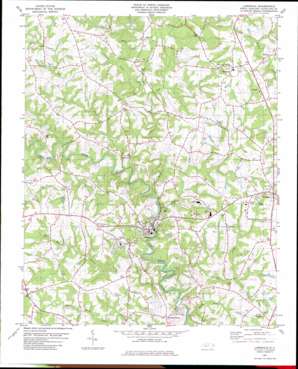
Lawndale Topo Map North Carolina
To zoom in, hover over the map of Lawndale
USGS Topo Quad 35081d5 - 1:24,000 scale
| Topo Map Name: | Lawndale |
| USGS Topo Quad ID: | 35081d5 |
| Print Size: | ca. 21 1/4" wide x 27" high |
| Southeast Coordinates: | 35.375° N latitude / 81.5° W longitude |
| Map Center Coordinates: | 35.4375° N latitude / 81.5625° W longitude |
| U.S. State: | NC |
| Filename: | o35081d5.jpg |
| Download Map JPG Image: | Lawndale topo map 1:24,000 scale |
| Map Type: | Topographic |
| Topo Series: | 7.5´ |
| Map Scale: | 1:24,000 |
| Source of Map Images: | United States Geological Survey (USGS) |
| Alternate Map Versions: |
Lawndale NC 1982, updated 1983 Download PDF Buy paper map Lawndale NC 2002, updated 2003 Download PDF Buy paper map Lawndale NC 2010 Download PDF Buy paper map Lawndale NC 2013 Download PDF Buy paper map Lawndale NC 2016 Download PDF Buy paper map |
1:24,000 Topo Quads surrounding Lawndale
> Back to 35081a1 at 1:100,000 scale
> Back to 35080a1 at 1:250,000 scale
> Back to U.S. Topo Maps home
Lawndale topo map: Gazetteer
Lawndale: Dams
Shufords Lake Dam elevation 300m 984′Stice Shoal Dam elevation 234m 767′
Lawndale: Lakes
Ross Pond elevation 298m 977′Lawndale: Populated Places
Belwood elevation 311m 1020′Campcall elevation 303m 994′
Double Shoals elevation 251m 823′
Fallston elevation 312m 1023′
Lawndale elevation 258m 846′
Rockdale elevation 290m 951′
Lawndale: Reservoirs
Shufords Fishing Lake elevation 300m 984′Stice Shoal Lake elevation 234m 767′
Lawndale: Streams
Adams Branch elevation 266m 872′Crooked Run Creek elevation 245m 803′
Grassy Branch elevation 247m 810′
Knob Creek elevation 243m 797′
Little Knob Creek elevation 256m 839′
Magness Creek elevation 229m 751′
Maple Creek elevation 238m 780′
Shoal Rock Creek elevation 225m 738′
Stoney Run Creek elevation 251m 823′
Lawndale digital topo map on disk
Buy this Lawndale topo map showing relief, roads, GPS coordinates and other geographical features, as a high-resolution digital map file on DVD:
South Carolina, Western North Carolina & Northeastern Georgia
Buy digital topo maps: South Carolina, Western North Carolina & Northeastern Georgia


