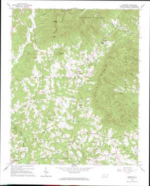
Sunshine Topo Map North Carolina
To zoom in, hover over the map of Sunshine
USGS Topo Quad 35081d7 - 1:24,000 scale
| Topo Map Name: | Sunshine |
| USGS Topo Quad ID: | 35081d7 |
| Print Size: | ca. 21 1/4" wide x 27" high |
| Southeast Coordinates: | 35.375° N latitude / 81.75° W longitude |
| Map Center Coordinates: | 35.4375° N latitude / 81.8125° W longitude |
| U.S. State: | NC |
| Filename: | o35081d7.jpg |
| Download Map JPG Image: | Sunshine topo map 1:24,000 scale |
| Map Type: | Topographic |
| Topo Series: | 7.5´ |
| Map Scale: | 1:24,000 |
| Source of Map Images: | United States Geological Survey (USGS) |
| Alternate Map Versions: |
Sunshine NC 1965, updated 1967 Download PDF Buy paper map Sunshine NC 2002, updated 2003 Download PDF Buy paper map Sunshine NC 2010 Download PDF Buy paper map Sunshine NC 2013 Download PDF Buy paper map Sunshine NC 2016 Download PDF Buy paper map |
1:24,000 Topo Quads surrounding Sunshine
> Back to 35081a1 at 1:100,000 scale
> Back to 35080a1 at 1:250,000 scale
> Back to U.S. Topo Maps home
Sunshine topo map: Gazetteer
Sunshine: Airports
Lebanon Field elevation 286m 938′Sunshine: Mines
Adkins Mine elevation 313m 1026′Sunshine: Populated Places
Sunshine elevation 336m 1102′Washburn elevation 317m 1040′
Sunshine: Ridges
Cherry Mountain elevation 592m 1942′Sunshine: Springs
Cooper Springs elevation 350m 1148′Sunshine: Streams
Heaveners Creek elevation 277m 908′Hunting Creek elevation 265m 869′
Mountain Creek elevation 280m 918′
Sunshine: Summits
Bridges Mountain elevation 464m 1522′Buck Hollow Mountain elevation 460m 1509′
Joshua Mountain elevation 515m 1689′
Lookadoo Mountain elevation 472m 1548′
Yellowtop Mountain elevation 689m 2260′
Sunshine digital topo map on disk
Buy this Sunshine topo map showing relief, roads, GPS coordinates and other geographical features, as a high-resolution digital map file on DVD:
South Carolina, Western North Carolina & Northeastern Georgia
Buy digital topo maps: South Carolina, Western North Carolina & Northeastern Georgia


