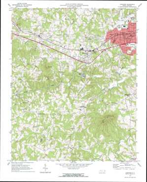
Longview Topo Map North Carolina
To zoom in, hover over the map of Longview
USGS Topo Quad 35081f4 - 1:24,000 scale
| Topo Map Name: | Longview |
| USGS Topo Quad ID: | 35081f4 |
| Print Size: | ca. 21 1/4" wide x 27" high |
| Southeast Coordinates: | 35.625° N latitude / 81.375° W longitude |
| Map Center Coordinates: | 35.6875° N latitude / 81.4375° W longitude |
| U.S. State: | NC |
| Filename: | o35081f4.jpg |
| Download Map JPG Image: | Longview topo map 1:24,000 scale |
| Map Type: | Topographic |
| Topo Series: | 7.5´ |
| Map Scale: | 1:24,000 |
| Source of Map Images: | United States Geological Survey (USGS) |
| Alternate Map Versions: |
Longview NC 1970, updated 1973 Download PDF Buy paper map Longview NC 1993, updated 1996 Download PDF Buy paper map Longview NC 2010 Download PDF Buy paper map Longview NC 2013 Download PDF Buy paper map Longview NC 2016 Download PDF Buy paper map |
1:24,000 Topo Quads surrounding Longview
> Back to 35081e1 at 1:100,000 scale
> Back to 35080a1 at 1:250,000 scale
> Back to U.S. Topo Maps home
Longview topo map: Gazetteer
Longview: Airports
Hickory Airport elevation 348m 1141′Hickory Municipal Airport elevation 350m 1148′
Longview: Bridges
Miller Bridge elevation 296m 971′Longview: Dams
Henry River Dam elevation 307m 1007′Longview: Populated Places
Advent Crossroads elevation 383m 1256′Drowning Creek (historical) elevation 338m 1108′
Hatterbrond (historical) elevation 323m 1059′
Henry River elevation 314m 1030′
Hildebran elevation 355m 1164′
Icard elevation 362m 1187′
Longview elevation 349m 1145′
Meadow Brook Village elevation 347m 1138′
Penelope elevation 349m 1145′
Propst Crossroads elevation 318m 1043′
Longview: Reservoirs
Henry River Lake elevation 307m 1007′Longview: Streams
Abee Creek elevation 300m 984′Camp Creek elevation 276m 905′
Tims Creek elevation 296m 971′
Longview: Summits
Baker Mountain elevation 530m 1738′Piney Mountain elevation 456m 1496′
Longview digital topo map on disk
Buy this Longview topo map showing relief, roads, GPS coordinates and other geographical features, as a high-resolution digital map file on DVD:
South Carolina, Western North Carolina & Northeastern Georgia
Buy digital topo maps: South Carolina, Western North Carolina & Northeastern Georgia


