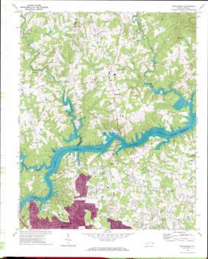
Bethlehem Topo Map North Carolina
To zoom in, hover over the map of Bethlehem
USGS Topo Quad 35081g3 - 1:24,000 scale
| Topo Map Name: | Bethlehem |
| USGS Topo Quad ID: | 35081g3 |
| Print Size: | ca. 21 1/4" wide x 27" high |
| Southeast Coordinates: | 35.75° N latitude / 81.25° W longitude |
| Map Center Coordinates: | 35.8125° N latitude / 81.3125° W longitude |
| U.S. State: | NC |
| Filename: | o35081g3.jpg |
| Download Map JPG Image: | Bethlehem topo map 1:24,000 scale |
| Map Type: | Topographic |
| Topo Series: | 7.5´ |
| Map Scale: | 1:24,000 |
| Source of Map Images: | United States Geological Survey (USGS) |
| Alternate Map Versions: |
Bethlehem NC 1970, updated 1973 Download PDF Buy paper map Bethlehem NC 1993, updated 1996 Download PDF Buy paper map Bethlehem NC 2010 Download PDF Buy paper map Bethlehem NC 2013 Download PDF Buy paper map Bethlehem NC 2016 Download PDF Buy paper map |
1:24,000 Topo Quads surrounding Bethlehem
> Back to 35081e1 at 1:100,000 scale
> Back to 35080a1 at 1:250,000 scale
> Back to U.S. Topo Maps home
Bethlehem topo map: Gazetteer
Bethlehem: Dams
Fox Dam elevation 323m 1059′Little River Dam elevation 294m 964′
Moretz Dam elevation 294m 964′
NC Noname Two-Hundred Thirty-Nine Dam elevation 359m 1177′
Rink Dam elevation 284m 931′
Bethlehem: Populated Places
Bethlehem elevation 344m 1128′Concord (historical) elevation 284m 931′
North Hickory elevation 315m 1033′
Petra Mills elevation 321m 1053′
Saint Stephens elevation 341m 1118′
Bethlehem: Reservoirs
Fox Lake elevation 323m 1059′Moretz Lake elevation 294m 964′
Rink Lake elevation 284m 931′
Shuford Pond elevation 294m 964′
Sims Pond elevation 359m 1177′
Bethlehem: Streams
Falling Creek elevation 283m 928′Gunpowder Creek elevation 284m 931′
Horseford Creek elevation 284m 931′
Isaac Creek elevation 284m 931′
Jumping Run elevation 289m 948′
Middle Little River elevation 283m 928′
Mill Creek elevation 284m 931′
Mountain Creek elevation 284m 931′
Rock Creek elevation 310m 1017′
Rock Creek elevation 289m 948′
Snow Creek elevation 283m 928′
Upper Little River elevation 283m 928′
Bethlehem: Summits
Sal Teague Hill elevation 462m 1515′Bethlehem digital topo map on disk
Buy this Bethlehem topo map showing relief, roads, GPS coordinates and other geographical features, as a high-resolution digital map file on DVD:
South Carolina, Western North Carolina & Northeastern Georgia
Buy digital topo maps: South Carolina, Western North Carolina & Northeastern Georgia


