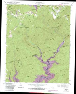
Reid Topo Map North Carolina
To zoom in, hover over the map of Reid
USGS Topo Quad 35082a8 - 1:24,000 scale
| Topo Map Name: | Reid |
| USGS Topo Quad ID: | 35082a8 |
| Print Size: | ca. 21 1/4" wide x 27" high |
| Southeast Coordinates: | 35° N latitude / 82.875° W longitude |
| Map Center Coordinates: | 35.0625° N latitude / 82.9375° W longitude |
| U.S. States: | NC, SC |
| Filename: | o35082a8.jpg |
| Download Map JPG Image: | Reid topo map 1:24,000 scale |
| Map Type: | Topographic |
| Topo Series: | 7.5´ |
| Map Scale: | 1:24,000 |
| Source of Map Images: | United States Geological Survey (USGS) |
| Alternate Map Versions: |
Reid NC 1935 Download PDF Buy paper map Reid NC 1946, updated 1956 Download PDF Buy paper map Reid NC 1946, updated 1967 Download PDF Buy paper map Reid NC 1946, updated 1972 Download PDF Buy paper map Reid NC 1946, updated 1991 Download PDF Buy paper map Reid NC 1947, updated 1947 Download PDF Buy paper map Reid NC 1997, updated 2001 Download PDF Buy paper map Reid NC 2011 Download PDF Buy paper map Reid NC 2013 Download PDF Buy paper map Reid NC 2016 Download PDF Buy paper map |
| FStopo: | US Forest Service topo Reid is available: Download FStopo PDF Download FStopo TIF |
1:24,000 Topo Quads surrounding Reid
> Back to 35082a1 at 1:100,000 scale
> Back to 35082a1 at 1:250,000 scale
> Back to U.S. Topo Maps home
Reid topo map: Gazetteer
Reid: Falls
Lower Falls elevation 548m 1797′Rainbow Falls elevation 805m 2641′
Toxaway Falls elevation 875m 2870′
Whitewater Falls elevation 338m 1108′
Windy Falls elevation 652m 2139′
Reid: Gaps
Bear Gap elevation 482m 1581′Hickory Gap elevation 604m 1981′
Line Rock Gap elevation 594m 1948′
Line Rock Gap elevation 598m 1961′
Tarkiln Gap elevation 856m 2808′
Turkeypen Gap elevation 575m 1886′
Reid: Parks
Gorges State Park elevation 586m 1922′Reid: Populated Places
Bear Wallow Hollow elevation 946m 3103′Bear Wallow Springs elevation 936m 3070′
Cane Brake elevation 339m 1112′
Oakland elevation 920m 3018′
Reid elevation 824m 2703′
Toxaway Falls elevation 906m 2972′
Union elevation 921m 3021′
Whitewater Pines elevation 940m 3083′
Reid: Reservoirs
Lake Toxaway elevation 903m 2962′Reid: Ridges
Grassy Ridge elevation 1014m 3326′Hogback elevation 944m 3097′
Long Spur Ridge elevation 855m 2805′
Narrow Rock Ridge elevation 690m 2263′
Reid: Streams
Auger Fork Creek elevation 393m 1289′Bear Creek elevation 344m 1128′
Bear Creek elevation 344m 1128′
Bearcamp Creek elevation 344m 1128′
Bearcamp Creek elevation 344m 1128′
Bearwallow Creek elevation 434m 1423′
Burlingame Creek elevation 900m 2952′
Cobb Creek elevation 344m 1128′
Cobb Creek elevation 344m 1128′
Coley Creek elevation 344m 1128′
Coley Creek elevation 344m 1128′
Devils Hole Creek elevation 344m 1128′
Eastatoe Ford elevation 572m 1876′
Horsepasture River elevation 344m 1128′
Horsepasture River elevation 344m 1128′
Indian Creek elevation 669m 2194′
Jackies Branch elevation 344m 1128′
James Creek elevation 881m 2890′
Laurel Fork Creek elevation 344m 1128′
Maple Spring Branch elevation 519m 1702′
Mill Creek elevation 344m 1128′
Morton Creek elevation 814m 2670′
Panther Branch elevation 512m 1679′
Reid Branch elevation 793m 2601′
Rock Creek elevation 345m 1131′
Rock Creek elevation 344m 1128′
Rock Creek elevation 894m 2933′
Toxaway Creek elevation 339m 1112′
Wright Creek elevation 344m 1128′
Reid: Summits
Bully Mountain elevation 614m 2014′Chestnut Mountain elevation 865m 2837′
Crossroads Mountain elevation 589m 1932′
Frozen Knob elevation 818m 2683′
Gallbuster Mountain elevation 638m 2093′
Grindstone Mountain elevation 643m 2109′
Hester Mountain elevation 477m 1564′
Laurel Fork Mountain elevation 780m 2559′
Licklog Mountain elevation 636m 2086′
Misery Mountain elevation 858m 2814′
Musterground Mountain elevation 707m 2319′
Puncheon Camp Mountain elevation 1092m 3582′
Rocky Knobs elevation 1141m 3743′
Roundtop elevation 1060m 3477′
Whitewater Mountain elevation 694m 2276′
Reid digital topo map on disk
Buy this Reid topo map showing relief, roads, GPS coordinates and other geographical features, as a high-resolution digital map file on DVD:
South Carolina, Western North Carolina & Northeastern Georgia
Buy digital topo maps: South Carolina, Western North Carolina & Northeastern Georgia


