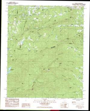
Saluda Topo Map South Carolina
To zoom in, hover over the map of Saluda
USGS Topo Quad 35082b3 - 1:24,000 scale
| Topo Map Name: | Saluda |
| USGS Topo Quad ID: | 35082b3 |
| Print Size: | ca. 21 1/4" wide x 27" high |
| Southeast Coordinates: | 35.125° N latitude / 82.25° W longitude |
| Map Center Coordinates: | 35.1875° N latitude / 82.3125° W longitude |
| U.S. States: | SC, NC |
| Filename: | o35082b3.jpg |
| Download Map JPG Image: | Saluda topo map 1:24,000 scale |
| Map Type: | Topographic |
| Topo Series: | 7.5´ |
| Map Scale: | 1:24,000 |
| Source of Map Images: | United States Geological Survey (USGS) |
| Alternate Map Versions: |
Saluda NC 1983, updated 1983 Download PDF Buy paper map Saluda NC 1983, updated 1992 Download PDF Buy paper map Saluda NC 2011 Download PDF Buy paper map Saluda NC 2013 Download PDF Buy paper map Saluda NC 2016 Download PDF Buy paper map |
1:24,000 Topo Quads surrounding Saluda
> Back to 35082a1 at 1:100,000 scale
> Back to 35082a1 at 1:250,000 scale
> Back to U.S. Topo Maps home
Saluda topo map: Gazetteer
Saluda: Cliffs
Cedar Cliff elevation 619m 2030′Glassy Rock elevation 773m 2536′
Saluda: Dams
John T Coates Dam elevation 613m 2011′Lake Shelia Dam elevation 658m 2158′
Melrose Mountain Dam Number One elevation 693m 2273′
Melrose Mountain Dam Number Two elevation 678m 2224′
Orchard Lake Dam elevation 639m 2096′
Saluda: Falls
Pearsons Falls elevation 521m 1709′Saluda: Gaps
Howard Gap elevation 566m 1856′Trammel Gap elevation 675m 2214′
Trammel Gap elevation 669m 2194′
Vaughns Gap elevation 788m 2585′
Saluda: Pillars
Round Rock elevation 800m 2624′Saluda: Populated Places
Melrose elevation 456m 1496′Mountain Page elevation 664m 2178′
Saluda elevation 639m 2096′
Valhalla elevation 293m 961′
Saluda: Reservoirs
Bullseye Orchard Lake elevation 639m 2096′Lake Shelia elevation 658m 2158′
Melrose Lake elevation 679m 2227′
Melrose Mountain Lake Number One elevation 693m 2273′
Melrose Mountain Lake Number Two elevation 678m 2224′
Warrior Mountain Lake elevation 605m 1984′
Saluda: Ridges
Bailey Ridge elevation 571m 1873′Brushy Ridge elevation 775m 2542′
Chestnut Ridge elevation 520m 1706′
Dughill Ridge elevation 455m 1492′
Hooker Ridge elevation 603m 1978′
Rocky Spur elevation 827m 2713′
Saluda: Streams
Bear Creek elevation 430m 1410′Big Fall Creek elevation 346m 1135′
Brice Creek elevation 381m 1250′
Brushy Creek elevation 376m 1233′
Colt Creek elevation 463m 1519′
Fork Creek elevation 450m 1476′
Joels Creek elevation 534m 1751′
Little Fall Creek elevation 317m 1040′
Shop Creek elevation 602m 1975′
Spring Branch elevation 657m 2155′
Vira Branch elevation 610m 2001′
Saluda: Summits
Alec Mountain elevation 725m 2378′Big Warrior Mountain elevation 732m 2401′
Blakes Peak elevation 727m 2385′
Bryant Mountain elevation 921m 3021′
Buck Mountain elevation 674m 2211′
Cedar Mountain elevation 635m 2083′
Fuller Mountain elevation 703m 2306′
Glassy Mountain elevation 848m 2782′
Hogback Mountain elevation 978m 3208′
Hoghead Mountain elevation 893m 2929′
Humes Mountain elevation 653m 2142′
Little Mountain elevation 643m 2109′
Little Warrior Mountain elevation 730m 2395′
Melrose Mountain elevation 789m 2588′
Mine Mountain elevation 721m 2365′
Piney Mountain elevation 515m 1689′
Rich Mountain elevation 922m 3024′
Round Mountain elevation 737m 2417′
Squirrel Mountain elevation 493m 1617′
Saluda digital topo map on disk
Buy this Saluda topo map showing relief, roads, GPS coordinates and other geographical features, as a high-resolution digital map file on DVD:
South Carolina, Western North Carolina & Northeastern Georgia
Buy digital topo maps: South Carolina, Western North Carolina & Northeastern Georgia


