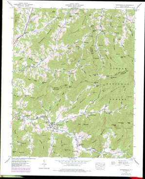
Barnardsville Topo Map North Carolina
To zoom in, hover over the map of Barnardsville
USGS Topo Quad 35082g4 - 1:24,000 scale
| Topo Map Name: | Barnardsville |
| USGS Topo Quad ID: | 35082g4 |
| Print Size: | ca. 21 1/4" wide x 27" high |
| Southeast Coordinates: | 35.75° N latitude / 82.375° W longitude |
| Map Center Coordinates: | 35.8125° N latitude / 82.4375° W longitude |
| U.S. State: | NC |
| Filename: | o35082g4.jpg |
| Download Map JPG Image: | Barnardsville topo map 1:24,000 scale |
| Map Type: | Topographic |
| Topo Series: | 7.5´ |
| Map Scale: | 1:24,000 |
| Source of Map Images: | United States Geological Survey (USGS) |
| Alternate Map Versions: |
Barnardsville NC 1935 Download PDF Buy paper map Barnardsville NC 1946, updated 1958 Download PDF Buy paper map Barnardsville NC 1946, updated 1965 Download PDF Buy paper map Barnardsville NC 1946, updated 1975 Download PDF Buy paper map Barnardsville NC 1946, updated 1979 Download PDF Buy paper map Barnardsville NC 1947, updated 1947 Download PDF Buy paper map Barnardsville NC 1947, updated 1947 Download PDF Buy paper map Barnardsville NC 1998, updated 2001 Download PDF Buy paper map Barnardsville NC 2011 Download PDF Buy paper map Barnardsville NC 2013 Download PDF Buy paper map Barnardsville NC 2016 Download PDF Buy paper map |
| FStopo: | US Forest Service topo Barnardsville is available: Download FStopo PDF Download FStopo TIF |
1:24,000 Topo Quads surrounding Barnardsville
> Back to 35082e1 at 1:100,000 scale
> Back to 35082a1 at 1:250,000 scale
> Back to U.S. Topo Maps home
Barnardsville topo map: Gazetteer
Barnardsville: Gaps
Anderson Gap elevation 880m 2887′Bobs Gap elevation 855m 2805′
Bradley Gap elevation 876m 2874′
Campground Gap elevation 1302m 4271′
Fort Gap elevation 729m 2391′
Fox Gap elevation 1143m 3750′
Hickory Gap elevation 1078m 3536′
Maney Gap elevation 1183m 3881′
Moody Gap elevation 975m 3198′
Oldfield Gap elevation 996m 3267′
Phipps Gap elevation 1034m 3392′
Pleasant Gap elevation 713m 2339′
Sprouse Gap elevation 980m 3215′
Sugartree Gap elevation 1140m 3740′
Wolfpen Gap elevation 790m 2591′
Wolfpit Gap elevation 971m 3185′
Barnardsville: Populated Places
Barnardsville elevation 671m 2201′Buckner elevation 697m 2286′
Democrat elevation 645m 2116′
Dillingham elevation 741m 2431′
Paint Fork elevation 700m 2296′
Price Creek elevation 831m 2726′
Rockview elevation 721m 2365′
Terry Fork elevation 762m 2500′
Waverly elevation 715m 2345′
Barnardsville: Post Offices
Barnardsville Post Office elevation 671m 2201′Barnardsville: Ridges
Angel Ridge elevation 884m 2900′Bearpen Ridge elevation 1191m 3907′
Flatfield Ridge elevation 1010m 3313′
John Anders Ridge elevation 912m 2992′
Oak Ridge elevation 1141m 3743′
Barnardsville: Streams
Bailey Branch elevation 663m 2175′Big Deadening Branch elevation 798m 2618′
Blankenship Creek elevation 827m 2713′
Brown Branch elevation 632m 2073′
Buckner Branch elevation 646m 2119′
Burleson Branch elevation 776m 2545′
Corner Rock Creek elevation 784m 2572′
Crooked Creek elevation 676m 2217′
Dade Branch elevation 798m 2618′
Dillingham Creek elevation 666m 2185′
Dock Branch elevation 673m 2208′
England Branch elevation 833m 2732′
Haw Branch elevation 688m 2257′
Ingle Branch elevation 762m 2500′
Little Will Branch elevation 849m 2785′
Manuel Branch elevation 1113m 3651′
Martin Creek elevation 724m 2375′
North Fork Ivy Creek elevation 666m 2185′
Paint Fork elevation 665m 2181′
Parker Branch elevation 806m 2644′
Poverty Branch elevation 673m 2208′
Ray Branch elevation 723m 2372′
Shake Rag Branch elevation 690m 2263′
Shelton Branch elevation 707m 2319′
Sodom Branch elevation 894m 2933′
Staire Branch elevation 831m 2726′
Stony Creek elevation 723m 2372′
Sugar Creek elevation 644m 2112′
Terry Fork elevation 668m 2191′
Tilden Metcalf Creek elevation 687m 2253′
Town Branch elevation 741m 2431′
Turkey Branch elevation 692m 2270′
Walker Branch elevation 784m 2572′
Whittemore Creek elevation 653m 2142′
Williams Branch elevation 695m 2280′
Willie Metcalf Creek elevation 682m 2237′
Barnardsville: Summits
Bailey Cabin Knob elevation 1270m 4166′Broomstraw Mountain elevation 937m 3074′
Bruce Knob elevation 1071m 3513′
Burt Mountain elevation 1009m 3310′
Campground Knob elevation 1371m 4498′
Carson Mountain elevation 1024m 3359′
Carter Mountain elevation 995m 3264′
Cedar Cliff Knob elevation 1262m 4140′
Chestnut Mountain elevation 1115m 3658′
Cold Knob elevation 1193m 3914′
Deweese Mountain elevation 816m 2677′
Grassy Knob elevation 888m 2913′
Hogback Mountain elevation 952m 3123′
Ingraham Mountain elevation 1060m 3477′
Ivy Knob elevation 1232m 4041′
Ledford Mountain elevation 1173m 3848′
Mill Knob elevation 1123m 3684′
Moody Knob elevation 1086m 3562′
Nofat Mountain elevation 915m 3001′
Panther Knob elevation 868m 2847′
Pigpen Knob elevation 1403m 4603′
Pinnacle Mountain elevation 1183m 3881′
Ramsey Mountain elevation 902m 2959′
Razor Mountain elevation 1161m 3809′
Rocky Knob elevation 1471m 4826′
Rogers Mountain elevation 1124m 3687′
Sheepwallow Knob elevation 1325m 4347′
South Mountain elevation 990m 3248′
Tharp Mountain elevation 1354m 4442′
Wildcat Knob elevation 1045m 3428′
Wildcat Mountain elevation 1019m 3343′
Barnardsville: Valleys
Maney Cove elevation 709m 2326′Spice Cove elevation 728m 2388′
Sugarhouse Cove elevation 852m 2795′
Barnardsville digital topo map on disk
Buy this Barnardsville topo map showing relief, roads, GPS coordinates and other geographical features, as a high-resolution digital map file on DVD:
South Carolina, Western North Carolina & Northeastern Georgia
Buy digital topo maps: South Carolina, Western North Carolina & Northeastern Georgia


