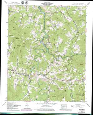
Micaville Topo Map North Carolina
To zoom in, hover over the map of Micaville
USGS Topo Quad 35082h2 - 1:24,000 scale
| Topo Map Name: | Micaville |
| USGS Topo Quad ID: | 35082h2 |
| Print Size: | ca. 21 1/4" wide x 27" high |
| Southeast Coordinates: | 35.875° N latitude / 82.125° W longitude |
| Map Center Coordinates: | 35.9375° N latitude / 82.1875° W longitude |
| U.S. State: | NC |
| Filename: | o35082h2.jpg |
| Download Map JPG Image: | Micaville topo map 1:24,000 scale |
| Map Type: | Topographic |
| Topo Series: | 7.5´ |
| Map Scale: | 1:24,000 |
| Source of Map Images: | United States Geological Survey (USGS) |
| Alternate Map Versions: |
Micaville NC 1934 Download PDF Buy paper map Micaville NC 1960, updated 1962 Download PDF Buy paper map Micaville NC 1960, updated 1976 Download PDF Buy paper map Micaville NC 1960, updated 1979 Download PDF Buy paper map Micaville NC 2011 Download PDF Buy paper map Micaville NC 2013 Download PDF Buy paper map Micaville NC 2016 Download PDF Buy paper map |
| FStopo: | US Forest Service topo Micaville is available: Download FStopo PDF Download FStopo TIF |
1:24,000 Topo Quads surrounding Micaville
> Back to 35082e1 at 1:100,000 scale
> Back to 35082a1 at 1:250,000 scale
> Back to U.S. Topo Maps home
Micaville topo map: Gazetteer
Micaville: Dams
Deneen Dam elevation 786m 2578′Micaville: Gaps
Butler Gap elevation 912m 2992′Shoal Creek Gap elevation 1177m 3861′
Tolley Gap elevation 1149m 3769′
Micaville: Mines
Hootowl Mine elevation 1060m 3477′Sink Hole Mine elevation 810m 2657′
Micaville: Populated Places
Bacchus elevation 733m 2404′Bandana elevation 795m 2608′
Blue Rock elevation 837m 2746′
Boonford elevation 738m 2421′
Bowditch elevation 808m 2650′
Double Island elevation 751m 2463′
Kona elevation 719m 2358′
Ledger elevation 849m 2785′
Lunday elevation 715m 2345′
Micaville elevation 744m 2440′
Newdale elevation 767m 2516′
Wing elevation 747m 2450′
Micaville: Reservoirs
Deneen Reservoir elevation 786m 2578′Saylor Lake elevation 790m 2591′
Micaville: Ridges
Bald Knob Ridge elevation 1096m 3595′Bee Ridge elevation 1125m 3690′
Big Ridge elevation 967m 3172′
Buck Ridge elevation 980m 3215′
Cedar Cliff Ridge elevation 996m 3267′
Narrow Ridge elevation 985m 3231′
Rattlesnake Ridge elevation 1000m 3280′
Micaville: Streams
Ayles Creek elevation 749m 2457′Bearwallow Branch elevation 762m 2500′
Big Crabtree Creek elevation 731m 2398′
Blue Rock Branch elevation 756m 2480′
Brushy Creek elevation 762m 2500′
Cane Branch elevation 756m 2480′
Chestnut Branch elevation 699m 2293′
Dobag Creek elevation 708m 2322′
Duck Branch elevation 740m 2427′
Gouge Branch elevation 703m 2306′
Lily Branch elevation 730m 2395′
Little Crabtree Creek elevation 739m 2424′
Long Branch elevation 746m 2447′
Mine Branch elevation 746m 2447′
Plum Branch elevation 761m 2496′
Rebels Creek elevation 717m 2352′
Roaring Branch elevation 776m 2545′
Rose Branch elevation 688m 2257′
Rose Creek elevation 687m 2253′
Shoal Creek elevation 777m 2549′
Sink Hole Creek elevation 691m 2267′
Snow Creek elevation 734m 2408′
South Toe River elevation 711m 2332′
Wing Branch elevation 753m 2470′
Wolf Branch elevation 722m 2368′
Micaville: Summits
Bald Knob elevation 1228m 4028′Blue Rock Knob elevation 1104m 3622′
Boone Knob elevation 994m 3261′
Burnt Mountain elevation 1058m 3471′
Chestnut Mountain elevation 1170m 3838′
Chestnut Mountain elevation 975m 3198′
Cox Knob elevation 1045m 3428′
Crabtree Mountain elevation 1198m 3930′
Ellis Mountain elevation 987m 3238′
Fawn Mountain elevation 1033m 3389′
Gouge Mountain elevation 938m 3077′
Mine Knob elevation 1262m 4140′
Otter Knobs elevation 1107m 3631′
Pig Pen Bluff elevation 1335m 4379′
Snow Hill elevation 871m 2857′
The Peak elevation 1152m 3779′
Thunderstruck Knob elevation 1113m 3651′
Wilson Knob elevation 1068m 3503′
Micaville: Valleys
Hootowl Hollow elevation 775m 2542′Micaville digital topo map on disk
Buy this Micaville topo map showing relief, roads, GPS coordinates and other geographical features, as a high-resolution digital map file on DVD:
South Carolina, Western North Carolina & Northeastern Georgia
Buy digital topo maps: South Carolina, Western North Carolina & Northeastern Georgia


