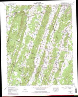
Mcdonald Topo Map Tennessee
To zoom in, hover over the map of Mcdonald
USGS Topo Quad 35084a8 - 1:24,000 scale
| Topo Map Name: | Mcdonald |
| USGS Topo Quad ID: | 35084a8 |
| Print Size: | ca. 21 1/4" wide x 27" high |
| Southeast Coordinates: | 35° N latitude / 84.875° W longitude |
| Map Center Coordinates: | 35.0625° N latitude / 84.9375° W longitude |
| U.S. State: | TN |
| Filename: | o35084a8.jpg |
| Download Map JPG Image: | Mcdonald topo map 1:24,000 scale |
| Map Type: | Topographic |
| Topo Series: | 7.5´ |
| Map Scale: | 1:24,000 |
| Source of Map Images: | United States Geological Survey (USGS) |
| Alternate Map Versions: |
Mc Donald TN 1935 Download PDF Buy paper map Mc Donald TN 1940, updated 1956 Download PDF Buy paper map Mc Donald TN 1941 Download PDF Buy paper map Mc Donald TN 1967, updated 1970 Download PDF Buy paper map Mc Donald TN 1967, updated 1977 Download PDF Buy paper map Mc Donald TN 1967, updated 1977 Download PDF Buy paper map McDonald TN 2010 Download PDF Buy paper map McDonald TN 2013 Download PDF Buy paper map McDonald TN 2016 Download PDF Buy paper map |
1:24,000 Topo Quads surrounding Mcdonald
> Back to 35084a1 at 1:100,000 scale
> Back to 35084a1 at 1:250,000 scale
> Back to U.S. Topo Maps home
Mcdonald topo map: Gazetteer
Mcdonald: Dams
Davis Lake Dam elevation 262m 859′Hidden Valley Dam elevation 269m 882′
Johnston Lake Dam Number One elevation 249m 816′
Mcdonald: Gaps
Maroon Gap elevation 270m 885′Sloan Gap elevation 242m 793′
Snyder Gap elevation 243m 797′
Sweet Gap elevation 259m 849′
Mcdonald: Mines
Black Fox Mine elevation 269m 882′D A M Mine elevation 277m 908′
Hambright Mine elevation 286m 938′
Hannah Prospect elevation 297m 974′
Hardwick Mine elevation 280m 918′
Jones Prospect elevation 274m 898′
Lord Mine elevation 284m 931′
Sloan Prospect elevation 257m 843′
Snyder Prospect elevation 286m 938′
Mcdonald: Populated Places
Black Fox elevation 248m 813′Blue Springs elevation 274m 898′
Dockery elevation 287m 941′
East View elevation 313m 1026′
Flint Springs elevation 254m 833′
Green Meadow elevation 284m 931′
Howardville elevation 292m 958′
Lebanon elevation 272m 892′
McDonald elevation 262m 859′
Parks Store elevation 257m 843′
Pine Hill elevation 277m 908′
Red Hill elevation 264m 866′
Timber Hills elevation 307m 1007′
Tucker Springs elevation 240m 787′
Mcdonald: Post Offices
McDonald Post Office elevation 263m 862′Mcdonald: Reservoirs
Bethea Pond elevation 262m 859′Davis Lake elevation 262m 859′
Hidden Valley Lake elevation 269m 882′
Johnston Ponds elevation 249m 816′
Mcdonald: Ridges
Blue Springs Ridge elevation 301m 987′Lead Mine Ridge elevation 343m 1125′
Lebanon Ridge elevation 349m 1145′
Lebanon Ridge elevation 324m 1062′
Pine Hill Ridge elevation 316m 1036′
Smith Ridge elevation 309m 1013′
Whites Cut Ridge elevation 350m 1148′
Mcdonald: Springs
Brown Spring elevation 261m 856′Cross Spring elevation 253m 830′
Eads Spring elevation 260m 853′
Finnel Spring elevation 256m 839′
Grant Spring elevation 262m 859′
Green Spring elevation 258m 846′
Hidden Valley Spring elevation 278m 912′
Higgins Springs elevation 273m 895′
Hysinger Spring elevation 260m 853′
Jerry Johnson Spring elevation 249m 816′
Johnston Spring elevation 241m 790′
McKay Spring elevation 262m 859′
Moore Spring elevation 261m 856′
Moss Spring elevation 273m 895′
Rymer Spring elevation 278m 912′
Taylor Spring elevation 271m 889′
Triplett Spring elevation 231m 757′
Vaughan Spring elevation 250m 820′
Mcdonald: Streams
Allen Branch elevation 248m 813′Black Fox Creek elevation 233m 764′
Blue Springs Branch elevation 257m 843′
Brymer Creek elevation 236m 774′
Drumgool Creek elevation 231m 757′
Dry Creek elevation 237m 777′
Maroon Branch elevation 254m 833′
Phillips Branch elevation 248m 813′
Taylor Branch elevation 255m 836′
Mcdonald: Summits
Butler Knobs elevation 331m 1085′Hickory Top elevation 339m 1112′
Johnson Knob elevation 309m 1013′
Quarry Knob elevation 298m 977′
Red Hills elevation 300m 984′
Sugarloaf Knob elevation 336m 1102′
Sweet Hill elevation 301m 987′
Mcdonald: Valleys
Black Fox Valley elevation 231m 757′Blue Springs Valley elevation 279m 915′
Hungry Hollow elevation 266m 872′
Lead Mine Valley elevation 254m 833′
Maroon Valley elevation 281m 921′
Red Hill Valley elevation 240m 787′
Mcdonald digital topo map on disk
Buy this Mcdonald topo map showing relief, roads, GPS coordinates and other geographical features, as a high-resolution digital map file on DVD:


