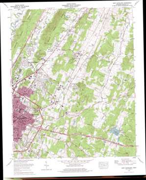
East Cleveland Topo Map Tennessee
To zoom in, hover over the map of East Cleveland
USGS Topo Quad 35084b7 - 1:24,000 scale
| Topo Map Name: | East Cleveland |
| USGS Topo Quad ID: | 35084b7 |
| Print Size: | ca. 21 1/4" wide x 27" high |
| Southeast Coordinates: | 35.125° N latitude / 84.75° W longitude |
| Map Center Coordinates: | 35.1875° N latitude / 84.8125° W longitude |
| U.S. State: | TN |
| Filename: | o35084b7.jpg |
| Download Map JPG Image: | East Cleveland topo map 1:24,000 scale |
| Map Type: | Topographic |
| Topo Series: | 7.5´ |
| Map Scale: | 1:24,000 |
| Source of Map Images: | United States Geological Survey (USGS) |
| Alternate Map Versions: |
East Cleveland TN 1935 Download PDF Buy paper map East Cleveland TN 1943, updated 1946 Download PDF Buy paper map East Cleveland TN 1943, updated 1965 Download PDF Buy paper map East Cleveland TN 1965, updated 1966 Download PDF Buy paper map East Cleveland TN 1976, updated 1977 Download PDF Buy paper map East Cleveland TN 2010 Download PDF Buy paper map East Cleveland TN 2013 Download PDF Buy paper map East Cleveland TN 2016 Download PDF Buy paper map |
1:24,000 Topo Quads surrounding East Cleveland
> Back to 35084a1 at 1:100,000 scale
> Back to 35084a1 at 1:250,000 scale
> Back to U.S. Topo Maps home
East Cleveland topo map: Gazetteer
East Cleveland: Airports
Hardwick Field elevation 257m 843′East Cleveland: Lakes
Fillauer Lake elevation 253m 830′East Cleveland: Mines
Griffin Mine elevation 275m 902′Hambright Mine elevation 214m 702′
East Cleveland: Parks
Bradley County Park elevation 268m 879′Deer Park elevation 255m 836′
Mike Burke Park elevation 273m 895′
Northeast Recreation Center elevation 275m 902′
Tinsley Park elevation 245m 803′
East Cleveland: Populated Places
American Heritage elevation 251m 823′Arrowhead Point elevation 271m 889′
Bellefounte elevation 239m 784′
Burlington Heights elevation 240m 787′
Chestuee elevation 256m 839′
Climer elevation 270m 885′
Colonial Estates elevation 246m 807′
East Cleveland elevation 295m 967′
Fairview elevation 253m 830′
Foxfire elevation 270m 885′
Heritage Hills elevation 247m 810′
Hickory Hills elevation 254m 833′
Hill Acres elevation 309m 1013′
Homestead Acres elevation 265m 869′
Hooper Acres elevation 248m 813′
Johnston Circle elevation 256m 839′
Kingwood Estates elevation 238m 780′
Mapleton Hills elevation 244m 800′
North Cleveland elevation 262m 859′
North Club Estates elevation 250m 820′
Oakwood elevation 272m 892′
Peach Orchard elevation 313m 1026′
Rolling Brook elevation 256m 839′
Royal Oak elevation 256m 839′
Sequoia Grove elevation 251m 823′
Shenandoah elevation 250m 820′
South Cleveland elevation 282m 925′
South Mapleton Hills elevation 232m 761′
Tasso elevation 248m 813′
Tasso Heights elevation 274m 898′
Taylor elevation 262m 859′
Twin Oaks elevation 282m 925′
Whisperwood elevation 269m 882′
Windwood elevation 264m 866′
East Cleveland: Reservoirs
Anstis Lake elevation 237m 777′East Cleveland: Ridges
Beeler Ridge elevation 295m 967′East Cleveland: Springs
Beeler Spring elevation 238m 780′Bell Fount Spring elevation 234m 767′
Carpenter Spring elevation 239m 784′
Hardwick Spring elevation 240m 787′
McKenzie Spring elevation 214m 702′
Morelock Springs elevation 262m 859′
Rattlesnake Spring elevation 224m 734′
Richey Spring elevation 237m 777′
East Cleveland: Streams
Fillauer Branch elevation 232m 761′Five Mile Branch elevation 237m 777′
Greasy Creek elevation 213m 698′
Little Chatata Creek elevation 224m 734′
Rattlesnake Branch elevation 212m 695′
East Cleveland: Valleys
Dry Valley elevation 250m 820′East Cleveland digital topo map on disk
Buy this East Cleveland topo map showing relief, roads, GPS coordinates and other geographical features, as a high-resolution digital map file on DVD:


