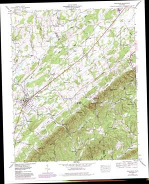
Englewood Topo Map Tennessee
To zoom in, hover over the map of Englewood
USGS Topo Quad 35084d4 - 1:24,000 scale
| Topo Map Name: | Englewood |
| USGS Topo Quad ID: | 35084d4 |
| Print Size: | ca. 21 1/4" wide x 27" high |
| Southeast Coordinates: | 35.375° N latitude / 84.375° W longitude |
| Map Center Coordinates: | 35.4375° N latitude / 84.4375° W longitude |
| U.S. State: | TN |
| Filename: | o35084d4.jpg |
| Download Map JPG Image: | Englewood topo map 1:24,000 scale |
| Map Type: | Topographic |
| Topo Series: | 7.5´ |
| Map Scale: | 1:24,000 |
| Source of Map Images: | United States Geological Survey (USGS) |
| Alternate Map Versions: |
Englewood TN 1934 Download PDF Buy paper map Englewood TN 1944, updated 1960 Download PDF Buy paper map Englewood TN 1944, updated 1968 Download PDF Buy paper map Englewood TN 1944, updated 1980 Download PDF Buy paper map Englewood TN 1944, updated 1980 Download PDF Buy paper map Englewood TN 1945, updated 1946 Download PDF Buy paper map Englewood TN 2010 Download PDF Buy paper map Englewood TN 2013 Download PDF Buy paper map Englewood TN 2016 Download PDF Buy paper map |
1:24,000 Topo Quads surrounding Englewood
> Back to 35084a1 at 1:100,000 scale
> Back to 35084a1 at 1:250,000 scale
> Back to U.S. Topo Maps home
Englewood topo map: Gazetteer
Englewood: Dams
City of Madisonville Dam elevation 278m 912′Estes Kefauver Lake Dam elevation 286m 938′
Englewood: Gaps
Bill Jack Gap elevation 325m 1066′Martin Gap elevation 300m 984′
Englewood: Guts
Beaver Branch elevation 263m 862′Sinkhole Creek elevation 289m 948′
Englewood: Parks
Englewood Mini-Park elevation 266m 872′Englewood: Populated Places
Arden elevation 284m 931′Burger elevation 271m 889′
Chestuee elevation 280m 918′
Ebenezer elevation 284m 931′
Englewood elevation 262m 859′
Gudger elevation 292m 958′
Ho (historical) elevation 307m 1007′
Liberty Hill elevation 273m 895′
Manila elevation 257m 843′
Nonaburg elevation 265m 869′
Old Englewood elevation 250m 820′
Englewood: Reservoirs
Madisonville Lake elevation 286m 938′Englewood: Springs
Gay Spring elevation 303m 994′Hicks-Brown Spring elevation 247m 810′
Englewood: Streams
Burger Branch elevation 250m 820′Carson Branch elevation 276m 905′
Cave Spring Branch elevation 261m 856′
Cline Branch elevation 272m 892′
Cochran Branch elevation 263m 862′
Dancing Branch elevation 268m 879′
Ferguson Branch elevation 250m 820′
Fiesta Branch elevation 246m 807′
Gravely Branch elevation 274m 898′
Jess Moore Branch elevation 272m 892′
Kinser Branch elevation 265m 869′
Little Chestuee Creek elevation 250m 820′
Rocky Branch elevation 243m 797′
Stanford Branch elevation 261m 856′
Wilson Branch elevation 266m 872′
Englewood: Summits
Johnson Knob elevation 392m 1286′Kelly Knob elevation 435m 1427′
Luther Bookout Knob elevation 408m 1338′
McDaniel Knob elevation 409m 1341′
Rider Knob elevation 378m 1240′
Wilson Knob elevation 388m 1272′
Englewood: Valleys
Dry Hollow elevation 253m 830′Happy Hollow elevation 293m 961′
Mason Hollow elevation 302m 990′
Warner Cove elevation 278m 912′
Englewood digital topo map on disk
Buy this Englewood topo map showing relief, roads, GPS coordinates and other geographical features, as a high-resolution digital map file on DVD:


