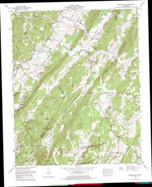
Tranquillity Topo Map Tennessee
To zoom in, hover over the map of Tranquillity
USGS Topo Quad 35084e6 - 1:24,000 scale
| Topo Map Name: | Tranquillity |
| USGS Topo Quad ID: | 35084e6 |
| Print Size: | ca. 21 1/4" wide x 27" high |
| Southeast Coordinates: | 35.5° N latitude / 84.625° W longitude |
| Map Center Coordinates: | 35.5625° N latitude / 84.6875° W longitude |
| U.S. State: | TN |
| Filename: | o35084e6.jpg |
| Download Map JPG Image: | Tranquillity topo map 1:24,000 scale |
| Map Type: | Topographic |
| Topo Series: | 7.5´ |
| Map Scale: | 1:24,000 |
| Source of Map Images: | United States Geological Survey (USGS) |
| Alternate Map Versions: |
Tranquillity TN 1936 Download PDF Buy paper map Tranquillity TN 1941, updated 1960 Download PDF Buy paper map Tranquillity TN 1941, updated 1965 Download PDF Buy paper map Tranquillity TN 1942 Download PDF Buy paper map Tranquillity TN 1973, updated 1974 Download PDF Buy paper map Tranquillity TN 1973, updated 1996 Download PDF Buy paper map Tranquillity TN 2010 Download PDF Buy paper map Tranquillity TN 2013 Download PDF Buy paper map Tranquillity TN 2016 Download PDF Buy paper map |
1:24,000 Topo Quads surrounding Tranquillity
> Back to 35084e1 at 1:100,000 scale
> Back to 35084a1 at 1:250,000 scale
> Back to U.S. Topo Maps home
Tranquillity topo map: Gazetteer
Tranquillity: Populated Places
Boggess Crossroad elevation 238m 780′Clearwater elevation 300m 984′
Collins Mill elevation 251m 823′
Cute (historical) elevation 219m 718′
Fiketon elevation 242m 793′
Rogers Creek elevation 247m 810′
Sewee elevation 225m 738′
Tranquillity elevation 272m 892′
Walnut Grove elevation 244m 800′
Tranquillity: Reservoirs
Cupp Lake elevation 232m 761′Lake Comfort elevation 277m 908′
Tranquillity: Ridges
Brickell Ridge elevation 333m 1092′Kennedy Ridge elevation 290m 951′
Newman Ridge elevation 330m 1082′
Tranquillity: Springs
Clearwater Spring elevation 293m 961′Kyker Spring elevation 251m 823′
Lockmiller Springs elevation 273m 895′
Simpson Spring elevation 255m 836′
Thomas Spring elevation 247m 810′
Tranquillity: Streams
Big Sewee Creek elevation 219m 718′Bivins Branch elevation 246m 807′
Black Ankle Creek elevation 212m 695′
Clearwater Branch elevation 248m 813′
Collins Branch elevation 231m 757′
Davis Creek elevation 212m 695′
Dry Fork elevation 212m 695′
Frog Branch elevation 244m 800′
Kyker Branch elevation 238m 780′
Little Sewee Creek elevation 218m 715′
Moore Branch elevation 215m 705′
South Fork Little Sewee Creek elevation 231m 757′
Ten Mile Creek elevation 225m 738′
Tranquillity: Valleys
Rails Hollow elevation 230m 754′Womac Hollow elevation 225m 738′
Woods Hollow elevation 217m 711′
Tranquillity digital topo map on disk
Buy this Tranquillity topo map showing relief, roads, GPS coordinates and other geographical features, as a high-resolution digital map file on DVD:


