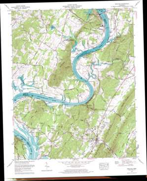
Decatur Topo Map Tennessee
To zoom in, hover over the map of Decatur
USGS Topo Quad 35084e7 - 1:24,000 scale
| Topo Map Name: | Decatur |
| USGS Topo Quad ID: | 35084e7 |
| Print Size: | ca. 21 1/4" wide x 27" high |
| Southeast Coordinates: | 35.5° N latitude / 84.75° W longitude |
| Map Center Coordinates: | 35.5625° N latitude / 84.8125° W longitude |
| U.S. State: | TN |
| Filename: | o35084e7.jpg |
| Download Map JPG Image: | Decatur topo map 1:24,000 scale |
| Map Type: | Topographic |
| Topo Series: | 7.5´ |
| Map Scale: | 1:24,000 |
| Source of Map Images: | United States Geological Survey (USGS) |
| Alternate Map Versions: |
Decatur TN 1935 Download PDF Buy paper map Decatur TN 1942, updated 1962 Download PDF Buy paper map Decatur TN 1942, updated 1972 Download PDF Buy paper map Decatur TN 1943, updated 1946 Download PDF Buy paper map Decatur TN 1973, updated 1975 Download PDF Buy paper map Decatur TN 1973, updated 1976 Download PDF Buy paper map Decatur TN 2010 Download PDF Buy paper map Decatur TN 2013 Download PDF Buy paper map Decatur TN 2016 Download PDF Buy paper map |
1:24,000 Topo Quads surrounding Decatur
> Back to 35084e1 at 1:100,000 scale
> Back to 35084a1 at 1:250,000 scale
> Back to U.S. Topo Maps home
Decatur topo map: Gazetteer
Decatur: Bars
Piney River Shoals elevation 226m 741′Waltons Shoals elevation 208m 682′
Watts Bar elevation 208m 682′
Wells Shoals elevation 208m 682′
Decatur: Bends
Forest Grove Bend elevation 213m 698′Hunter Bend elevation 210m 688′
McDonald Bend elevation 208m 682′
Smith Bend elevation 210m 688′
Decatur: Bridges
Forest Grove Bridge elevation 212m 695′Iron Bridge elevation 211m 692′
Decatur: Cliffs
Butcher Bluff elevation 234m 767′Eaves Bluff elevation 284m 931′
Hunter Bluff elevation 215m 705′
Lillard Bluff elevation 246m 807′
Decatur: Crossings
Eves Ferry (historical) elevation 208m 682′Pinhook Ferry elevation 209m 685′
Prices Ferry (historical) elevation 208m 682′
Decatur: Dams
Porter Lake Dam elevation 217m 711′Watts Bar Dam elevation 208m 682′
Decatur: Gaps
Guinn Narrows elevation 232m 761′Decatur: Guts
Blue Spring Slough elevation 208m 682′Decatur: Islands
Hunter Island elevation 213m 698′Waltons Islands (historical) elevation 208m 682′
Decatur: Parks
Yellow Creek Wildlife Management Area elevation 229m 751′Decatur: Populated Places
Breedenton elevation 227m 744′Calico elevation 232m 761′
Decatur elevation 237m 777′
Decatur Hills elevation 280m 918′
Fairview elevation 227m 744′
Forest Grove elevation 218m 715′
Slabtown elevation 226m 741′
Decatur: Post Offices
Watts Bar Dam Post Office elevation 256m 839′Decatur: Reservoirs
Porter Lake elevation 217m 711′Watts Bar Lake elevation 208m 682′
Decatur: Ridges
Blalock Ridge elevation 318m 1043′Correll Ridge elevation 277m 908′
Decatur Ridge elevation 318m 1043′
Ditney Ridge elevation 259m 849′
No Pone Ridge elevation 312m 1023′
Ward Ridge elevation 349m 1145′
Decatur: Springs
Carpenter Spring elevation 214m 702′Cave Spring elevation 275m 902′
Eaves Spring elevation 243m 797′
Kincaid Spring elevation 217m 711′
Ward Spring elevation 219m 718′
Decatur: Streams
Bush Creek elevation 211m 692′Clear Creek elevation 208m 682′
Dake Branch elevation 208m 682′
Decatur Branch elevation 222m 728′
Dry Branch elevation 208m 682′
Hutsell Branch elevation 224m 734′
Lick Branch elevation 208m 682′
McKinley Branch elevation 210m 688′
Poe Branch elevation 210m 688′
Sewee Creek elevation 210m 688′
Stewart Branch elevation 210m 688′
Tadpole Branch elevation 210m 688′
Watts Creek elevation 215m 705′
Yellow Creek elevation 210m 688′
Decatur: Summits
Ingle Rocks elevation 208m 682′Presley Hill elevation 305m 1000′
River Knobs elevation 292m 958′
Decatur: Valleys
Buck Hollow elevation 211m 692′Decatur digital topo map on disk
Buy this Decatur topo map showing relief, roads, GPS coordinates and other geographical features, as a high-resolution digital map file on DVD:


