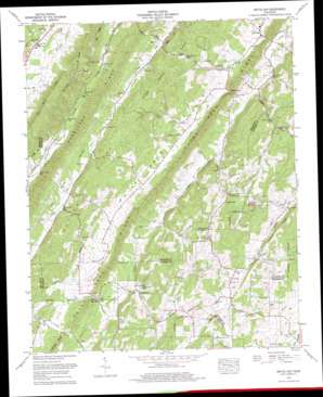
Pattie Gap Topo Map Tennessee
To zoom in, hover over the map of Pattie Gap
USGS Topo Quad 35084f5 - 1:24,000 scale
| Topo Map Name: | Pattie Gap |
| USGS Topo Quad ID: | 35084f5 |
| Print Size: | ca. 21 1/4" wide x 27" high |
| Southeast Coordinates: | 35.625° N latitude / 84.5° W longitude |
| Map Center Coordinates: | 35.6875° N latitude / 84.5625° W longitude |
| U.S. State: | TN |
| Filename: | o35084f5.jpg |
| Download Map JPG Image: | Pattie Gap topo map 1:24,000 scale |
| Map Type: | Topographic |
| Topo Series: | 7.5´ |
| Map Scale: | 1:24,000 |
| Source of Map Images: | United States Geological Survey (USGS) |
| Alternate Map Versions: |
Pattie Gap TN 1936 Download PDF Buy paper map Pattie Gap TN 1940 Download PDF Buy paper map Pattie Gap TN 1952, updated 1954 Download PDF Buy paper map Pattie Gap TN 1973, updated 1975 Download PDF Buy paper map Pattie Gap TN 1973, updated 1996 Download PDF Buy paper map Pattie Gap TN 2010 Download PDF Buy paper map Pattie Gap TN 2013 Download PDF Buy paper map Pattie Gap TN 2016 Download PDF Buy paper map |
1:24,000 Topo Quads surrounding Pattie Gap
> Back to 35084e1 at 1:100,000 scale
> Back to 35084a1 at 1:250,000 scale
> Back to U.S. Topo Maps home
Pattie Gap topo map: Gazetteer
Pattie Gap: Gaps
Pattie Gap elevation 243m 797′Pattie Gap: Populated Places
Cedar Fork elevation 274m 898′Cook Mill elevation 260m 853′
Erie elevation 280m 918′
Johnson elevation 273m 895′
Luttrell elevation 324m 1062′
Morrisgap (historical) elevation 271m 889′
Oak Hill elevation 271m 889′
Paint Rock elevation 242m 793′
Pattie Gap (historical) elevation 250m 820′
Regret (historical) elevation 262m 859′
Pattie Gap: Ridges
Big Ridge elevation 342m 1122′Galyon Ridge elevation 360m 1181′
Hurricane Ridge elevation 370m 1213′
Paint Rock Ridge elevation 342m 1122′
Riley Ridge elevation 329m 1079′
Walker Ridge elevation 323m 1059′
Pattie Gap: Springs
Blue Spring elevation 279m 915′Cooley Spring elevation 283m 928′
Galyon Spring elevation 257m 843′
Pattie Gap: Streams
Blue Spring Creek elevation 245m 803′Cedar Fork elevation 248m 813′
Little Paint Rock Creek elevation 237m 777′
Mud Creek elevation 278m 912′
Sandy Branch elevation 239m 784′
West Fork Paint Rock Creek elevation 242m 793′
White Branch elevation 251m 823′
Pattie Gap: Summits
Gage Hill elevation 350m 1148′Pattie Gap: Valleys
Dry Fork Valley elevation 256m 839′Paint Rock Valley elevation 260m 853′
Pattie Gap digital topo map on disk
Buy this Pattie Gap topo map showing relief, roads, GPS coordinates and other geographical features, as a high-resolution digital map file on DVD:


