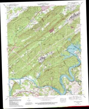
Bethel Valley Topo Map Tennessee
To zoom in, hover over the map of Bethel Valley
USGS Topo Quad 35084h3 - 1:24,000 scale
| Topo Map Name: | Bethel Valley |
| USGS Topo Quad ID: | 35084h3 |
| Print Size: | ca. 21 1/4" wide x 27" high |
| Southeast Coordinates: | 35.875° N latitude / 84.25° W longitude |
| Map Center Coordinates: | 35.9375° N latitude / 84.3125° W longitude |
| U.S. State: | TN |
| Filename: | o35084h3.jpg |
| Download Map JPG Image: | Bethel Valley topo map 1:24,000 scale |
| Map Type: | Topographic |
| Topo Series: | 7.5´ |
| Map Scale: | 1:24,000 |
| Source of Map Images: | United States Geological Survey (USGS) |
| Alternate Map Versions: |
Bethel Valley TN 1935 Download PDF Buy paper map Bethel Valley TN 1941 Download PDF Buy paper map Bethel Valley TN 1941, updated 1952 Download PDF Buy paper map Bethel Valley TN 1953, updated 1955 Download PDF Buy paper map Bethel Valley TN 1953, updated 1961 Download PDF Buy paper map Bethel Valley TN 1968, updated 1972 Download PDF Buy paper map Bethel Valley TN 1989, updated 1990 Download PDF Buy paper map Bethel Valley TN 1998, updated 2001 Download PDF Buy paper map Bethel Valley TN 2010 Download PDF Buy paper map Bethel Valley TN 2013 Download PDF Buy paper map Bethel Valley TN 2016 Download PDF Buy paper map |
1:24,000 Topo Quads surrounding Bethel Valley
> Back to 35084e1 at 1:100,000 scale
> Back to 35084a1 at 1:250,000 scale
> Back to U.S. Topo Maps home
Bethel Valley topo map: Gazetteer
Bethel Valley: Bars
Blue Spring Island Shoals elevation 226m 741′Bogles Shoals elevation 242m 793′
Hickory Shoals elevation 242m 793′
Hops Shoals elevation 242m 793′
Hursts Shoals elevation 242m 793′
Paw Paw Island Shoals elevation 226m 741′
Vancouvers Shoals elevation 242m 793′
Bethel Valley: Bends
Gallaher Bend elevation 278m 912′Hickory Creek Bend elevation 260m 853′
Bethel Valley: Bridges
Charles Vanden Bulck Bridge elevation 226m 741′Bethel Valley: Cliffs
Stubbs Bluff elevation 272m 892′Bethel Valley: Crossings
Wallers Ferry (historical) elevation 226m 741′White Wing Ferry (historical) elevation 226m 741′
Williams Ferry (historical) elevation 226m 741′
Bethel Valley: Dams
Melton Hill Dam elevation 226m 741′Whiteoak Dam elevation 227m 744′
Bethel Valley: Gaps
Pinhook Gap elevation 254m 833′Bethel Valley: Islands
Grubb Islands elevation 230m 754′Jones Island elevation 226m 741′
Bethel Valley: Parks
Hickory Creek Park elevation 249m 816′Melton Hill Dam Recreation Area elevation 253m 830′
Bethel Valley: Populated Places
Bear (historical) elevation 267m 875′Buttermilk Shores elevation 254m 833′
Ethel (historical) elevation 243m 797′
Lakeland Subdivision elevation 263m 862′
Leedom (historical) elevation 245m 803′
Oak Hills Estates elevation 262m 859′
Selkirk (historical) elevation 235m 770′
Woodlawn elevation 274m 898′
Bethel Valley: Reservoirs
Melton Hill Lake elevation 226m 741′Whiteoak Lake elevation 227m 744′
Bethel Valley: Ridges
East Fork Ridge elevation 337m 1105′Haw Ridge elevation 319m 1046′
Hood Ridge elevation 328m 1076′
McKinney Ridge elevation 350m 1148′
Bethel Valley: Streams
Bear Creek elevation 229m 751′Bearden Creek elevation 242m 793′
Caney Creek elevation 228m 748′
Grubb Creek elevation 246m 807′
Gum Hollow Branch elevation 237m 777′
Gum Hollow Branch elevation 237m 777′
Hickory Creek elevation 242m 793′
Hope Creek elevation 242m 793′
Melton Branch elevation 229m 751′
Mill Branch elevation 248m 813′
Pawpaw Creek elevation 226m 741′
Pinhook Branch elevation 238m 780′
Raccoon Creek elevation 226m 741′
Walker Branch elevation 242m 793′
Whiteoak Creek elevation 226m 741′
Bethel Valley: Summits
Fanny Knob elevation 378m 1240′Melton Hill elevation 411m 1348′
Bethel Valley: Valleys
Bethel Valley elevation 227m 744′Bradbury Valley elevation 234m 767′
Gamble Valley elevation 263m 862′
McNew Hollow elevation 243m 797′
Bethel Valley digital topo map on disk
Buy this Bethel Valley topo map showing relief, roads, GPS coordinates and other geographical features, as a high-resolution digital map file on DVD:


