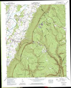
Ketner Gap Topo Map Tennessee
To zoom in, hover over the map of Ketner Gap
USGS Topo Quad 35085b4 - 1:24,000 scale
| Topo Map Name: | Ketner Gap |
| USGS Topo Quad ID: | 35085b4 |
| Print Size: | ca. 21 1/4" wide x 27" high |
| Southeast Coordinates: | 35.125° N latitude / 85.375° W longitude |
| Map Center Coordinates: | 35.1875° N latitude / 85.4375° W longitude |
| U.S. State: | TN |
| Filename: | o35085b4.jpg |
| Download Map JPG Image: | Ketner Gap topo map 1:24,000 scale |
| Map Type: | Topographic |
| Topo Series: | 7.5´ |
| Map Scale: | 1:24,000 |
| Source of Map Images: | United States Geological Survey (USGS) |
| Alternate Map Versions: |
Ketner Gap TN 1936 Download PDF Buy paper map Ketner Gap TN 1943, updated 1960 Download PDF Buy paper map Ketner Gap TN 1943, updated 1965 Download PDF Buy paper map Ketner Gap TN 1943, updated 1972 Download PDF Buy paper map Ketner Gap TN 1943, updated 1977 Download PDF Buy paper map Ketner Gap TN 1943, updated 1977 Download PDF Buy paper map Ketner Gap TN 1946, updated 1947 Download PDF Buy paper map Ketner Gap TN 2010 Download PDF Buy paper map Ketner Gap TN 2013 Download PDF Buy paper map Ketner Gap TN 2016 Download PDF Buy paper map |
1:24,000 Topo Quads surrounding Ketner Gap
> Back to 35085a1 at 1:100,000 scale
> Back to 35084a1 at 1:250,000 scale
> Back to U.S. Topo Maps home
Ketner Gap topo map: Gazetteer
Ketner Gap: Dams
Ketner Cove Lake Dam elevation 254m 833′Ketner Gap: Gaps
Burnett Gap elevation 650m 2132′Ditch Gap elevation 484m 1587′
Ketner Gap elevation 582m 1909′
Ketner Gap: Lakes
Davis Lake elevation 218m 715′Ketner Gap: Mines
Baggett and Pickett Mines elevation 525m 1722′Barnes Mine elevation 518m 1699′
Big Government Mine elevation 531m 1742′
Griffith and Wallace Number 4 Mine elevation 676m 2217′
Grover Lewis Mine elevation 665m 2181′
Hassler Mine elevation 517m 1696′
Hickey Mine elevation 519m 1702′
Lane Number 1 Mine elevation 671m 2201′
Lane Number 2 Mine elevation 658m 2158′
Lane Number 3 Mine elevation 675m 2214′
Lewis Barker Mine elevation 513m 1683′
Moore and Turner Mine elevation 697m 2286′
Panther Creek Number 1 Mine elevation 610m 2001′
Perkins Mine elevation 698m 2290′
Pickett Mine elevation 522m 1712′
Pickett Mine elevation 663m 2175′
Scott and Bowman Number 1 Mine elevation 704m 2309′
Scott and Bowman Number 2 Mine elevation 710m 2329′
Smith Number 3 Mine elevation 668m 2191′
Spurgeon Smith Mine elevation 605m 1984′
Tate Number 5 Mine elevation 654m 2145′
Tate Number 6 Mine elevation 660m 2165′
Wilburn Kilgore Mine elevation 625m 2050′
Ketner Gap: Populated Places
Powells Crossroads elevation 206m 675′Shirleyton elevation 203m 666′
Suck Creek elevation 604m 1981′
Sulphur Springs elevation 202m 662′
Ketner Gap: Reservoirs
Ketner Cove Lake elevation 254m 833′Ketner Gap: Springs
Johnson Spring elevation 635m 2083′Ketner Gap: Streams
Conner Creek elevation 381m 1250′Daniel Creek elevation 201m 659′
Grayson Branch elevation 198m 649′
Griffith Creek elevation 198m 649′
Hudson Branch elevation 198m 649′
Hurricane Creek elevation 461m 1512′
Lewis Creek elevation 443m 1453′
Looneys Creek elevation 195m 639′
Marshall Fork Branch elevation 421m 1381′
Meager Spring Branch elevation 485m 1591′
Mike Creek elevation 432m 1417′
North Suck Creek elevation 316m 1036′
Panther Creek elevation 470m 1541′
Peacock Branch elevation 496m 1627′
Shelton Creek elevation 390m 1279′
Short Creek elevation 421m 1381′
South Suck Creek elevation 316m 1036′
Sulphur Branch elevation 207m 679′
Ketner Gap digital topo map on disk
Buy this Ketner Gap topo map showing relief, roads, GPS coordinates and other geographical features, as a high-resolution digital map file on DVD:


