Collins Topo Map Tennessee
To zoom in, hover over the map of Collins
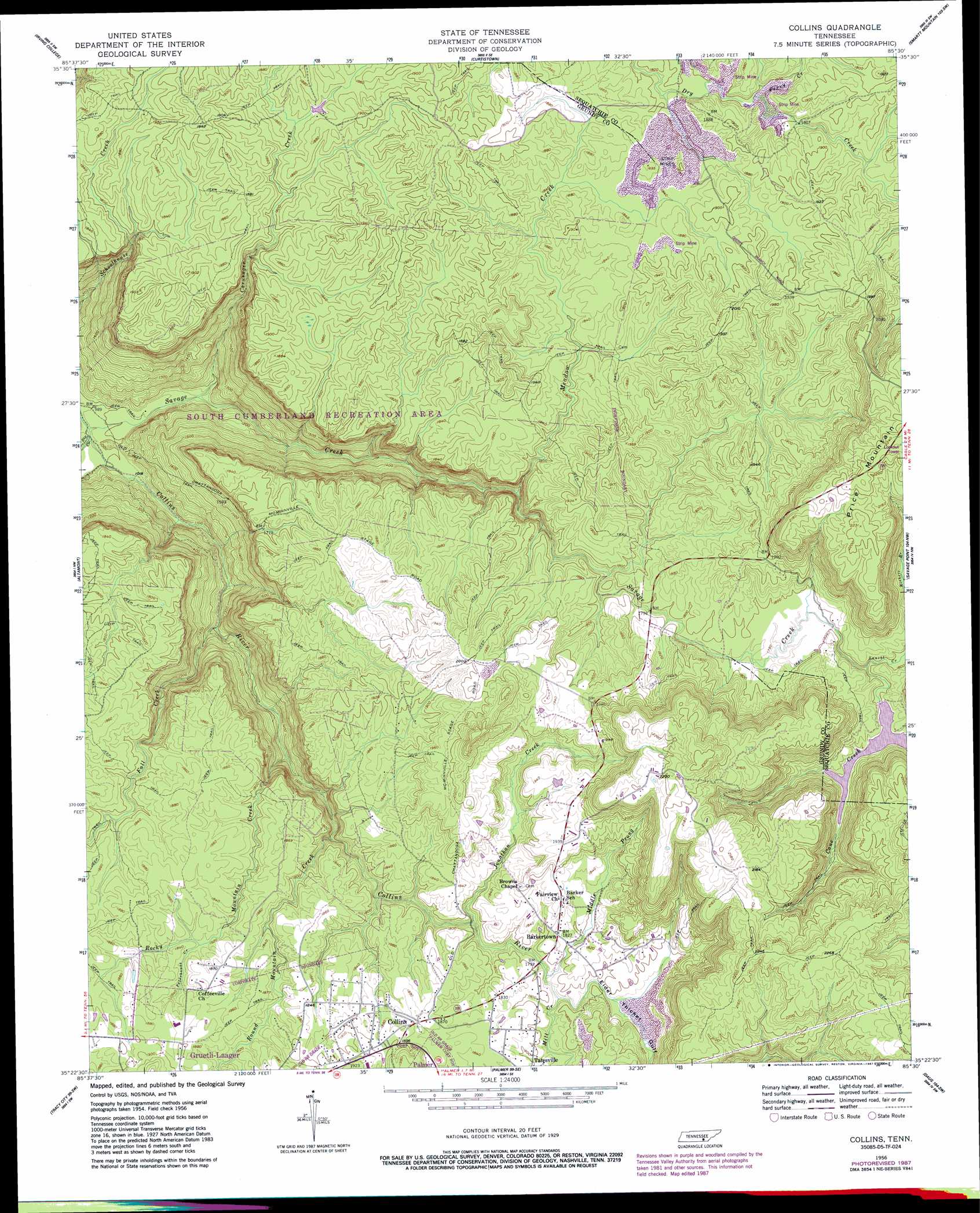
USGS Topo Quad 35085d5 - 1:24,000 scale
| Topo Map Name: | Collins |
| USGS Topo Quad ID: | 35085d5 |
| Print Size: | ca. 21 1/4" wide x 27" high |
| Southeast Coordinates: | 35.375° N latitude / 85.5° W longitude |
| Map Center Coordinates: | 35.4375° N latitude / 85.5625° W longitude |
| U.S. State: | TN |
| Filename: | o35085d5.jpg |
| Download Map JPG Image: | Collins topo map 1:24,000 scale |
| Map Type: | Topographic |
| Topo Series: | 7.5´ |
| Map Scale: | 1:24,000 |
| Source of Map Images: | United States Geological Survey (USGS) |
| Alternate Map Versions: |
Collins TN 1956, updated 1957 Download PDF Buy paper map Collins TN 1956, updated 1965 Download PDF Buy paper map Collins TN 1956, updated 1980 Download PDF Buy paper map Collins TN 1956, updated 1987 Download PDF Buy paper map Collins TN 1956, updated 1987 Download PDF Buy paper map Collins TN 1956, updated 1988 Download PDF Buy paper map Collins TN 2010 Download PDF Buy paper map Collins TN 2013 Download PDF Buy paper map Collins TN 2016 Download PDF Buy paper map |
1:24,000 Topo Quads surrounding Collins
Mcminnville |
Cardwell Mountain |
Welchland |
Spencer |
Sampson |
Viola |
Irving College |
Curtistown |
Smartt Mountain |
Brockdell |
Cane Hollow |
Altamont |
Collins |
Savage Point |
Mount Airy |
Burrow Cove |
Tracy City |
Palmer |
Daus |
Henson Gap |
Monteagle |
White City |
Whitwell |
Ketner Gap |
Fairmount |
> Back to 35085a1 at 1:100,000 scale
> Back to 35084a1 at 1:250,000 scale
> Back to U.S. Topo Maps home
Collins topo map: Gazetteer
Collins: Dams
S K Johnson Lake Dam elevation 552m 1811′Collins: Parks
Savage Gulf State Natural Area elevation 303m 994′South Cumberland Recreation Area elevation 567m 1860′
Collins: Populated Places
Barkertown elevation 555m 1820′Collins elevation 571m 1873′
Collins: Reservoirs
S K Johnson Lake elevation 552m 1811′Collins: Streams
Big Creek elevation 299m 980′Caruenger Creek elevation 319m 1046′
Dunaway Creek elevation 552m 1811′
Fall Creek elevation 368m 1207′
Jonathan Creek elevation 530m 1738′
Laurel Creek elevation 543m 1781′
Meadow Creek elevation 479m 1571′
Middle Prong Collins River elevation 536m 1758′
Mill Creek elevation 536m 1758′
Perry Creek elevation 546m 1791′
Peterhouse Creek elevation 551m 1807′
Rocky Mountain Creek elevation 421m 1381′
Round Mountain Creek elevation 511m 1676′
Savage Creek elevation 299m 980′
Walker Branch elevation 552m 1811′
Collins: Summits
Price Mountain elevation 689m 2260′Collins: Valleys
Elder Thicket Gulf elevation 534m 1751′Savage Gulf elevation 303m 994′
Collins digital topo map on disk
Buy this Collins topo map showing relief, roads, GPS coordinates and other geographical features, as a high-resolution digital map file on DVD: