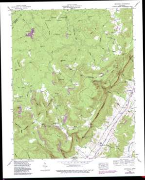
Brockdell Topo Map Tennessee
To zoom in, hover over the map of Brockdell
USGS Topo Quad 35085e3 - 1:24,000 scale
| Topo Map Name: | Brockdell |
| USGS Topo Quad ID: | 35085e3 |
| Print Size: | ca. 21 1/4" wide x 27" high |
| Southeast Coordinates: | 35.5° N latitude / 85.25° W longitude |
| Map Center Coordinates: | 35.5625° N latitude / 85.3125° W longitude |
| U.S. State: | TN |
| Filename: | o35085e3.jpg |
| Download Map JPG Image: | Brockdell topo map 1:24,000 scale |
| Map Type: | Topographic |
| Topo Series: | 7.5´ |
| Map Scale: | 1:24,000 |
| Source of Map Images: | United States Geological Survey (USGS) |
| Alternate Map Versions: |
Brockdell TN 1935 Download PDF Buy paper map Brockdell TN 1946, updated 1989 Download PDF Buy paper map Brockdell TN 1947, updated 1947 Download PDF Buy paper map Brockdell TN 2010 Download PDF Buy paper map Brockdell TN 2013 Download PDF Buy paper map Brockdell TN 2016 Download PDF Buy paper map |
1:24,000 Topo Quads surrounding Brockdell
> Back to 35085e1 at 1:100,000 scale
> Back to 35084a1 at 1:250,000 scale
> Back to U.S. Topo Maps home
Brockdell topo map: Gazetteer
Brockdell: Capes
Corner Point elevation 517m 1696′Devils Neck elevation 514m 1686′
Francis Point elevation 639m 2096′
Brockdell: Dams
Meadow Creek Dam elevation 512m 1679′Brockdell: Gaps
Flat Gap elevation 551m 1807′Brockdell: Mines
Atpontly Mine elevation 494m 1620′Bickford Mines elevation 597m 1958′
Colvard Mine elevation 523m 1715′
Dillard and Anderson Mines elevation 603m 1978′
Elliston Mine elevation 603m 1978′
Elson Mine elevation 549m 1801′
Johnson Mines elevation 556m 1824′
Keener Mines elevation 607m 1991′
Merriman Mine elevation 605m 1984′
Merriman Mine elevation 598m 1961′
Rainey Mine elevation 568m 1863′
Recupsido Mine elevation 496m 1627′
Russell Mines elevation 598m 1961′
Smith Mine elevation 610m 2001′
Staggs Mine elevation 623m 2043′
Staggs Mine elevation 597m 1958′
Walters Mine elevation 514m 1686′
Whitlow Mine elevation 621m 2037′
Brockdell: Populated Places
Brockdell elevation 502m 1646′Dill elevation 531m 1742′
Griffith elevation 555m 1820′
Lees Station elevation 260m 853′
Lusk elevation 244m 800′
Old Cumberland elevation 551m 1807′
Brockdell: Reservoirs
Meadow Creek Lake elevation 512m 1679′Brockdell: Ridges
Brock Ridge elevation 634m 2080′Chinquapin Ridge elevation 556m 1824′
Higginbotham Ridge elevation 672m 2204′
Pointer Ridge elevation 576m 1889′
Rainey Ridge elevation 636m 2086′
Turner Ridge elevation 641m 2103′
Brockdell: Streams
Bills Branch elevation 515m 1689′Durham Branch elevation 506m 1660′
Flat Rock Branch elevation 490m 1607′
Fox Thicket Creek elevation 515m 1689′
Gardner Creek elevation 509m 1669′
Hill Branch elevation 511m 1676′
Howard Branch elevation 508m 1666′
Maise Creek elevation 236m 774′
Pemberton Branch elevation 242m 793′
Pineorchard Creek elevation 488m 1601′
Polebridge Creek elevation 498m 1633′
Rocky Branch elevation 242m 793′
Slaytons Fork elevation 508m 1666′
Turkey Creek elevation 497m 1630′
Brockdell: Summits
Basin Mountain elevation 631m 2070′Blair Mountain elevation 583m 1912′
Horseshoe Mountain elevation 633m 2076′
Keener Hill elevation 593m 1945′
Little Mountain elevation 630m 2066′
Sheepnose Mountain elevation 594m 1948′
Tucker Knob elevation 616m 2020′
Brockdell: Valleys
Brock Hollow elevation 487m 1597′Lees Gulf elevation 273m 895′
Rains Gulf elevation 300m 984′
Sullivan Cove elevation 542m 1778′
Brockdell digital topo map on disk
Buy this Brockdell topo map showing relief, roads, GPS coordinates and other geographical features, as a high-resolution digital map file on DVD:


