Spencer Topo Map Tennessee
To zoom in, hover over the map of Spencer
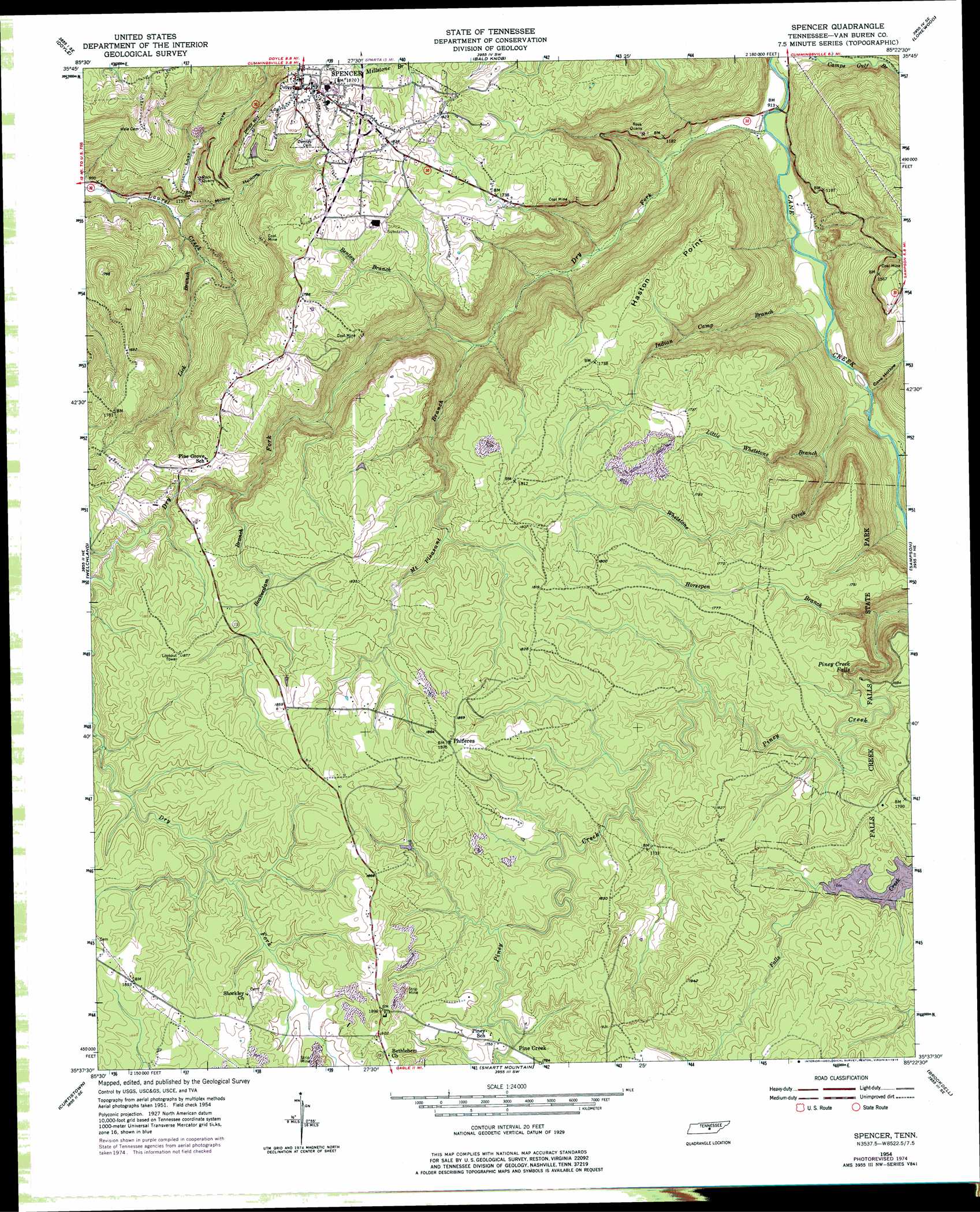
USGS Topo Quad 35085f4 - 1:24,000 scale
| Topo Map Name: | Spencer |
| USGS Topo Quad ID: | 35085f4 |
| Print Size: | ca. 21 1/4" wide x 27" high |
| Southeast Coordinates: | 35.625° N latitude / 85.375° W longitude |
| Map Center Coordinates: | 35.6875° N latitude / 85.4375° W longitude |
| U.S. State: | TN |
| Filename: | o35085f4.jpg |
| Download Map JPG Image: | Spencer topo map 1:24,000 scale |
| Map Type: | Topographic |
| Topo Series: | 7.5´ |
| Map Scale: | 1:24,000 |
| Source of Map Images: | United States Geological Survey (USGS) |
| Alternate Map Versions: |
Spencer TN 1954, updated 1955 Download PDF Buy paper map Spencer TN 1954, updated 1968 Download PDF Buy paper map Spencer TN 1954, updated 1975 Download PDF Buy paper map Spencer TN 2010 Download PDF Buy paper map Spencer TN 2013 Download PDF Buy paper map Spencer TN 2016 Download PDF Buy paper map |
1:24,000 Topo Quads surrounding Spencer
Sligo Bridge |
Cassville |
Sparta |
De Rossett |
Pleasant Hill |
Campaign |
Doyle |
Bald Knob |
Lonewood |
Herbert Domain |
Cardwell Mountain |
Welchland |
Spencer |
Sampson |
Billingsley Gap |
Irving College |
Curtistown |
Smartt Mountain |
Brockdell |
Pikeville |
Altamont |
Collins |
Savage Point |
Mount Airy |
Brayton |
> Back to 35085e1 at 1:100,000 scale
> Back to 35084a1 at 1:250,000 scale
> Back to U.S. Topo Maps home
Spencer topo map: Gazetteer
Spencer: Capes
Haston Point elevation 534m 1751′Spencer: Falls
Piney Creek Falls elevation 456m 1496′Spencer: Mines
Rigby Number One Mine elevation 566m 1856′Spencer: Populated Places
Gillentine (historical) elevation 574m 1883′Phiferes elevation 570m 1870′
Pine Creek elevation 525m 1722′
Pine Grove elevation 523m 1715′
Spencer elevation 548m 1797′
Spencer: Streams
Beaverdam Branch elevation 476m 1561′Benton Branch elevation 364m 1194′
Dry Fork elevation 276m 905′
Horsepen Branch elevation 381m 1250′
Indian Camp Branch elevation 296m 971′
Lick Branch elevation 309m 1013′
Little Whetstone Branch elevation 355m 1164′
Mount Pleasant Branch elevation 348m 1141′
Wheatstone Creek elevation 303m 994′
Spencer: Valleys
Cave Hollow elevation 311m 1020′Lick Cove elevation 300m 984′
Lost Cove elevation 338m 1108′
Molloy Hollow elevation 304m 997′
Spencer digital topo map on disk
Buy this Spencer topo map showing relief, roads, GPS coordinates and other geographical features, as a high-resolution digital map file on DVD: