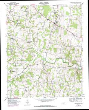
Centertown Topo Map Tennessee
To zoom in, hover over the map of Centertown
USGS Topo Quad 35085f8 - 1:24,000 scale
| Topo Map Name: | Centertown |
| USGS Topo Quad ID: | 35085f8 |
| Print Size: | ca. 21 1/4" wide x 27" high |
| Southeast Coordinates: | 35.625° N latitude / 85.875° W longitude |
| Map Center Coordinates: | 35.6875° N latitude / 85.9375° W longitude |
| U.S. State: | TN |
| Filename: | o35085f8.jpg |
| Download Map JPG Image: | Centertown topo map 1:24,000 scale |
| Map Type: | Topographic |
| Topo Series: | 7.5´ |
| Map Scale: | 1:24,000 |
| Source of Map Images: | United States Geological Survey (USGS) |
| Alternate Map Versions: |
Centertown TN 1952, updated 1957 Download PDF Buy paper map Centertown TN 1952, updated 1970 Download PDF Buy paper map Centertown TN 1953, updated 1955 Download PDF Buy paper map Centertown TN 1953, updated 1977 Download PDF Buy paper map Centertown TN 1953, updated 1985 Download PDF Buy paper map Centertown TN 2010 Download PDF Buy paper map Centertown TN 2013 Download PDF Buy paper map Centertown TN 2016 Download PDF Buy paper map |
1:24,000 Topo Quads surrounding Centertown
> Back to 35085e1 at 1:100,000 scale
> Back to 35084a1 at 1:250,000 scale
> Back to U.S. Topo Maps home
Centertown topo map: Gazetteer
Centertown: Cliffs
Ivy Bluff elevation 319m 1046′Pine Bluff elevation 286m 938′
Smoot Bluff elevation 308m 1010′
Centertown: Pillars
Starkey Rock elevation 298m 977′Centertown: Populated Places
Bates Hill elevation 336m 1102′Centertown elevation 336m 1102′
Clearmont elevation 314m 1030′
Crisp (historical) elevation 323m 1059′
Crisp Spring elevation 291m 954′
New (historical) elevation 304m 997′
Nicholson Springs (historical) elevation 314m 1030′
Oak Grove elevation 305m 1000′
Pleasant View elevation 343m 1125′
Trousdale elevation 305m 1000′
Centertown: Springs
Crisp Spring elevation 283m 928′Gregory Spring elevation 333m 1092′
Gum Spring elevation 339m 1112′
Centertown: Streams
Bullpen Creek elevation 301m 987′Caney Branch elevation 296m 971′
Cates Branch elevation 294m 964′
Dog Branch elevation 285m 935′
Dry Branch elevation 294m 964′
Garner Branch elevation 283m 928′
Henegar Branch elevation 285m 935′
Kelsy Branch elevation 307m 1007′
Liberty Creek elevation 304m 997′
McAfee Branch elevation 310m 1017′
Miller Branch elevation 310m 1017′
Mud Creek elevation 304m 997′
North Prong Barren Fork elevation 291m 954′
South Prong Barren Fork elevation 294m 964′
Witty Creek elevation 294m 964′
Youngblood Creek elevation 301m 987′
Centertown: Swamps
De Berry Swamp elevation 328m 1076′Centertown digital topo map on disk
Buy this Centertown topo map showing relief, roads, GPS coordinates and other geographical features, as a high-resolution digital map file on DVD:


