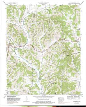
Frankewing Topo Map Tennessee
To zoom in, hover over the map of Frankewing
USGS Topo Quad 35086b7 - 1:24,000 scale
| Topo Map Name: | Frankewing |
| USGS Topo Quad ID: | 35086b7 |
| Print Size: | ca. 21 1/4" wide x 27" high |
| Southeast Coordinates: | 35.125° N latitude / 86.75° W longitude |
| Map Center Coordinates: | 35.1875° N latitude / 86.8125° W longitude |
| U.S. State: | TN |
| Filename: | o35086b7.jpg |
| Download Map JPG Image: | Frankewing topo map 1:24,000 scale |
| Map Type: | Topographic |
| Topo Series: | 7.5´ |
| Map Scale: | 1:24,000 |
| Source of Map Images: | United States Geological Survey (USGS) |
| Alternate Map Versions: |
Frankewing TN 1936 Download PDF Buy paper map Frankewing TN 1948, updated 1975 Download PDF Buy paper map Frankewing TN 1948, updated 1982 Download PDF Buy paper map Frankewing TN 1951 Download PDF Buy paper map Frankewing TN 2010 Download PDF Buy paper map Frankewing TN 2013 Download PDF Buy paper map Frankewing TN 2016 Download PDF Buy paper map |
1:24,000 Topo Quads surrounding Frankewing
> Back to 35086a1 at 1:100,000 scale
> Back to 35086a1 at 1:250,000 scale
> Back to U.S. Topo Maps home
Frankewing topo map: Gazetteer
Frankewing: Cliffs
Ballentine Bluff elevation 198m 649′Frankewing: Crossings
Interchange 14 elevation 239m 784′Frankewing: Gaps
Bowden Gap elevation 259m 849′Frankewing: Populated Places
Bradshaw elevation 240m 787′Frankewing elevation 205m 672′
Jerusalem elevation 294m 964′
McBurg elevation 206m 675′
Millville elevation 193m 633′
Red Oak elevation 222m 728′
Speiden elevation 218m 715′
Taylortown elevation 207m 679′
West Cyruston elevation 200m 656′
Woodrow elevation 199m 652′
Frankewing: Post Offices
Frankewing Post Office elevation 205m 672′Frankewing: Ridges
Backbone Ridge elevation 251m 823′Frankewing: Springs
Bee Spring elevation 255m 836′Frankewing: Streams
Bell Branch elevation 195m 639′Chicken Creek elevation 192m 629′
East Fork Bradshaw Creek elevation 210m 688′
East Fork Leatherwood Creek elevation 205m 672′
Leatherwood Creek elevation 190m 623′
Little Bradshaw Creek elevation 207m 679′
Little Creek elevation 201m 659′
McAfee Creek elevation 198m 649′
Reed Hollow Branch elevation 203m 666′
West Fork Bradshaw Creek elevation 213m 698′
West Fork Leatherwood Creek elevation 204m 669′
Frankewing: Summits
Bee Spring Hill elevation 282m 925′Buffalo Hill elevation 296m 971′
Cathcart Hill elevation 317m 1040′
Chapel Hill elevation 298m 977′
Dawes Hill elevation 238m 780′
Howell Hill elevation 319m 1046′
Mansfield Hill elevation 293m 961′
Frankewing: Valleys
Barnes Hollow elevation 202m 662′Creecy Hollow elevation 218m 715′
Duckworth Hollow elevation 233m 764′
Hames Hollow elevation 199m 652′
Harrison Hollow elevation 199m 652′
Lloyd Hollow elevation 211m 692′
Luna Hollow elevation 222m 728′
Mitchel Hollow elevation 230m 754′
Reed Hollow elevation 203m 666′
Reed Hollow elevation 223m 731′
Robertson Hollow elevation 205m 672′
Tightbark Hollow elevation 206m 675′
William Hollow elevation 214m 702′
Worsham Hollow elevation 239m 784′
Frankewing digital topo map on disk
Buy this Frankewing topo map showing relief, roads, GPS coordinates and other geographical features, as a high-resolution digital map file on DVD:


