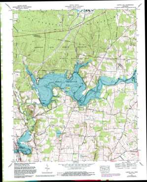
Capitol Hill Topo Map Tennessee
To zoom in, hover over the map of Capitol Hill
USGS Topo Quad 35086c1 - 1:24,000 scale
| Topo Map Name: | Capitol Hill |
| USGS Topo Quad ID: | 35086c1 |
| Print Size: | ca. 21 1/4" wide x 27" high |
| Southeast Coordinates: | 35.25° N latitude / 86° W longitude |
| Map Center Coordinates: | 35.3125° N latitude / 86.0625° W longitude |
| U.S. State: | TN |
| Filename: | o35086c1.jpg |
| Download Map JPG Image: | Capitol Hill topo map 1:24,000 scale |
| Map Type: | Topographic |
| Topo Series: | 7.5´ |
| Map Scale: | 1:24,000 |
| Source of Map Images: | United States Geological Survey (USGS) |
| Alternate Map Versions: |
Capitol Hill TN 1936 Download PDF Buy paper map Capitol Hill TN 1941, updated 1944 Download PDF Buy paper map Capitol Hill TN 1941, updated 1944 Download PDF Buy paper map Capitol Hill TN 1962, updated 1964 Download PDF Buy paper map Capitol Hill TN 1972, updated 1973 Download PDF Buy paper map Capitol Hill TN 1972, updated 1982 Download PDF Buy paper map Capitol Hill TN 1972, updated 1988 Download PDF Buy paper map Capitol Hill TN 1972, updated 1993 Download PDF Buy paper map Capitol Hill TN 2010 Download PDF Buy paper map Capitol Hill TN 2013 Download PDF Buy paper map Capitol Hill TN 2016 Download PDF Buy paper map |
1:24,000 Topo Quads surrounding Capitol Hill
> Back to 35086a1 at 1:100,000 scale
> Back to 35086a1 at 1:250,000 scale
> Back to U.S. Topo Maps home
Capitol Hill topo map: Gazetteer
Capitol Hill: Bridges
Estill Springs Bridge elevation 271m 889′Leach Bridge (historical) elevation 293m 961′
Morris Ferry Bridge elevation 293m 961′
Capitol Hill: Crossings
Gossage Ford (historical) elevation 271m 889′Jones Ford (historical) elevation 293m 961′
Kemp Ford (historical) elevation 293m 961′
Morris Ferry (historical) elevation 293m 961′
Morris Ford (historical) elevation 293m 961′
Capitol Hill: Dams
Elk River Dam elevation 293m 961′Secondary Retention Reservoir Dam elevation 335m 1099′
Capitol Hill: Islands
Elder Island elevation 298m 977′Capitol Hill: Lakes
Duncan Lake elevation 300m 984′Holland Pond elevation 312m 1023′
Lye Pond elevation 302m 990′
Capitol Hill: Parks
Coffee County Recreation Area elevation 305m 1000′Franklin County Park elevation 297m 974′
Capitol Hill: Populated Places
Buncombe (historical) elevation 302m 990′Calls elevation 324m 1062′
Capitol Hill elevation 311m 1020′
Duncantown elevation 316m 1036′
Gum Creek elevation 305m 1000′
Penile Hill elevation 331m 1085′
Capitol Hill: Reservoirs
Secondary Retention Reservoir elevation 335m 1099′Woods Reservoir elevation 293m 961′
Capitol Hill: Streams
Bradley Creek elevation 293m 961′Brumalow Creek elevation 293m 961′
Childer Creek elevation 294m 964′
Gum Creek elevation 294m 964′
Hardaway Branch elevation 293m 961′
Possum Branch elevation 294m 964′
Rowland Creek elevation 293m 961′
Spring Creek elevation 275m 902′
Capitol Hill: Summits
Little Mountain elevation 368m 1207′Capitol Hill: Valleys
Bluehole Hollow elevation 309m 1013′Lawson Hollow elevation 293m 961′
Capitol Hill digital topo map on disk
Buy this Capitol Hill topo map showing relief, roads, GPS coordinates and other geographical features, as a high-resolution digital map file on DVD:


