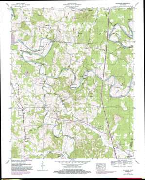
Glendale Topo Map Tennessee
To zoom in, hover over the map of Glendale
USGS Topo Quad 35086e8 - 1:24,000 scale
| Topo Map Name: | Glendale |
| USGS Topo Quad ID: | 35086e8 |
| Print Size: | ca. 21 1/4" wide x 27" high |
| Southeast Coordinates: | 35.5° N latitude / 86.875° W longitude |
| Map Center Coordinates: | 35.5625° N latitude / 86.9375° W longitude |
| U.S. State: | TN |
| Filename: | o35086e8.jpg |
| Download Map JPG Image: | Glendale topo map 1:24,000 scale |
| Map Type: | Topographic |
| Topo Series: | 7.5´ |
| Map Scale: | 1:24,000 |
| Source of Map Images: | United States Geological Survey (USGS) |
| Alternate Map Versions: |
Glendale TN 1936 Download PDF Buy paper map Glendale TN 1947, updated 1948 Download PDF Buy paper map Glendale TN 1947, updated 1948 Download PDF Buy paper map Glendale TN 1947, updated 1967 Download PDF Buy paper map Glendale TN 1947, updated 1974 Download PDF Buy paper map Glendale TN 1947, updated 1982 Download PDF Buy paper map Glendale TN 1947, updated 1982 Download PDF Buy paper map Glendale TN 2010 Download PDF Buy paper map Glendale TN 2013 Download PDF Buy paper map Glendale TN 2016 Download PDF Buy paper map |
1:24,000 Topo Quads surrounding Glendale
> Back to 35086e1 at 1:100,000 scale
> Back to 35086a1 at 1:250,000 scale
> Back to U.S. Topo Maps home
Glendale topo map: Gazetteer
Glendale: Airports
Mule Patch Airport elevation 220m 721′Glendale: Bends
Cannon Bend elevation 194m 636′Cheek Bend elevation 199m 652′
Rieves Bend elevation 185m 606′
Sowell Bend elevation 193m 633′
Vaughan Bend elevation 180m 590′
Whitworth Bend elevation 202m 662′
Glendale: Bridges
Edmondson Bridge elevation 185m 606′Howard Bridge elevation 172m 564′
Scribners Mill Bridge elevation 188m 616′
Sowell Mill Bridge elevation 170m 557′
Glendale: Crossings
Davis Ford elevation 180m 590′Holland Ford elevation 171m 561′
Interchange 37 elevation 223m 731′
Glendale: Islands
Branch Islands elevation 190m 623′Hooper Island elevation 176m 577′
Glendale: Populated Places
Beech Grove elevation 256m 839′Bryant Station elevation 220m 721′
Cuba (historical) elevation 202m 662′
Fountain Heights elevation 185m 606′
Glendale elevation 196m 643′
Hill elevation 188m 616′
Lickskillet (historical) elevation 191m 626′
Mount Tema elevation 207m 679′
Park Station elevation 205m 672′
Philadelphia elevation 194m 636′
Rock Springs elevation 210m 688′
Scribner elevation 194m 636′
Sowell Ford elevation 175m 574′
Union Grove elevation 187m 613′
Glendale: Springs
Blue Spring elevation 180m 590′Glendale: Streams
Alf Loftin Branch elevation 170m 557′Brush Creek elevation 189m 620′
Cedar Creek elevation 178m 583′
Derryberry Branch elevation 180m 590′
Fountain Creek elevation 170m 557′
Goose Creek elevation 170m 557′
Goose Creek elevation 214m 702′
Greasy Branch elevation 179m 587′
Hurricane Creek elevation 174m 570′
Long Tom Branch elevation 188m 616′
Nancy Branch elevation 176m 577′
Negro Creek elevation 172m 564′
Shade Loftin Branch elevation 170m 557′
Silver Creek elevation 170m 557′
Smith Branch elevation 186m 610′
Glendale: Summits
Buzzard Roost elevation 234m 767′Crews Hill elevation 227m 744′
Hayes Hills elevation 297m 974′
Jackson Knob elevation 283m 928′
Little Hill elevation 267m 875′
Loftin Hill elevation 263m 862′
Glendale digital topo map on disk
Buy this Glendale topo map showing relief, roads, GPS coordinates and other geographical features, as a high-resolution digital map file on DVD:


