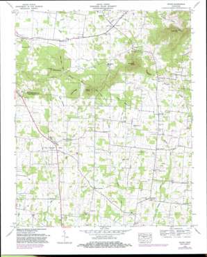
Rover Topo Map Tennessee
To zoom in, hover over the map of Rover
USGS Topo Quad 35086f5 - 1:24,000 scale
| Topo Map Name: | Rover |
| USGS Topo Quad ID: | 35086f5 |
| Print Size: | ca. 21 1/4" wide x 27" high |
| Southeast Coordinates: | 35.625° N latitude / 86.5° W longitude |
| Map Center Coordinates: | 35.6875° N latitude / 86.5625° W longitude |
| U.S. State: | TN |
| Filename: | o35086f5.jpg |
| Download Map JPG Image: | Rover topo map 1:24,000 scale |
| Map Type: | Topographic |
| Topo Series: | 7.5´ |
| Map Scale: | 1:24,000 |
| Source of Map Images: | United States Geological Survey (USGS) |
| Alternate Map Versions: |
Rover TN 1936 Download PDF Buy paper map Rover TN 1949, updated 1966 Download PDF Buy paper map Rover TN 1949, updated 1981 Download PDF Buy paper map Rover TN 1949, updated 1984 Download PDF Buy paper map Rover TN 1951 Download PDF Buy paper map Rover TN 2010 Download PDF Buy paper map Rover TN 2013 Download PDF Buy paper map Rover TN 2016 Download PDF Buy paper map |
1:24,000 Topo Quads surrounding Rover
> Back to 35086e1 at 1:100,000 scale
> Back to 35086a1 at 1:250,000 scale
> Back to U.S. Topo Maps home
Rover topo map: Gazetteer
Rover: Airports
Puckett Airport elevation 240m 787′Rover: Basins
Byler Bottoms elevation 227m 744′Fruit Valley elevation 238m 780′
Lamb Bottoms elevation 230m 754′
Rover: Populated Places
Bunker Hill elevation 235m 770′Carter Crossroads elevation 236m 774′
Concord elevation 236m 774′
Link elevation 244m 800′
Longview elevation 226m 741′
Mount Vernon elevation 225m 738′
Newtown elevation 232m 761′
Rover elevation 235m 770′
Taylor Crossroads elevation 229m 751′
Versailles elevation 253m 830′
Walnut Grove elevation 238m 780′
Rover: Ridges
Cedar Ridge elevation 264m 866′Rover: Springs
Dripping Spring elevation 247m 810′Head of River Spring elevation 223m 731′
Rover: Streams
Dolly Branch elevation 222m 728′Puckett Branch elevation 223m 731′
Taylor Branch elevation 217m 711′
Rover: Summits
Bett Ray Hill elevation 285m 935′Brady Knob elevation 344m 1128′
Driping Spring Hill elevation 307m 1007′
Hudson Hill elevation 278m 912′
Pinnacle Hill elevation 372m 1220′
Versailles Knob elevation 381m 1250′
Rover: Valleys
Douglas Hollow elevation 241m 790′Haunt Hollow elevation 237m 777′
Rover digital topo map on disk
Buy this Rover topo map showing relief, roads, GPS coordinates and other geographical features, as a high-resolution digital map file on DVD:


