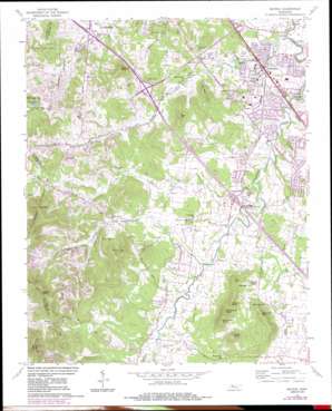
Smyrna Topo Map Tennessee
To zoom in, hover over the map of Smyrna
USGS Topo Quad 35086h5 - 1:24,000 scale
| Topo Map Name: | Smyrna |
| USGS Topo Quad ID: | 35086h5 |
| Print Size: | ca. 21 1/4" wide x 27" high |
| Southeast Coordinates: | 35.875° N latitude / 86.5° W longitude |
| Map Center Coordinates: | 35.9375° N latitude / 86.5625° W longitude |
| U.S. State: | TN |
| Filename: | o35086h5.jpg |
| Download Map JPG Image: | Smyrna topo map 1:24,000 scale |
| Map Type: | Topographic |
| Topo Series: | 7.5´ |
| Map Scale: | 1:24,000 |
| Source of Map Images: | United States Geological Survey (USGS) |
| Alternate Map Versions: |
Smyrna TN 1957, updated 1958 Download PDF Buy paper map Smyrna TN 1957, updated 1967 Download PDF Buy paper map Smyrna TN 1957, updated 1980 Download PDF Buy paper map Smyrna TN 1957, updated 1984 Download PDF Buy paper map Smyrna TN 1998, updated 1999 Download PDF Buy paper map Smyrna TN 2010 Download PDF Buy paper map Smyrna TN 2013 Download PDF Buy paper map Smyrna TN 2016 Download PDF Buy paper map |
1:24,000 Topo Quads surrounding Smyrna
> Back to 35086e1 at 1:100,000 scale
> Back to 35086a1 at 1:250,000 scale
> Back to U.S. Topo Maps home
Smyrna topo map: Gazetteer
Smyrna: Crossings
Interchange 62 elevation 182m 597′Interchange 64 elevation 190m 623′
Interchange 70 elevation 162m 531′
Smyrna: Lakes
Blue Water Lake elevation 226m 741′Smyrna: Parks
Battle Road Park elevation 215m 705′Gregory Mill Dam Park elevation 157m 515′
Smyrna Recreation Park elevation 168m 551′
Smyrna: Populated Places
Aberdeen Park elevation 174m 570′Belle Mead elevation 168m 551′
Bluefield elevation 174m 570′
Creekside elevation 174m 570′
Davis Meadows elevation 169m 554′
Emmitt Heights elevation 179m 587′
Foxland Forest elevation 173m 567′
Glenrose Park elevation 168m 551′
Green Acres elevation 174m 570′
Haynes elevation 226m 741′
Hilltop elevation 193m 633′
Jordan Acres elevation 181m 593′
Little Hope elevation 189m 620′
Loafers Corner elevation 172m 564′
Marathon Trail elevation 178m 583′
McAndore Estates elevation 169m 554′
Neal Circle elevation 173m 567′
Oak Valley elevation 162m 531′
Quail Ridge elevation 168m 551′
Rocksprings elevation 201m 659′
Rocky Fork elevation 190m 623′
Rosewood Park elevation 172m 564′
Rosswood elevation 178m 583′
Sagefield elevation 168m 551′
Shadowbrook elevation 173m 567′
Smyrna elevation 166m 544′
Southern Meadows elevation 174m 570′
Stone Ridge elevation 186m 610′
Tarrytown Estates elevation 168m 551′
Valley Green Acres elevation 169m 554′
Walnut Ridge elevation 221m 725′
Smyrna: Post Offices
Smyrna Post Office elevation 167m 547′Smyrna: Springs
Gwyn Spring elevation 164m 538′Smyrna: Streams
Harts Branch elevation 153m 501′Maxwell Branch elevation 174m 570′
Olive Branch elevation 157m 515′
Rock Spring Branch elevation 162m 531′
Rocky Fork Creek elevation 164m 538′
Smyrna: Summits
Blackman Hill elevation 257m 843′Britton Hill elevation 226m 741′
Flag Hill elevation 334m 1095′
Gibbs Knob elevation 274m 898′
Grindstone Knob elevation 278m 912′
Hickory Knob elevation 265m 869′
Moor Hill elevation 254m 833′
Persimmon Knob elevation 263m 862′
Prewitts Knob elevation 293m 961′
Sanford Knob elevation 274m 898′
Signal Knob elevation 353m 1158′
Smith Hill elevation 230m 754′
Sumner Knob elevation 370m 1213′
Smyrna digital topo map on disk
Buy this Smyrna topo map showing relief, roads, GPS coordinates and other geographical features, as a high-resolution digital map file on DVD:


