Ovilla Topo Map Tennessee
To zoom in, hover over the map of Ovilla
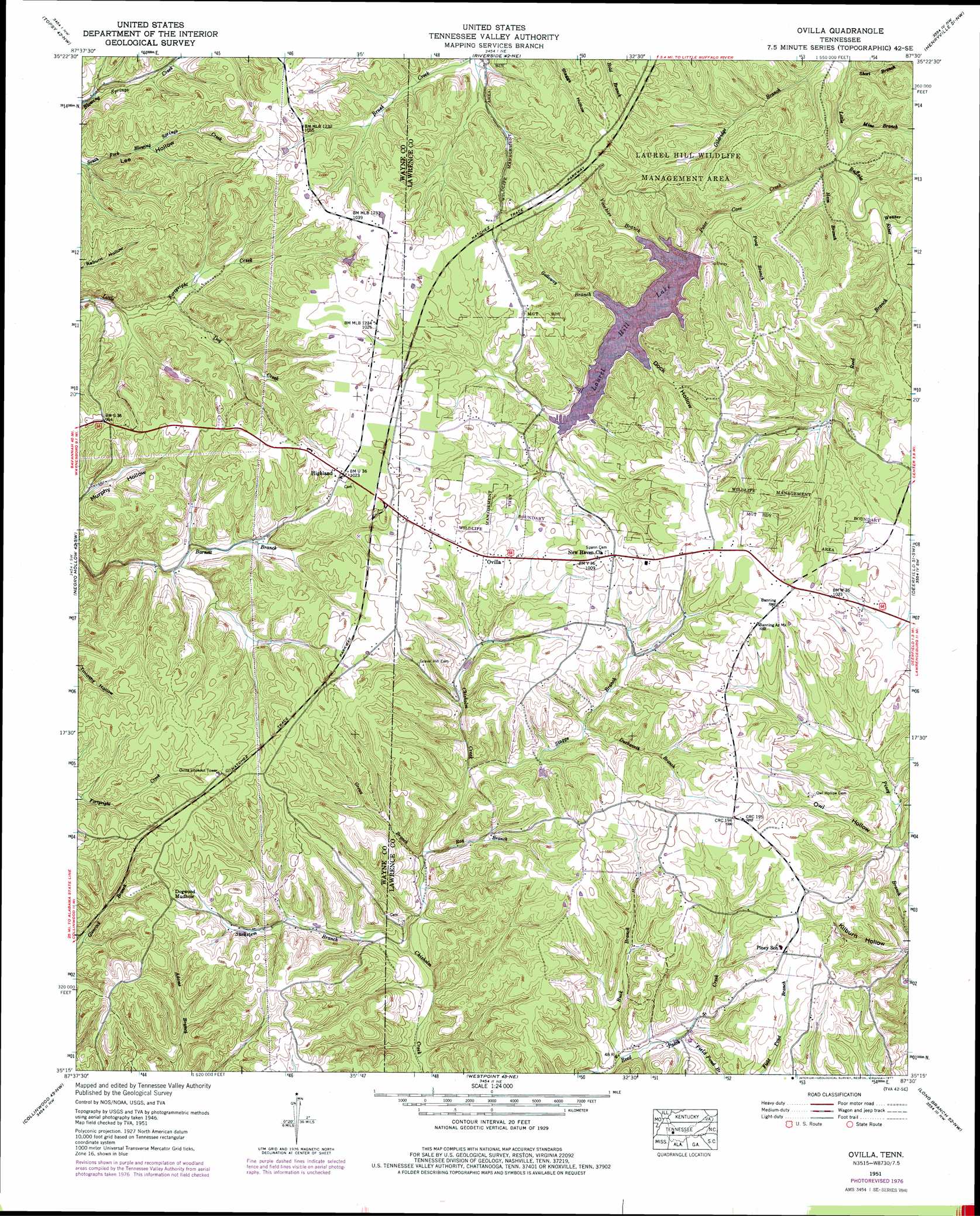
USGS Topo Quad 35087c5 - 1:24,000 scale
| Topo Map Name: | Ovilla |
| USGS Topo Quad ID: | 35087c5 |
| Print Size: | ca. 21 1/4" wide x 27" high |
| Southeast Coordinates: | 35.25° N latitude / 87.5° W longitude |
| Map Center Coordinates: | 35.3125° N latitude / 87.5625° W longitude |
| U.S. State: | TN |
| Filename: | o35087c5.jpg |
| Download Map JPG Image: | Ovilla topo map 1:24,000 scale |
| Map Type: | Topographic |
| Topo Series: | 7.5´ |
| Map Scale: | 1:24,000 |
| Source of Map Images: | United States Geological Survey (USGS) |
| Alternate Map Versions: |
Ovilla TN 1936 Download PDF Buy paper map Ovilla TN 1951, updated 1954 Download PDF Buy paper map Ovilla TN 1951, updated 1977 Download PDF Buy paper map Ovilla TN 2010 Download PDF Buy paper map Ovilla TN 2013 Download PDF Buy paper map Ovilla TN 2016 Download PDF Buy paper map |
1:24,000 Topo Quads surrounding Ovilla
Linden |
Graves Spring |
Kimmins |
Gordonsburg |
Mount Joy |
Leatherwood |
Topsy |
Riverside |
Henryville |
Summertown |
Waynesboro |
Negro Hollow |
Ovilla |
Deerfield |
Ethridge |
Three Churches |
Collinwood |
Westpoint |
Long Branch |
Lawrenceburg |
Cypress Inn |
Whitten |
Saint Joseph |
Loretto |
Bonnertown |
> Back to 35087a1 at 1:100,000 scale
> Back to 35086a1 at 1:250,000 scale
> Back to U.S. Topo Maps home
Ovilla topo map: Gazetteer
Ovilla: Dams
Laurel Hill Lake Dam elevation 264m 866′Ovilla: Parks
Laurel Hill Wildlife Management Area elevation 294m 964′Ovilla: Populated Places
Bird (historical) elevation 304m 997′Gower (historical) elevation 305m 1000′
Highland elevation 311m 1020′
New Haven elevation 306m 1003′
Ovilla elevation 299m 980′
Ovilla: Reservoirs
Laurel Hill Lake elevation 264m 866′Ovilla: Streams
Buck Branch elevation 243m 797′Dog Creek elevation 243m 797′
Duckworth Branch elevation 262m 859′
Field Pond Branch elevation 257m 843′
Galloway Branch elevation 265m 869′
Grews Branch elevation 238m 780′
Ham Branch elevation 244m 800′
Mine Branch elevation 242m 793′
Peter Cave Creek elevation 244m 800′
Poag Branch elevation 255m 836′
Ray Branch elevation 239m 784′
Reed Branch elevation 251m 823′
Short Branch elevation 237m 777′
Staggs Branch elevation 249m 816′
Suckstem Branch elevation 234m 767′
Taylor Branch elevation 255m 836′
Voorhies Branch elevation 264m 866′
Weaver Branch elevation 244m 800′
Ovilla: Valleys
Dock Hollow elevation 264m 866′Owl Hollow elevation 255m 836′
Ovilla digital topo map on disk
Buy this Ovilla topo map showing relief, roads, GPS coordinates and other geographical features, as a high-resolution digital map file on DVD: