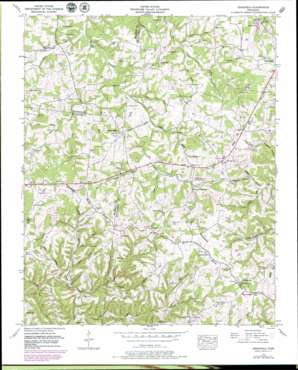
Craigfield Topo Map Tennessee
To zoom in, hover over the map of Craigfield
USGS Topo Quad 35087h2 - 1:24,000 scale
| Topo Map Name: | Craigfield |
| USGS Topo Quad ID: | 35087h2 |
| Print Size: | ca. 21 1/4" wide x 27" high |
| Southeast Coordinates: | 35.875° N latitude / 87.125° W longitude |
| Map Center Coordinates: | 35.9375° N latitude / 87.1875° W longitude |
| U.S. State: | TN |
| Filename: | o35087h2.jpg |
| Download Map JPG Image: | Craigfield topo map 1:24,000 scale |
| Map Type: | Topographic |
| Topo Series: | 7.5´ |
| Map Scale: | 1:24,000 |
| Source of Map Images: | United States Geological Survey (USGS) |
| Alternate Map Versions: |
Craigfield TN 1936 Download PDF Buy paper map Craigfield TN 1953, updated 1957 Download PDF Buy paper map Craigfield TN 1953, updated 1978 Download PDF Buy paper map Craigfield TN 1953, updated 1980 Download PDF Buy paper map Craigfield TN 2010 Download PDF Buy paper map Craigfield TN 2013 Download PDF Buy paper map Craigfield TN 2016 Download PDF Buy paper map |
1:24,000 Topo Quads surrounding Craigfield
> Back to 35087e1 at 1:100,000 scale
> Back to 35086a1 at 1:250,000 scale
> Back to U.S. Topo Maps home
Craigfield topo map: Gazetteer
Craigfield: Dams
Lake Weona Dam elevation 244m 800′Craigfield: Populated Places
Clement Lake Estates elevation 234m 767′Craigfield elevation 281m 921′
Daugherty Estates elevation 278m 912′
Fairview Heights elevation 270m 885′
Glenhaven elevation 263m 862′
Green Valley elevation 280m 918′
Hallview Meadows elevation 264m 866′
Kenny Brook elevation 254m 833′
Lake Road elevation 267m 875′
Liberty Hill elevation 255m 836′
Loriland elevation 262m 859′
Meadowwood Acres elevation 255m 836′
Spencers Mill elevation 216m 708′
Tidwell elevation 284m 931′
Valley Green Estates elevation 257m 843′
Craigfield: Reservoirs
Clement Lake elevation 229m 751′Lake Weona elevation 244m 800′
Craigfield: Springs
Quinn Spring elevation 229m 751′Craigfield: Streams
Aden Branch elevation 202m 662′Barren Fork elevation 193m 633′
Bice Creek elevation 192m 629′
Bradford Branch elevation 207m 679′
Craig Branch elevation 220m 721′
Davis Branch elevation 206m 675′
Deadfall Branch elevation 213m 698′
Dobson Branch elevation 202m 662′
Hickman Branch elevation 214m 702′
Joe Branch elevation 207m 679′
Nancy Branch elevation 215m 705′
Naomi Branch elevation 206m 675′
Overby Branch elevation 205m 672′
Parker Creek elevation 187m 613′
Quinn Branch elevation 201m 659′
Rials Branch elevation 200m 656′
Sims Branch elevation 212m 695′
Sugar Camp Branch elevation 201m 659′
Tidwell Branch elevation 225m 738′
Walker Branch elevation 216m 708′
Younger Creek elevation 188m 616′
Craigfield: Valleys
Sleepy Hollow elevation 228m 748′Craigfield digital topo map on disk
Buy this Craigfield topo map showing relief, roads, GPS coordinates and other geographical features, as a high-resolution digital map file on DVD:


