Michie Topo Map Tennessee
To zoom in, hover over the map of Michie
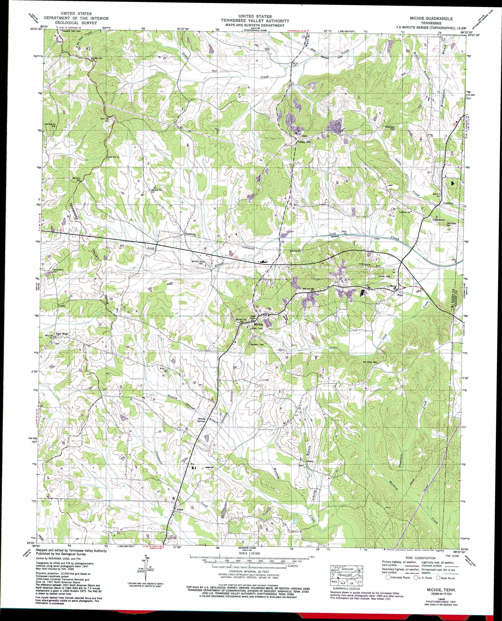
USGS Topo Quad 35088a4 - 1:24,000 scale
| Topo Map Name: | Michie |
| USGS Topo Quad ID: | 35088a4 |
| Print Size: | ca. 21 1/4" wide x 27" high |
| Southeast Coordinates: | 35° N latitude / 88.375° W longitude |
| Map Center Coordinates: | 35.0625° N latitude / 88.4375° W longitude |
| U.S. State: | TN |
| Filename: | o35088a4.jpg |
| Download Map JPG Image: | Michie topo map 1:24,000 scale |
| Map Type: | Topographic |
| Topo Series: | 7.5´ |
| Map Scale: | 1:24,000 |
| Source of Map Images: | United States Geological Survey (USGS) |
| Alternate Map Versions: |
Michie TN 1936 Download PDF Buy paper map Michie TN 1949, updated 1974 Download PDF Buy paper map Michie TN 1949, updated 1991 Download PDF Buy paper map Michie TN 1952 Download PDF Buy paper map Michie TN 2010 Download PDF Buy paper map Michie TN 2013 Download PDF Buy paper map Michie TN 2016 Download PDF Buy paper map |
1:24,000 Topo Quads surrounding Michie
Masseyville |
Mount Peter |
Leapwood |
Milledgeville |
Hookers Bend |
Rose Creek |
Purdy |
Stantonville |
Pittsburg Landing |
Savannah |
Chewalla |
Guys |
Michie |
Counce |
Pickwick |
Kossuth North |
Corinth |
Kendrick |
Doskie |
Yellow Creek |
Kossuth South |
Rienzi |
Glens |
Burnsville |
Iuka |
> Back to 35088a1 at 1:100,000 scale
> Back to 35088a1 at 1:250,000 scale
> Back to U.S. Topo Maps home
Michie topo map: Gazetteer
Michie: Populated Places
Acton elevation 141m 462′Caffey elevation 153m 501′
Chambers elevation 143m 469′
Liberty elevation 142m 465′
Michie elevation 185m 606′
Needmore elevation 149m 488′
New Hope elevation 152m 498′
Pebble Hill elevation 183m 600′
Tulu elevation 139m 456′
Michie: Springs
Donald Springs elevation 138m 452′Michie: Streams
Donald Springs Branch elevation 136m 446′Liberty Branch elevation 133m 436′
Little Lick Creek elevation 122m 400′
Little Owl Creek elevation 125m 410′
Sharp Branch elevation 134m 439′
Singleton Creek elevation 129m 423′
Spring Branch elevation 128m 419′
Wyatt Branch elevation 125m 410′
Michie digital topo map on disk
Buy this Michie topo map showing relief, roads, GPS coordinates and other geographical features, as a high-resolution digital map file on DVD: