Hornsby Topo Map Tennessee
To zoom in, hover over the map of Hornsby
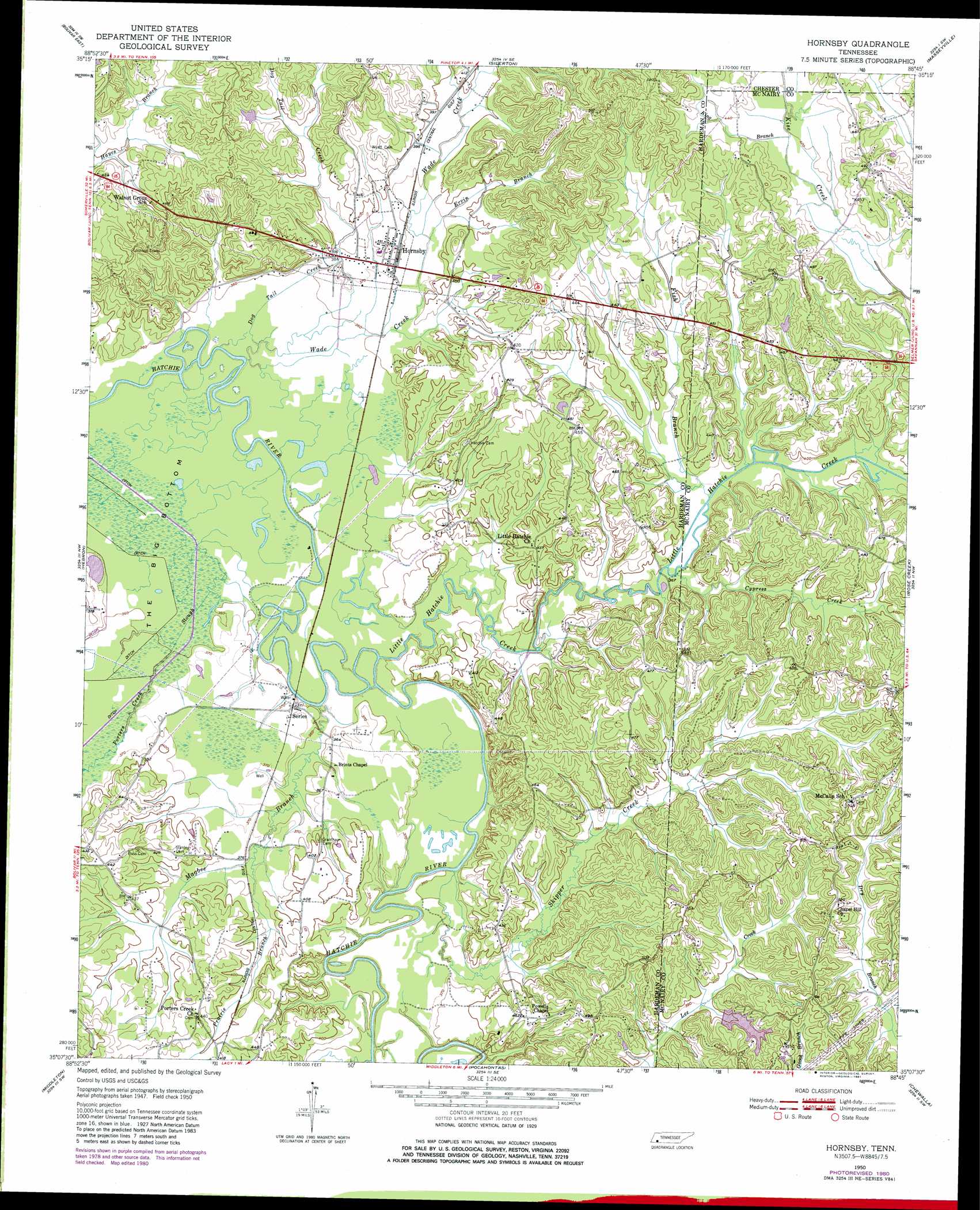
USGS Topo Quad 35088b7 - 1:24,000 scale
| Topo Map Name: | Hornsby |
| USGS Topo Quad ID: | 35088b7 |
| Print Size: | ca. 21 1/4" wide x 27" high |
| Southeast Coordinates: | 35.125° N latitude / 88.75° W longitude |
| Map Center Coordinates: | 35.1875° N latitude / 88.8125° W longitude |
| U.S. State: | TN |
| Filename: | o35088b7.jpg |
| Download Map JPG Image: | Hornsby topo map 1:24,000 scale |
| Map Type: | Topographic |
| Topo Series: | 7.5´ |
| Map Scale: | 1:24,000 |
| Source of Map Images: | United States Geological Survey (USGS) |
| Alternate Map Versions: |
Hornsby TN 1950, updated 1973 Download PDF Buy paper map Hornsby TN 1950, updated 1981 Download PDF Buy paper map Hornsby TN 1950, updated 1981 Download PDF Buy paper map Hornsby TN 1951 Download PDF Buy paper map Hornsby TN 2010 Download PDF Buy paper map Hornsby TN 2013 Download PDF Buy paper map Hornsby TN 2016 Download PDF Buy paper map |
1:24,000 Topo Quads surrounding Hornsby
Mercer |
Teague |
Medon |
Henderson |
Jacks Creek |
Bolivar West |
Bolivar East |
Silerton |
Masseyville |
Mount Peter |
Middleburg |
Hebron |
Hornsby |
Rose Creek |
Purdy |
Saulsbury |
Middleton |
Pocahontas |
Chewalla |
Guys |
Camp Hill |
Walnut |
Chalybeate |
Kossuth North |
Corinth |
> Back to 35088a1 at 1:100,000 scale
> Back to 35088a1 at 1:250,000 scale
> Back to U.S. Topo Maps home
Hornsby topo map: Gazetteer
Hornsby: Basins
The Big Bottom elevation 109m 357′Hornsby: Dams
J J Madison Dam elevation 125m 410′Hornsby: Populated Places
Hornsby elevation 116m 380′Porters Creek elevation 132m 433′
Serles elevation 113m 370′
Hornsby: Reservoirs
J J Madison Lake elevation 125m 410′Hornsby: Streams
Cypress Creek elevation 111m 364′Dog Tail Creek elevation 107m 351′
Ervin Branch elevation 113m 370′
Fish Branch elevation 111m 364′
King Branch elevation 128m 419′
Little Hatchie Creek elevation 107m 351′
Magbee Branch elevation 107m 351′
Porters Creek Slough elevation 109m 357′
Prairie Branch elevation 111m 364′
Skipper Creek elevation 107m 351′
Wade Creek elevation 107m 351′
Hornsby digital topo map on disk
Buy this Hornsby topo map showing relief, roads, GPS coordinates and other geographical features, as a high-resolution digital map file on DVD: