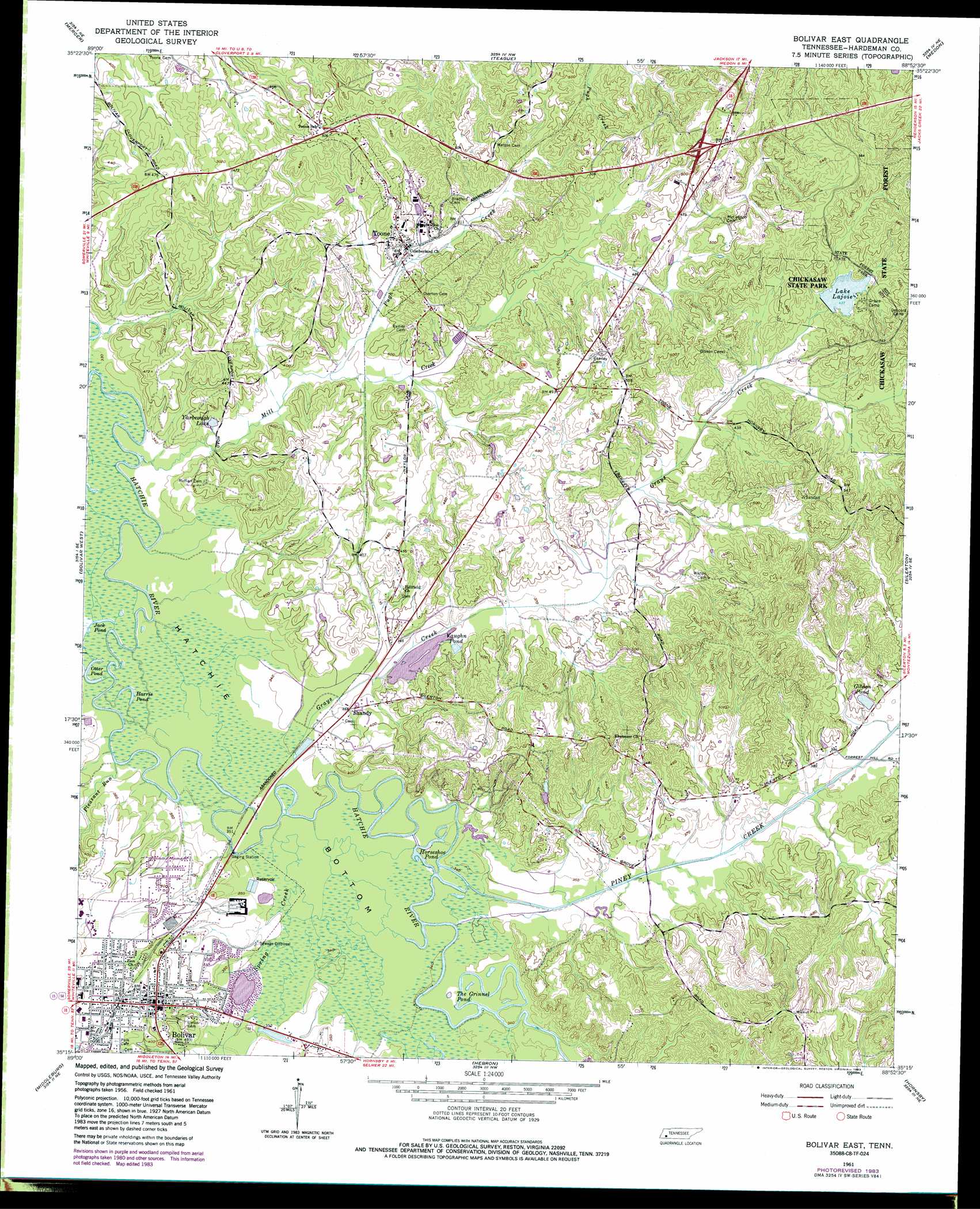
Bolivar East Topo Map Tennessee
To zoom in, hover over the map of Bolivar East
USGS Topo Quad 35088c8 - 1:24,000 scale
| Topo Map Name: | Bolivar East |
| USGS Topo Quad ID: | 35088c8 |
| Print Size: | ca. 21 1/4" wide x 27" high |
| Southeast Coordinates: | 35.25° N latitude / 88.875° W longitude |
| Map Center Coordinates: | 35.3125° N latitude / 88.9375° W longitude |
| U.S. State: | TN |
| Filename: | o35088c8.jpg |
| Download Map JPG Image: | Bolivar East topo map 1:24,000 scale |
| Map Type: | Topographic |
| Topo Series: | 7.5´ |
| Map Scale: | 1:24,000 |
| Source of Map Images: | United States Geological Survey (USGS) |
| Alternate Map Versions: |
Bolivar East TN 1961, updated 1964 Download PDF Buy paper map Bolivar East TN 1961, updated 1981 Download PDF Buy paper map Bolivar East TN 1961, updated 1983 Download PDF Buy paper map Bolivar East TN 2010 Download PDF Buy paper map Bolivar East TN 2013 Download PDF Buy paper map Bolivar East TN 2016 Download PDF Buy paper map |
1:24,000 Topo Quads surrounding Bolivar East
Sunnyhill |
Denmark |
Westover |
Jackson South |
Beech Bluff |
Hillville |
Mercer |
Teague |
Medon |
Henderson |
Whiteville |
Bolivar West |
Bolivar East |
Silerton |
Masseyville |
Hickory Valley |
Middleburg |
Hebron |
Hornsby |
Rose Creek |
Grand Junction |
Saulsbury |
Middleton |
Pocahontas |
Chewalla |
> Back to 35088a1 at 1:100,000 scale
> Back to 35088a1 at 1:250,000 scale
> Back to U.S. Topo Maps home
Bolivar East topo map: Gazetteer
Bolivar East: Dams
Lake Lajoie Dam elevation 133m 436′Bolivar East: Lakes
Beaver Pond elevation 102m 334′Harris Pond elevation 101m 331′
Horseshoe Pond elevation 101m 331′
Jack Pond elevation 101m 331′
Otter Pond elevation 101m 331′
The Grinnel Pond elevation 101m 331′
Vaughn Pond elevation 114m 374′
Bolivar East: Parks
Bills-McNeal Historic District elevation 135m 442′Bolivar Courthouse Square Historic District elevation 136m 446′
North Main Street Historic District elevation 133m 436′
Bolivar East: Populated Places
Bolivar elevation 136m 446′Shandy elevation 110m 360′
Toone elevation 125m 410′
Bolivar East: Post Offices
Bolivar Post Office elevation 136m 446′Bolivar East: Reservoirs
Gibson Pond elevation 119m 390′Lake Lajoice elevation 133m 436′
Yarbrough Lake elevation 108m 354′
Bolivar East: Streams
Grays Creek elevation 101m 331′Mill Creek elevation 100m 328′
Piney Creek elevation 101m 331′
Pleasant Run elevation 101m 331′
Pugh Creek elevation 109m 357′
Spring Creek elevation 101m 331′
Bolivar East digital topo map on disk
Buy this Bolivar East topo map showing relief, roads, GPS coordinates and other geographical features, as a high-resolution digital map file on DVD: