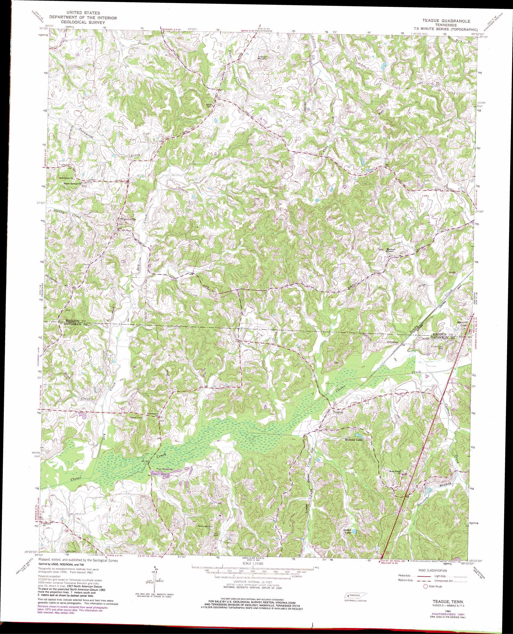
Teague Topo Map Tennessee
To zoom in, hover over the map of Teague
USGS Topo Quad 35088d8 - 1:24,000 scale
| Topo Map Name: | Teague |
| USGS Topo Quad ID: | 35088d8 |
| Print Size: | ca. 21 1/4" wide x 27" high |
| Southeast Coordinates: | 35.375° N latitude / 88.875° W longitude |
| Map Center Coordinates: | 35.4375° N latitude / 88.9375° W longitude |
| U.S. State: | TN |
| Filename: | o35088d8.jpg |
| Download Map JPG Image: | Teague topo map 1:24,000 scale |
| Map Type: | Topographic |
| Topo Series: | 7.5´ |
| Map Scale: | 1:24,000 |
| Source of Map Images: | United States Geological Survey (USGS) |
| Alternate Map Versions: |
Teague TN 1961, updated 1964 Download PDF Buy paper map Teague TN 1961, updated 1981 Download PDF Buy paper map Teague TN 2010 Download PDF Buy paper map Teague TN 2013 Download PDF Buy paper map Teague TN 2016 Download PDF Buy paper map |
1:24,000 Topo Quads surrounding Teague
Jones |
Bells |
Adair |
Jackson North |
Claybrook |
Sunnyhill |
Denmark |
Westover |
Jackson South |
Beech Bluff |
Hillville |
Mercer |
Teague |
Medon |
Henderson |
Whiteville |
Bolivar West |
Bolivar East |
Silerton |
Masseyville |
Hickory Valley |
Middleburg |
Hebron |
Hornsby |
Rose Creek |
> Back to 35088a1 at 1:100,000 scale
> Back to 35088a1 at 1:250,000 scale
> Back to U.S. Topo Maps home
Teague topo map: Gazetteer
Teague: Dams
Johnson Creek Dam Two elevation 146m 479′Teague: Lakes
Butler Lake elevation 130m 426′Teague: Populated Places
Teague elevation 116m 380′Uptonville elevation 157m 515′
Teague: Reservoirs
Holland Lake elevation 128m 419′Johnson Creek Lake Two elevation 146m 479′
Teague: Streams
Bean Creek elevation 110m 360′Cobb Creek elevation 150m 492′
Cypress Creek elevation 117m 383′
Dry Creek elevation 105m 344′
Pugh Creek elevation 110m 360′
Sandy Creek elevation 115m 377′
Sweeton Branch elevation 123m 403′
Teague digital topo map on disk
Buy this Teague topo map showing relief, roads, GPS coordinates and other geographical features, as a high-resolution digital map file on DVD: