Reagan Topo Map Tennessee
To zoom in, hover over the map of Reagan
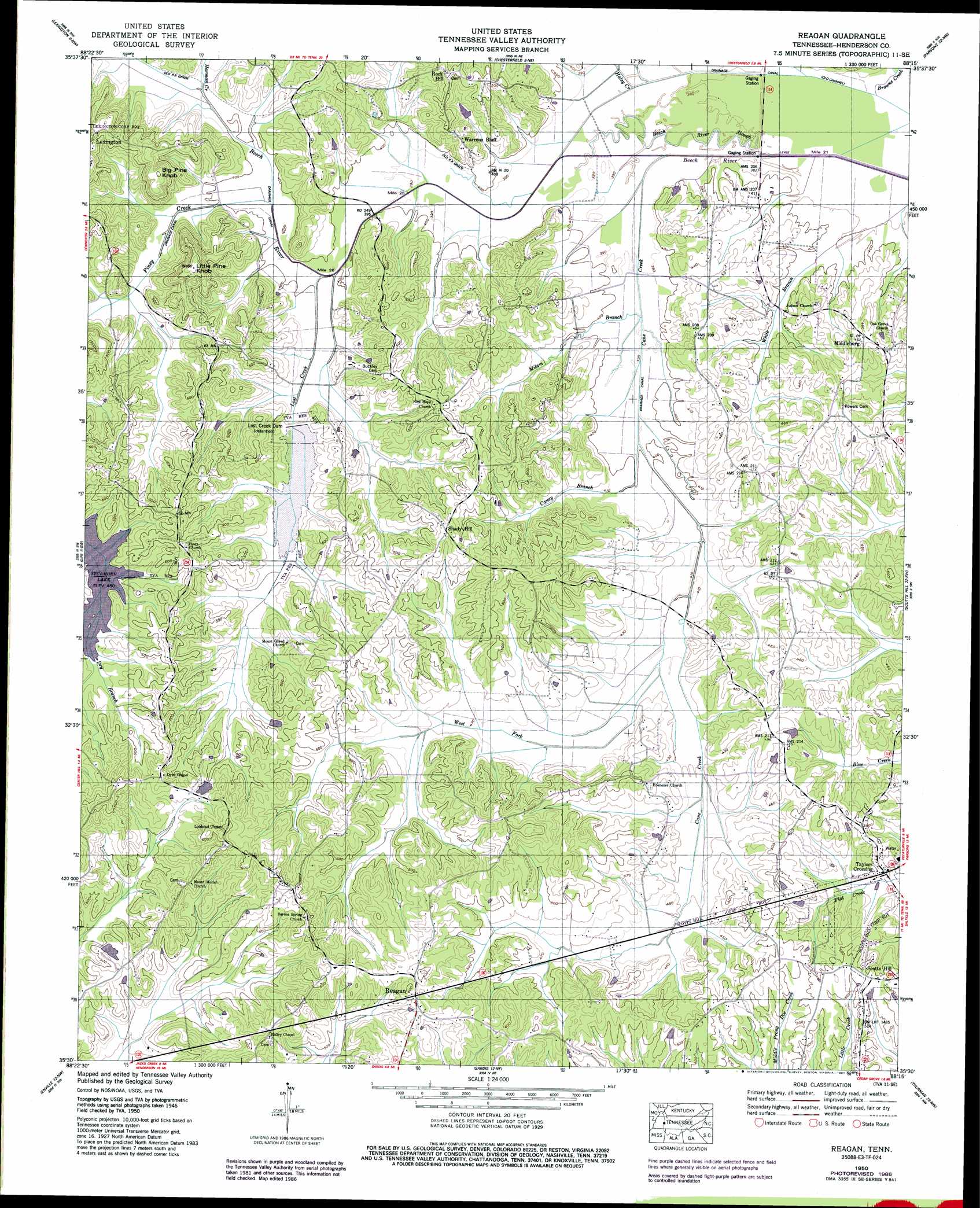
USGS Topo Quad 35088e3 - 1:24,000 scale
| Topo Map Name: | Reagan |
| USGS Topo Quad ID: | 35088e3 |
| Print Size: | ca. 21 1/4" wide x 27" high |
| Southeast Coordinates: | 35.5° N latitude / 88.25° W longitude |
| Map Center Coordinates: | 35.5625° N latitude / 88.3125° W longitude |
| U.S. State: | TN |
| Filename: | o35088e3.jpg |
| Download Map JPG Image: | Reagan topo map 1:24,000 scale |
| Map Type: | Topographic |
| Topo Series: | 7.5´ |
| Map Scale: | 1:24,000 |
| Source of Map Images: | United States Geological Survey (USGS) |
| Alternate Map Versions: |
Reagan TN 1936 Download PDF Buy paper map Reagan TN 1950, updated 1952 Download PDF Buy paper map Reagan TN 1950, updated 1987 Download PDF Buy paper map Reagan TN 2010 Download PDF Buy paper map Reagan TN 2013 Download PDF Buy paper map Reagan TN 2016 Download PDF Buy paper map |
1:24,000 Topo Quads surrounding Reagan
Cedar Grove |
Clarksburg |
Yuma |
Holladay |
Sugar Tree |
Juno |
Lexington |
Chesterfield |
Parsons |
Jeanette |
Luray |
Life |
Reagan |
Scotts Hill |
Perryville |
Jacks Creek |
Enville |
Sardis |
Thurman |
Bath Springs |
Mount Peter |
Leapwood |
Milledgeville |
Hookers Bend |
Olivehill |
> Back to 35088e1 at 1:100,000 scale
> Back to 35088a1 at 1:250,000 scale
> Back to U.S. Topo Maps home
Reagan topo map: Gazetteer
Reagan: Dams
Hesse Lake Dam elevation 140m 459′Lost Creek Dam elevation 124m 406′
Robert L Hopkins Dam elevation 156m 511′
Reagan: Populated Places
Middleburg elevation 142m 465′Reagan elevation 180m 590′
Rock Hill elevation 159m 521′
Shady Hill elevation 167m 547′
Stubblefields (historical) elevation 141m 462′
Taylors Crossing elevation 135m 442′
Warrens Bluff elevation 140m 459′
Reagan: Post Offices
Reagan Post Office elevation 175m 574′Warrens Bluff Post Office (historical) elevation 134m 439′
Reagan: Reservoirs
Hesse Lake elevation 140m 459′Robert Hopkins Lake elevation 156m 511′
Reagan: Streams
Browns Creek elevation 114m 374′Caney Branch elevation 119m 390′
East Fork Cane Creek elevation 122m 400′
Haley Creek elevation 116m 380′
Harmon Creek elevation 122m 400′
Lick Creek elevation 116m 380′
Lost Creek elevation 119m 390′
Milam Branch elevation 117m 383′
Piney Creek elevation 119m 390′
West Fork Cane Creek elevation 122m 400′
White Branch elevation 115m 377′
Reagan: Summits
Big Pine Knob elevation 184m 603′Little Pine Knob elevation 193m 633′
Reagan digital topo map on disk
Buy this Reagan topo map showing relief, roads, GPS coordinates and other geographical features, as a high-resolution digital map file on DVD: