Westover Topo Map Tennessee
To zoom in, hover over the map of Westover
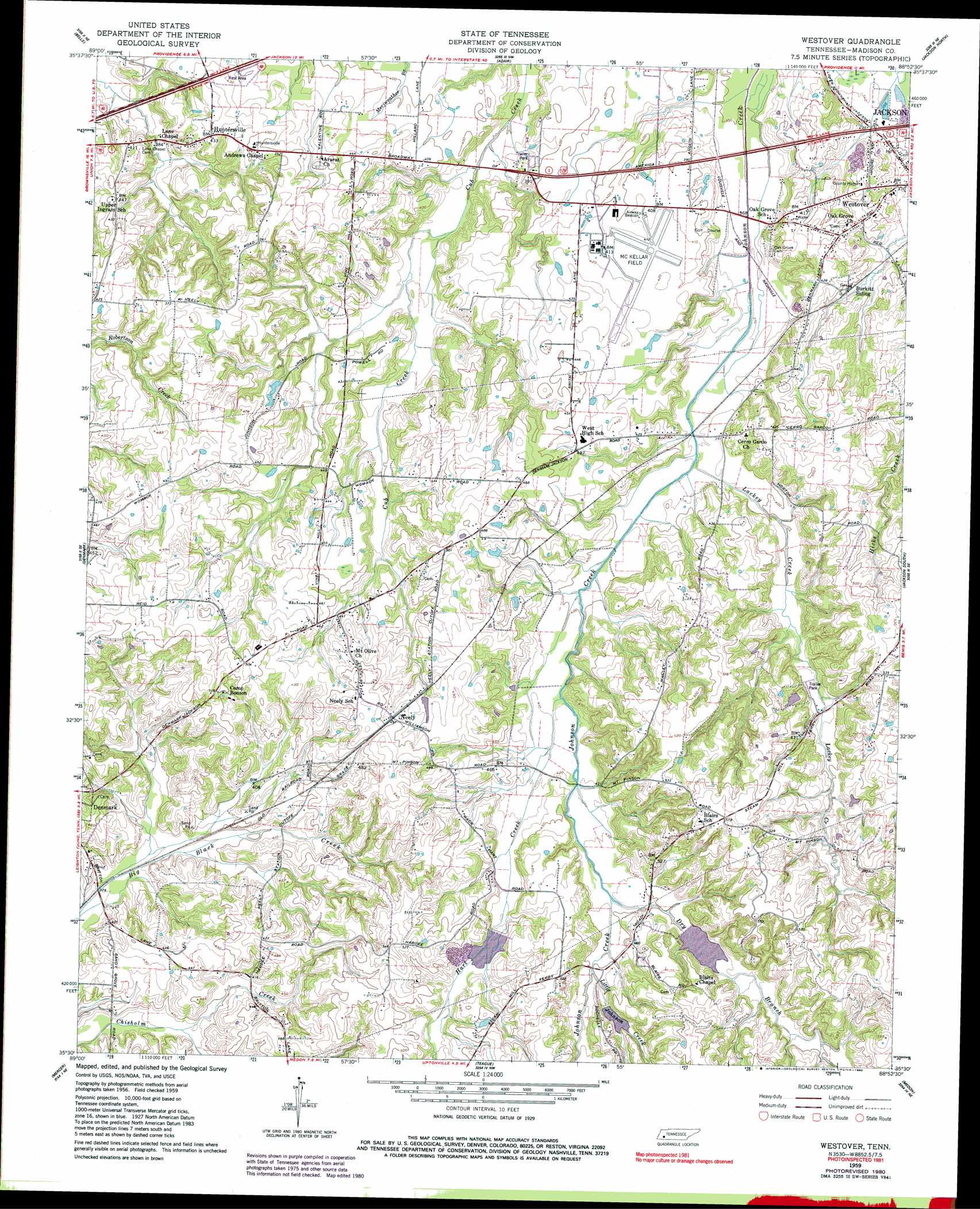
USGS Topo Quad 35088e8 - 1:24,000 scale
| Topo Map Name: | Westover |
| USGS Topo Quad ID: | 35088e8 |
| Print Size: | ca. 21 1/4" wide x 27" high |
| Southeast Coordinates: | 35.5° N latitude / 88.875° W longitude |
| Map Center Coordinates: | 35.5625° N latitude / 88.9375° W longitude |
| U.S. State: | TN |
| Filename: | o35088e8.jpg |
| Download Map JPG Image: | Westover topo map 1:24,000 scale |
| Map Type: | Topographic |
| Topo Series: | 7.5´ |
| Map Scale: | 1:24,000 |
| Source of Map Images: | United States Geological Survey (USGS) |
| Alternate Map Versions: |
Westover TN 1959, updated 1960 Download PDF Buy paper map Westover TN 1959, updated 1980 Download PDF Buy paper map Westover TN 1959, updated 1990 Download PDF Buy paper map Westover TN 2010 Download PDF Buy paper map Westover TN 2013 Download PDF Buy paper map Westover TN 2016 Download PDF Buy paper map |
1:24,000 Topo Quads surrounding Westover
Maury City |
Alamo |
Humboldt |
Medina |
Spring Creek |
Jones |
Bells |
Adair |
Jackson North |
Claybrook |
Sunnyhill |
Denmark |
Westover |
Jackson South |
Beech Bluff |
Hillville |
Mercer |
Teague |
Medon |
Henderson |
Whiteville |
Bolivar West |
Bolivar East |
Silerton |
Masseyville |
> Back to 35088e1 at 1:100,000 scale
> Back to 35088a1 at 1:250,000 scale
> Back to U.S. Topo Maps home
Westover topo map: Gazetteer
Westover: Airports
McKellar Field elevation 127m 416′Westover: Dams
Johnson Creek Dam Four elevation 133m 436′Johnson Creek Dam Seven elevation 127m 416′
Johnson Creek Dam Ten elevation 152m 498′
Westover: Parks
Pope Park elevation 127m 416′Westover: Populated Places
Huntersville elevation 133m 436′Neely elevation 150m 492′
Oak Grove elevation 112m 367′
Westover elevation 112m 367′
Westover: Reservoirs
Johnson Creek Lake Four elevation 133m 436′Johnson Creek Lake Seven elevation 127m 416′
Johnson Creek Lake Ten elevation 152m 498′
Westover: Streams
Dry Branch elevation 132m 433′Hart Creek elevation 122m 400′
Lackey Creek elevation 114m 374′
Little Johnson Creek elevation 138m 452′
Westover digital topo map on disk
Buy this Westover topo map showing relief, roads, GPS coordinates and other geographical features, as a high-resolution digital map file on DVD: