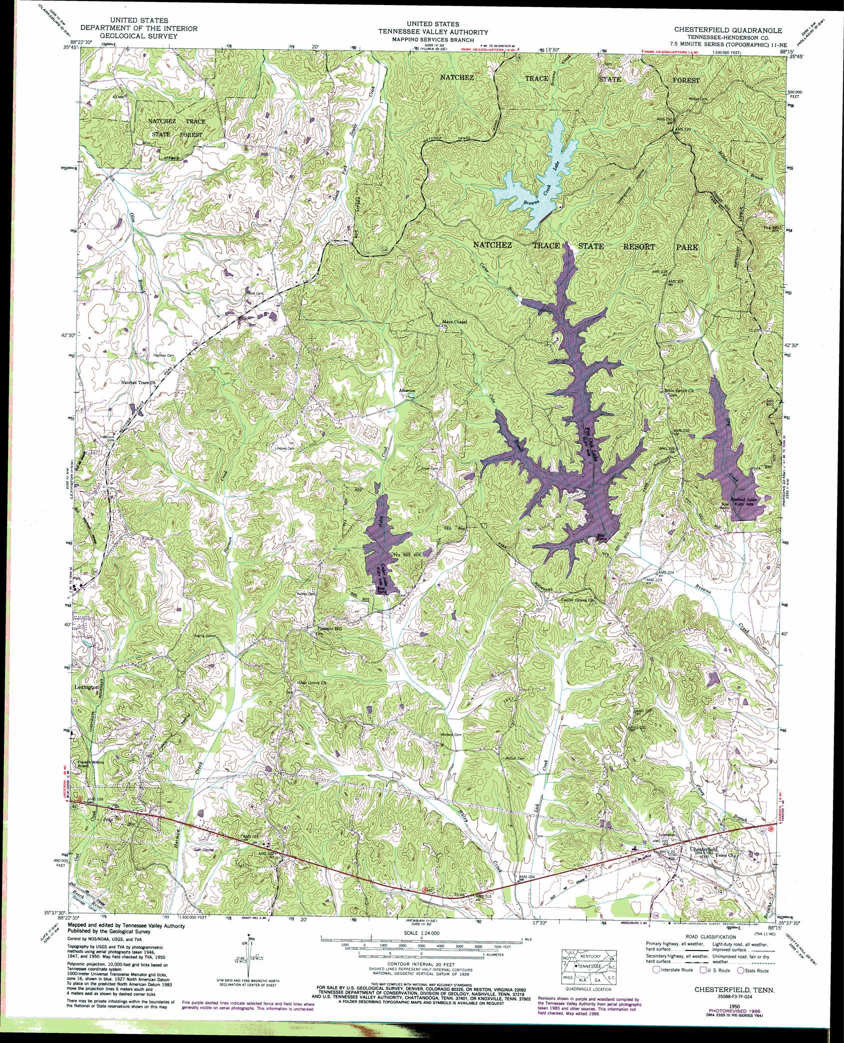
Chesterfield Topo Map Tennessee
To zoom in, hover over the map of Chesterfield
USGS Topo Quad 35088f3 - 1:24,000 scale
| Topo Map Name: | Chesterfield |
| USGS Topo Quad ID: | 35088f3 |
| Print Size: | ca. 21 1/4" wide x 27" high |
| Southeast Coordinates: | 35.625° N latitude / 88.25° W longitude |
| Map Center Coordinates: | 35.6875° N latitude / 88.3125° W longitude |
| U.S. State: | TN |
| Filename: | o35088f3.jpg |
| Download Map JPG Image: | Chesterfield topo map 1:24,000 scale |
| Map Type: | Topographic |
| Topo Series: | 7.5´ |
| Map Scale: | 1:24,000 |
| Source of Map Images: | United States Geological Survey (USGS) |
| Alternate Map Versions: |
Chesterfield TN 1936 Download PDF Buy paper map Chesterfield TN 1950, updated 1953 Download PDF Buy paper map Chesterfield TN 1950, updated 1965 Download PDF Buy paper map Chesterfield TN 1950, updated 1974 Download PDF Buy paper map Chesterfield TN 1950, updated 1987 Download PDF Buy paper map Chesterfield TN 2010 Download PDF Buy paper map Chesterfield TN 2013 Download PDF Buy paper map Chesterfield TN 2016 Download PDF Buy paper map |
1:24,000 Topo Quads surrounding Chesterfield
Mclemoresville |
Palmer Shelter |
Buena Vista |
Seventeen Creek |
Rockport |
Cedar Grove |
Clarksburg |
Yuma |
Holladay |
Sugar Tree |
Juno |
Lexington |
Chesterfield |
Parsons |
Jeanette |
Luray |
Life |
Reagan |
Scotts Hill |
Perryville |
Jacks Creek |
Enville |
Sardis |
Thurman |
Bath Springs |
> Back to 35088e1 at 1:100,000 scale
> Back to 35088a1 at 1:250,000 scale
> Back to U.S. Topo Maps home
Chesterfield topo map: Gazetteer
Chesterfield: Dams
Brown Creek Dam elevation 144m 472′Cedar Dam elevation 132m 433′
Pin Oak Dam elevation 133m 436′
Redbud Dam elevation 134m 439′
Chesterfield: Parks
Amis City Park elevation 175m 574′Chesterfield: Populated Places
Alberton elevation 139m 456′Chesterfield elevation 123m 403′
Oak Grove elevation 163m 534′
Pleasant Hill elevation 166m 544′
Chesterfield: Post Offices
Chesterfield Post Office (historical) elevation 128m 419′Chesterfield: Reservoirs
Browns Creek Lake elevation 144m 472′Cedar Lake elevation 132m 433′
Pinoak Lake elevation 133m 436′
Redbud Lake elevation 134m 439′
Chesterfield: Streams
Cabe Branch elevation 137m 449′Caney Branch elevation 118m 387′
Carter Branch elevation 137m 449′
Dry Creek elevation 123m 403′
Owl Creek elevation 123m 403′
Chesterfield digital topo map on disk
Buy this Chesterfield topo map showing relief, roads, GPS coordinates and other geographical features, as a high-resolution digital map file on DVD: