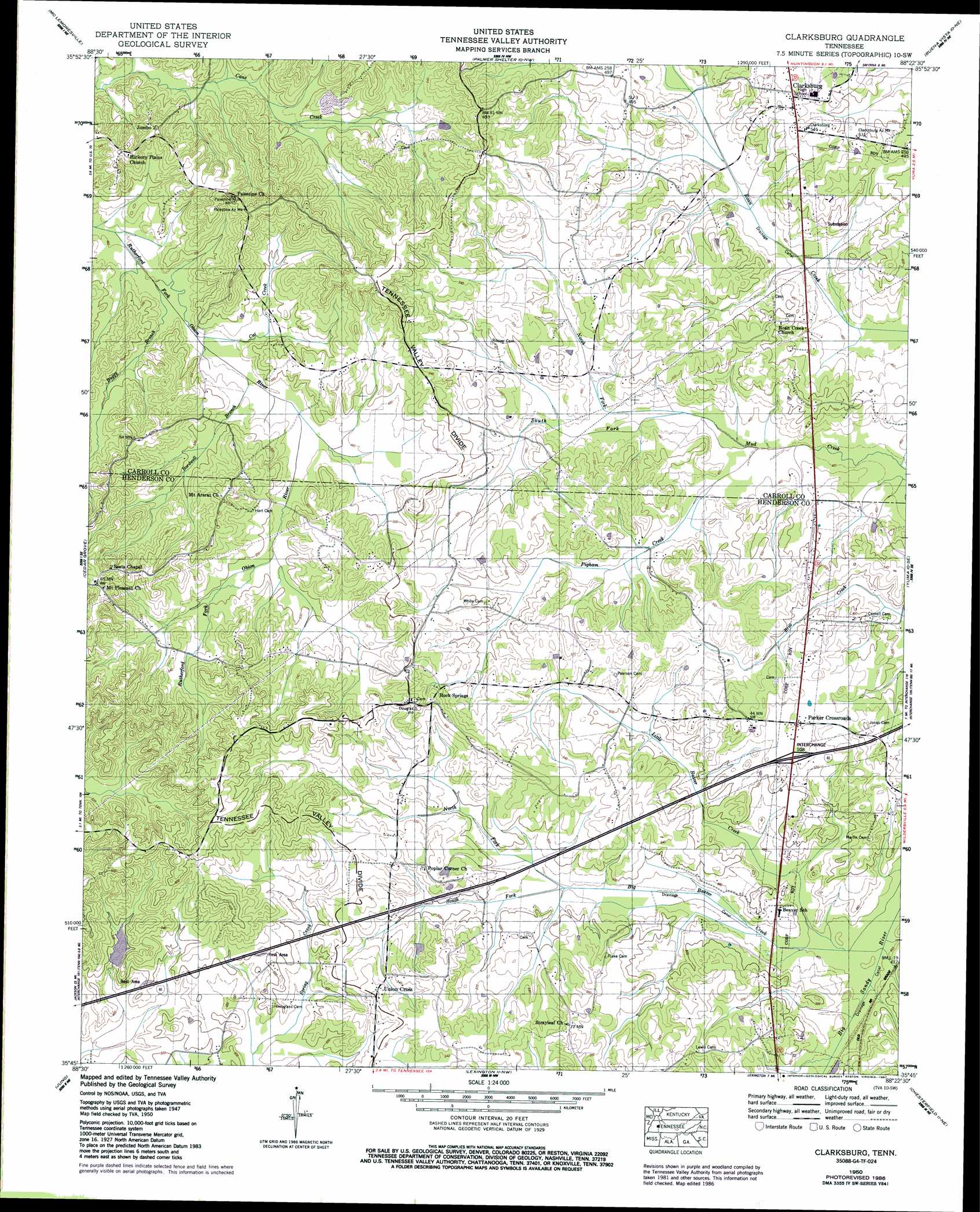
Clarksburg Topo Map Tennessee
To zoom in, hover over the map of Clarksburg
USGS Topo Quad 35088g4 - 1:24,000 scale
| Topo Map Name: | Clarksburg |
| USGS Topo Quad ID: | 35088g4 |
| Print Size: | ca. 21 1/4" wide x 27" high |
| Southeast Coordinates: | 35.75° N latitude / 88.375° W longitude |
| Map Center Coordinates: | 35.8125° N latitude / 88.4375° W longitude |
| U.S. State: | TN |
| Filename: | o35088g4.jpg |
| Download Map JPG Image: | Clarksburg topo map 1:24,000 scale |
| Map Type: | Topographic |
| Topo Series: | 7.5´ |
| Map Scale: | 1:24,000 |
| Source of Map Images: | United States Geological Survey (USGS) |
| Alternate Map Versions: |
Clarksburg TN 1936 Download PDF Buy paper map Clarksburg TN 1950, updated 1953 Download PDF Buy paper map Clarksburg TN 1950, updated 1987 Download PDF Buy paper map Clarksburg TN 2010 Download PDF Buy paper map Clarksburg TN 2013 Download PDF Buy paper map Clarksburg TN 2016 Download PDF Buy paper map |
1:24,000 Topo Quads surrounding Clarksburg
Trezevant West |
Trezevant East |
Huntingdon |
Vale |
Bruceton |
Atwood |
Mclemoresville |
Palmer Shelter |
Buena Vista |
Seventeen Creek |
Spring Creek |
Cedar Grove |
Clarksburg |
Yuma |
Holladay |
Claybrook |
Juno |
Lexington |
Chesterfield |
Parsons |
Beech Bluff |
Luray |
Life |
Reagan |
Scotts Hill |
> Back to 35088e1 at 1:100,000 scale
> Back to 35088a1 at 1:250,000 scale
> Back to U.S. Topo Maps home
Clarksburg topo map: Gazetteer
Clarksburg: Crossings
Interchange 108 elevation 158m 518′Clarksburg: Dams
Donald Halters Dam elevation 162m 531′Elon Douglas Dam elevation 165m 541′
Spring Creek OFDBA 88-2 Dam elevation 148m 485′
Clarksburg: Populated Places
Clarksburg elevation 159m 521′Floyville (historical) elevation 174m 570′
Jumbo elevation 183m 600′
Parker Crossroads elevation 159m 521′
Rock Springs elevation 159m 521′
Union Cross elevation 167m 547′
Clarksburg: Reservoirs
Donald Halters Lake elevation 162m 531′Elon Douglas Lake elevation 165m 541′
Spring Creek Lake elevation 148m 485′
Clarksburg: Springs
Mount Ararat Spring elevation 145m 475′Clarksburg: Streams
Bardwell Branch elevation 143m 469′Big Beaver Creek elevation 140m 459′
Buggy Branch elevation 140m 459′
Cat Creek elevation 142m 465′
Little Beaver Creek elevation 140m 459′
North Fork Big Beaver Creek elevation 145m 475′
North Fork Mud Creek elevation 138m 452′
Pigham Creek elevation 137m 449′
South Fork Big Beaver Creek elevation 145m 475′
South Fork Mud Creek elevation 138m 452′
Clarksburg digital topo map on disk
Buy this Clarksburg topo map showing relief, roads, GPS coordinates and other geographical features, as a high-resolution digital map file on DVD: