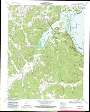
Rockport Topo Map Tennessee
To zoom in, hover over the map of Rockport
USGS Topo Quad 35088h1 - 1:24,000 scale
| Topo Map Name: | Rockport |
| USGS Topo Quad ID: | 35088h1 |
| Print Size: | ca. 21 1/4" wide x 27" high |
| Southeast Coordinates: | 35.875° N latitude / 88° W longitude |
| Map Center Coordinates: | 35.9375° N latitude / 88.0625° W longitude |
| U.S. State: | TN |
| Filename: | o35088h1.jpg |
| Download Map JPG Image: | Rockport topo map 1:24,000 scale |
| Map Type: | Topographic |
| Topo Series: | 7.5´ |
| Map Scale: | 1:24,000 |
| Source of Map Images: | United States Geological Survey (USGS) |
| Alternate Map Versions: |
Rockport TN 1936 Download PDF Buy paper map Rockport TN 1950, updated 1953 Download PDF Buy paper map Rockport TN 1950, updated 1968 Download PDF Buy paper map Rockport TN 1950, updated 1974 Download PDF Buy paper map Rockport TN 1950, updated 1987 Download PDF Buy paper map Rockport TN 2010 Download PDF Buy paper map Rockport TN 2013 Download PDF Buy paper map Rockport TN 2016 Download PDF Buy paper map |
1:24,000 Topo Quads surrounding Rockport
> Back to 35088e1 at 1:100,000 scale
> Back to 35088a1 at 1:250,000 scale
> Back to U.S. Topo Maps home
Rockport topo map: Gazetteer
Rockport: Bars
Duck River Bar elevation 109m 357′Suck Bar elevation 109m 357′
Rockport: Channels
Moore Chute elevation 109m 357′Rockport: Cliffs
McCauleys Bluff elevation 115m 377′Rockport: Crossings
Trotters Ferry (historical) elevation 109m 357′Rockport: Islands
Little Island (historical) elevation 109m 357′Rockport: Populated Places
Birdsong Creek Subdivision elevation 125m 410′Birdsong Heights elevation 122m 400′
Camden Bay Subdivision elevation 129m 423′
Chalklevel elevation 129m 423′
Chaseville elevation 177m 580′
Coxburg elevation 140m 459′
Gismonda elevation 160m 524′
Mount Moriah elevation 122m 400′
Rockport elevation 178m 583′
Wildlife Cove Village elevation 116m 380′
Rockport: Rapids
Duck River Suck elevation 109m 357′Rockport: Streams
Ammon Creek elevation 112m 367′Badger Creek elevation 109m 357′
Baggett Branch elevation 113m 370′
Ballard Branch elevation 109m 357′
Birdsong Creek elevation 109m 357′
Caney Branch elevation 113m 370′
Conley Branch elevation 110m 360′
Coon Creek elevation 116m 380′
Dalton Creek elevation 110m 360′
Green Hatley Branch elevation 110m 360′
Hauk Hatley Branch elevation 110m 360′
Jepp Branch elevation 113m 370′
Little Birdsong Creek elevation 110m 360′
Moore Branch elevation 122m 400′
Turkey Creek elevation 116m 380′
White Branch elevation 116m 380′
York Branch elevation 109m 357′
Rockport: Summits
Tie Hill elevation 161m 528′Rockport: Valleys
Ayres Hollow elevation 124m 406′Capps Hollow elevation 139m 456′
Coldbranch Hollow elevation 109m 357′
Mill Hollow elevation 143m 469′
Reeves Hollow elevation 130m 426′
Stillhouse Hollow elevation 127m 416′
Woods Hollow elevation 136m 446′
Rockport digital topo map on disk
Buy this Rockport topo map showing relief, roads, GPS coordinates and other geographical features, as a high-resolution digital map file on DVD:


