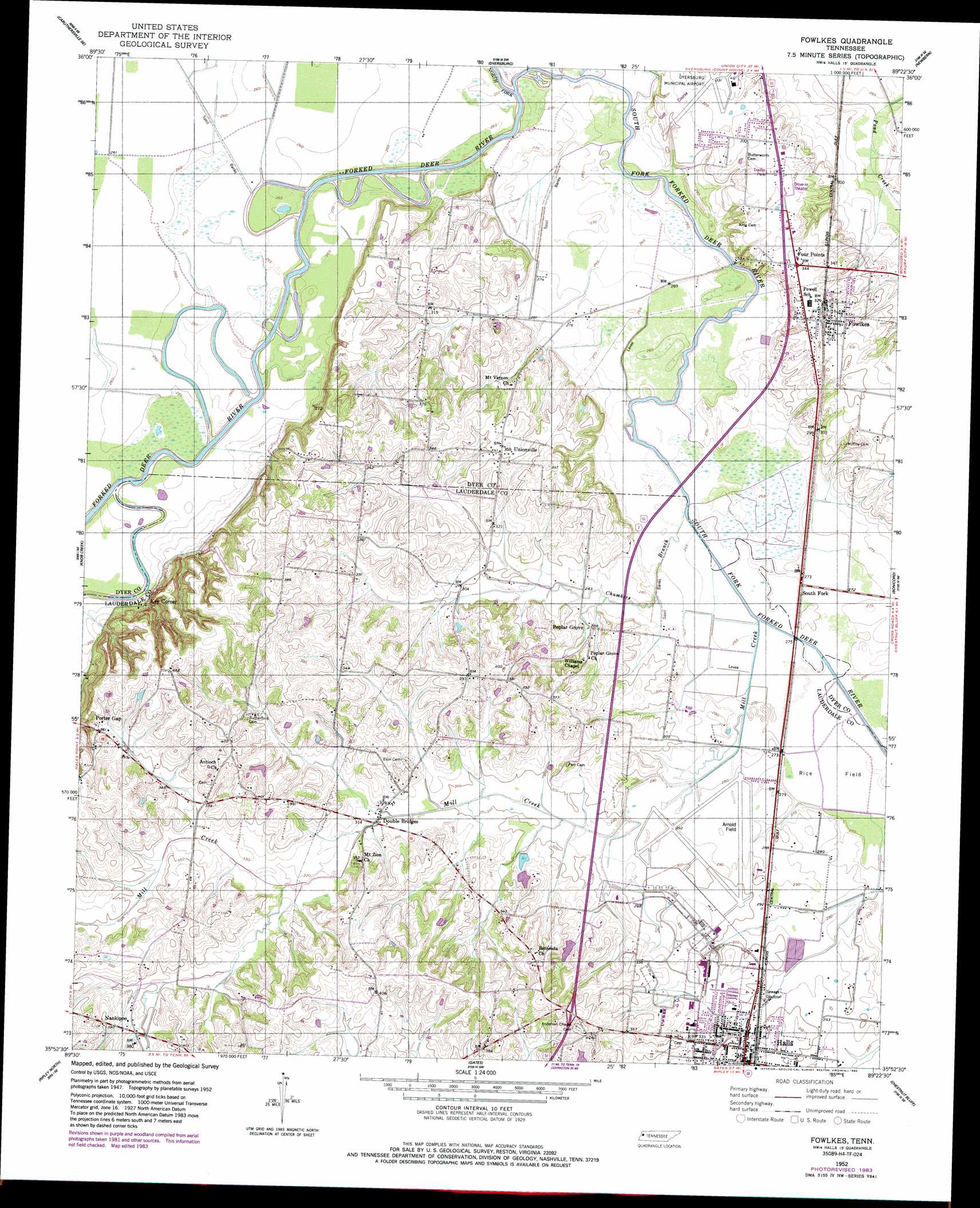
Fowlkes Topo Map Tennessee
To zoom in, hover over the map of Fowlkes
USGS Topo Quad 35089h4 - 1:24,000 scale
| Topo Map Name: | Fowlkes |
| USGS Topo Quad ID: | 35089h4 |
| Print Size: | ca. 21 1/4" wide x 27" high |
| Southeast Coordinates: | 35.875° N latitude / 89.375° W longitude |
| Map Center Coordinates: | 35.9375° N latitude / 89.4375° W longitude |
| U.S. State: | TN |
| Filename: | o35089h4.jpg |
| Download Map JPG Image: | Fowlkes topo map 1:24,000 scale |
| Map Type: | Topographic |
| Topo Series: | 7.5´ |
| Map Scale: | 1:24,000 |
| Source of Map Images: | United States Geological Survey (USGS) |
| Alternate Map Versions: |
Fowlkes TN 1952, updated 1954 Download PDF Buy paper map Fowlkes TN 1952, updated 1984 Download PDF Buy paper map Fowlkes TN 2010 Download PDF Buy paper map Fowlkes TN 2013 Download PDF Buy paper map Fowlkes TN 2016 Download PDF Buy paper map |
1:24,000 Topo Quads surrounding Fowlkes
Caruthersville |
Tennemo |
Miston |
Lane |
Trimble |
Cottonwood Point |
Caruthersville Se |
Dyersburg |
Newbern |
Tatumville |
Chic |
Knob Creek |
Fowlkes |
Bonicord |
Friendship |
Open Lake |
Ripley North |
Gates |
Chestnut Bluff |
Maury City |
Fort Pillow |
Ripley South |
Durhamville |
Tibbs |
Jones |
> Back to 35089e1 at 1:100,000 scale
> Back to 35088a1 at 1:250,000 scale
> Back to U.S. Topo Maps home
Fowlkes topo map: Gazetteer
Fowlkes: Airports
Arnold Field elevation 87m 285′Fowlkes: Bridges
Yellow Bluff Bridge elevation 79m 259′Fowlkes: Cliffs
Yellow Bluff elevation 85m 278′Fowlkes: Islands
Island Number Four (historical) elevation 81m 265′Island Number One (historical) elevation 76m 249′
Island Number Three (historical) elevation 79m 259′
Island Number Two (historical) elevation 78m 255′
Fowlkes: Populated Places
Double Bridges elevation 91m 298′Four Points elevation 105m 344′
Fowlkes elevation 104m 341′
Halls elevation 95m 311′
Key Corner elevation 79m 259′
Poplar Grove elevation 88m 288′
Porter Gap elevation 110m 360′
South Fork elevation 82m 269′
Unionville elevation 108m 354′
Fowlkes: Post Offices
Fowlks Post Office elevation 104m 341′Fowlkes: Streams
Chambers Branch elevation 81m 265′Edwards Creek elevation 76m 249′
Mill Creek elevation 81m 265′
North Fork Forked Deer River elevation 76m 249′
South Fork Forked Deer River elevation 76m 249′
Fowlkes digital topo map on disk
Buy this Fowlkes topo map showing relief, roads, GPS coordinates and other geographical features, as a high-resolution digital map file on DVD: