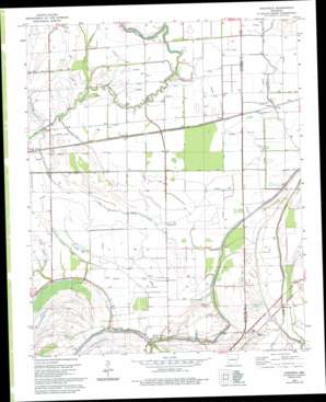
Chatfield Topo Map Arkansas
To zoom in, hover over the map of Chatfield
USGS Topo Quad 35090a4 - 1:24,000 scale
| Topo Map Name: | Chatfield |
| USGS Topo Quad ID: | 35090a4 |
| Print Size: | ca. 21 1/4" wide x 27" high |
| Southeast Coordinates: | 35° N latitude / 90.375° W longitude |
| Map Center Coordinates: | 35.0625° N latitude / 90.4375° W longitude |
| U.S. State: | AR |
| Filename: | o35090a4.jpg |
| Download Map JPG Image: | Chatfield topo map 1:24,000 scale |
| Map Type: | Topographic |
| Topo Series: | 7.5´ |
| Map Scale: | 1:24,000 |
| Source of Map Images: | United States Geological Survey (USGS) |
| Alternate Map Versions: |
Edmondson SW AR 1975, updated 1976 Download PDF Buy paper map Chatfield AR 1981, updated 1982 Download PDF Buy paper map Chatfield AR 1981, updated 1993 Download PDF Buy paper map Chatfield AR 2011 Download PDF Buy paper map Chatfield AR 2014 Download PDF Buy paper map |
1:24,000 Topo Quads surrounding Chatfield
> Back to 35090a1 at 1:100,000 scale
> Back to 35090a1 at 1:250,000 scale
> Back to U.S. Topo Maps home
Chatfield topo map: Gazetteer
Chatfield: Bridges
Myers Bridge elevation 58m 190′Chatfield: Canals
Blackfish Ditch elevation 56m 183′Ditch Number 1 elevation 62m 203′
Ditch Number 18 elevation 61m 200′
Ditch Number 19 elevation 60m 196′
Ditch Number 2 elevation 61m 200′
Ditch Number 20 elevation 62m 203′
Ditch Number 21 elevation 61m 200′
Ditch Number 25 elevation 61m 200′
Ditch Number 3 elevation 62m 203′
Ditch Number 4 elevation 60m 196′
Ditch Number 5 elevation 62m 203′
Ditch Number 6 elevation 62m 203′
Chatfield: Populated Places
Browns elevation 64m 209′Chatfield elevation 64m 209′
Democrat elevation 62m 203′
Greasy Corner elevation 62m 203′
Heth elevation 62m 203′
Jonquil elevation 63m 206′
Mallory Spur elevation 61m 200′
Tarsus elevation 61m 200′
Wildwood elevation 61m 200′
Chatfield: Streams
Dry Bayou elevation 61m 200′Little Rabbit Bayou elevation 56m 183′
Chatfield digital topo map on disk
Buy this Chatfield topo map showing relief, roads, GPS coordinates and other geographical features, as a high-resolution digital map file on DVD:


