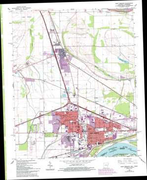
West Memphis Topo Map Arkansas
To zoom in, hover over the map of West Memphis
USGS Topo Quad 35090b2 - 1:24,000 scale
| Topo Map Name: | West Memphis |
| USGS Topo Quad ID: | 35090b2 |
| Print Size: | ca. 21 1/4" wide x 27" high |
| Southeast Coordinates: | 35.125° N latitude / 90.125° W longitude |
| Map Center Coordinates: | 35.1875° N latitude / 90.1875° W longitude |
| U.S. States: | AR, TN |
| Filename: | o35090b2.jpg |
| Download Map JPG Image: | West Memphis topo map 1:24,000 scale |
| Map Type: | Topographic |
| Topo Series: | 7.5´ |
| Map Scale: | 1:24,000 |
| Source of Map Images: | United States Geological Survey (USGS) |
| Alternate Map Versions: |
West Memphis AR 1966, updated 1967 Download PDF Buy paper map West Memphis AR 1966, updated 1974 Download PDF Buy paper map West Memphis AR 1966, updated 1993 Download PDF Buy paper map West Memphis AR 1997, updated 2001 Download PDF Buy paper map West Memphis AR 2011 Download PDF Buy paper map West Memphis AR 2014 Download PDF Buy paper map |
1:24,000 Topo Quads surrounding West Memphis
> Back to 35090a1 at 1:100,000 scale
> Back to 35090a1 at 1:250,000 scale
> Back to U.S. Topo Maps home
West Memphis topo map: Gazetteer
West Memphis: Airports
West Memphis Municipal Airport elevation 66m 216′West Memphis: Canals
Ditch Number 12 elevation 65m 213′Ditch Number 13 elevation 64m 209′
Ditch Number 14 elevation 65m 213′
Ditch Number 15 elevation 63m 206′
Ditch Number 16 elevation 66m 216′
Ditch Number 2 elevation 65m 213′
Ditch Number 4a elevation 64m 209′
Ditch Number 5 elevation 65m 213′
Ditch Number 50 elevation 67m 219′
Ditch Number 5a elevation 65m 213′
Ditch Number 5b elevation 66m 216′
Ditch Number 6 elevation 66m 216′
Ditch Number 9 elevation 67m 219′
Tenmile Bayou Diversion Ditch elevation 66m 216′
West Memphis: Crossings
Interchange 10 elevation 75m 246′Interchange 275 elevation 67m 219′
Interchange 277 elevation 62m 203′
Interchange 278 elevation 66m 216′
Interchange 279 B elevation 66m 216′
Interchange 279A elevation 67m 219′
Interchange 280 elevation 65m 213′
Interchange 281 elevation 67m 219′
Interchange 7 elevation 65m 213′
Interchange 8 elevation 65m 213′
West Memphis: Flats
Lloyd Bottom elevation 67m 219′West Memphis: Lakes
Alligator Lake (historical) elevation 66m 216′Big Lake (historical) elevation 64m 209′
Cypress Lake (historical) elevation 63m 206′
Marion Lake elevation 61m 200′
McCarter Lake elevation 64m 209′
West Memphis: Levees
Head of Vice Presidents Island Dikes (historical) elevation 61m 200′Saint Francis Levee elevation 69m 226′
West Memphis: Parks
Avondale Park elevation 65m 213′Franklin Park elevation 66m 216′
Hicks Park elevation 63m 206′
Hightower Park elevation 65m 213′
Horton Park elevation 66m 216′
Matthews Park elevation 63m 206′
Rowe Park elevation 67m 219′
Tenth Street Mini-Park elevation 67m 219′
Worthington Park elevation 66m 216′
West Memphis: Populated Places
Almont (historical) elevation 66m 216′Bauxippi (historical) elevation 67m 219′
Blanton elevation 64m 209′
Briark elevation 67m 219′
Gammon elevation 67m 219′
Gavin elevation 67m 219′
Harvard elevation 67m 219′
Hulbert elevation 65m 213′
Marion elevation 69m 226′
Mound City elevation 64m 209′
Presley Junction elevation 70m 229′
Sunset elevation 68m 223′
West Memphis elevation 64m 209′
Wylie Spur elevation 66m 216′
West Memphis: Post Offices
West Memphis Post Office elevation 64m 209′West Memphis digital topo map on disk
Buy this West Memphis topo map showing relief, roads, GPS coordinates and other geographical features, as a high-resolution digital map file on DVD:


