Princedale Topo Map Arkansas
To zoom in, hover over the map of Princedale
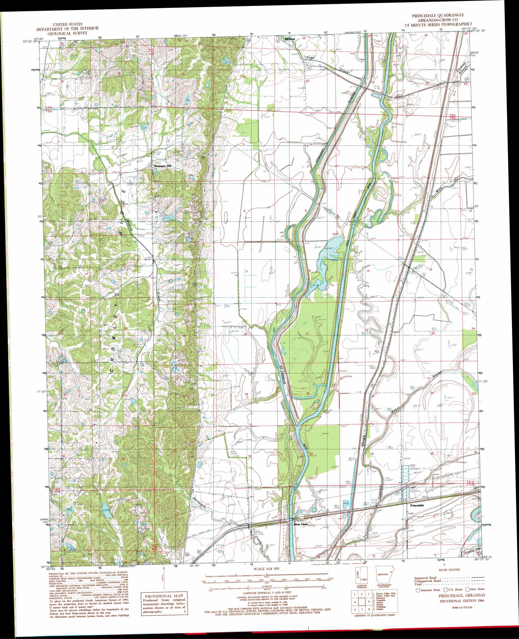
USGS Topo Quad 35090c6 - 1:24,000 scale
| Topo Map Name: | Princedale |
| USGS Topo Quad ID: | 35090c6 |
| Print Size: | ca. 21 1/4" wide x 27" high |
| Southeast Coordinates: | 35.25° N latitude / 90.625° W longitude |
| Map Center Coordinates: | 35.3125° N latitude / 90.6875° W longitude |
| U.S. State: | AR |
| Filename: | o35090c6.jpg |
| Download Map JPG Image: | Princedale topo map 1:24,000 scale |
| Map Type: | Topographic |
| Topo Series: | 7.5´ |
| Map Scale: | 1:24,000 |
| Source of Map Images: | United States Geological Survey (USGS) |
| Alternate Map Versions: |
Princedale AR 1984, updated 1985 Download PDF Buy paper map Princedale AR 2011 Download PDF Buy paper map Princedale AR 2014 Download PDF Buy paper map |
1:24,000 Topo Quads surrounding Princedale
Weiner |
Powers Slough |
Harrisburg |
Mccormick |
Marked Tree |
Hickory Ridge |
Cherry Valley West |
Cherry Valley East |
Monterey |
Joyland |
Central |
Vanndale |
Princedale |
Parkin |
Earle |
Hamlin |
Wynne |
Wittsburg |
Gieseck |
Jeanette |
Hawkins |
Forrest City |
Madison |
Round Pond |
Chatfield |
> Back to 35090a1 at 1:100,000 scale
> Back to 35090a1 at 1:250,000 scale
> Back to U.S. Topo Maps home
Princedale topo map: Gazetteer
Princedale: Canals
Cross County Ditch elevation 59m 193′Princedale: Dams
Robinson Lake Dam elevation 102m 334′Princedale: Populated Places
Pleasant Hill elevation 93m 305′Princedale elevation 64m 209′
River Front elevation 63m 206′
Princedale: Reservoirs
Robinson Lake elevation 102m 334′Princedale: Streams
Bee Tree Slough elevation 63m 206′Lindley Slough elevation 58m 190′
Magot Slough elevation 62m 203′
Pope Creek elevation 57m 187′
Wolf Slough elevation 59m 193′
Princedale digital topo map on disk
Buy this Princedale topo map showing relief, roads, GPS coordinates and other geographical features, as a high-resolution digital map file on DVD: