Joyland Topo Map Arkansas
To zoom in, hover over the map of Joyland
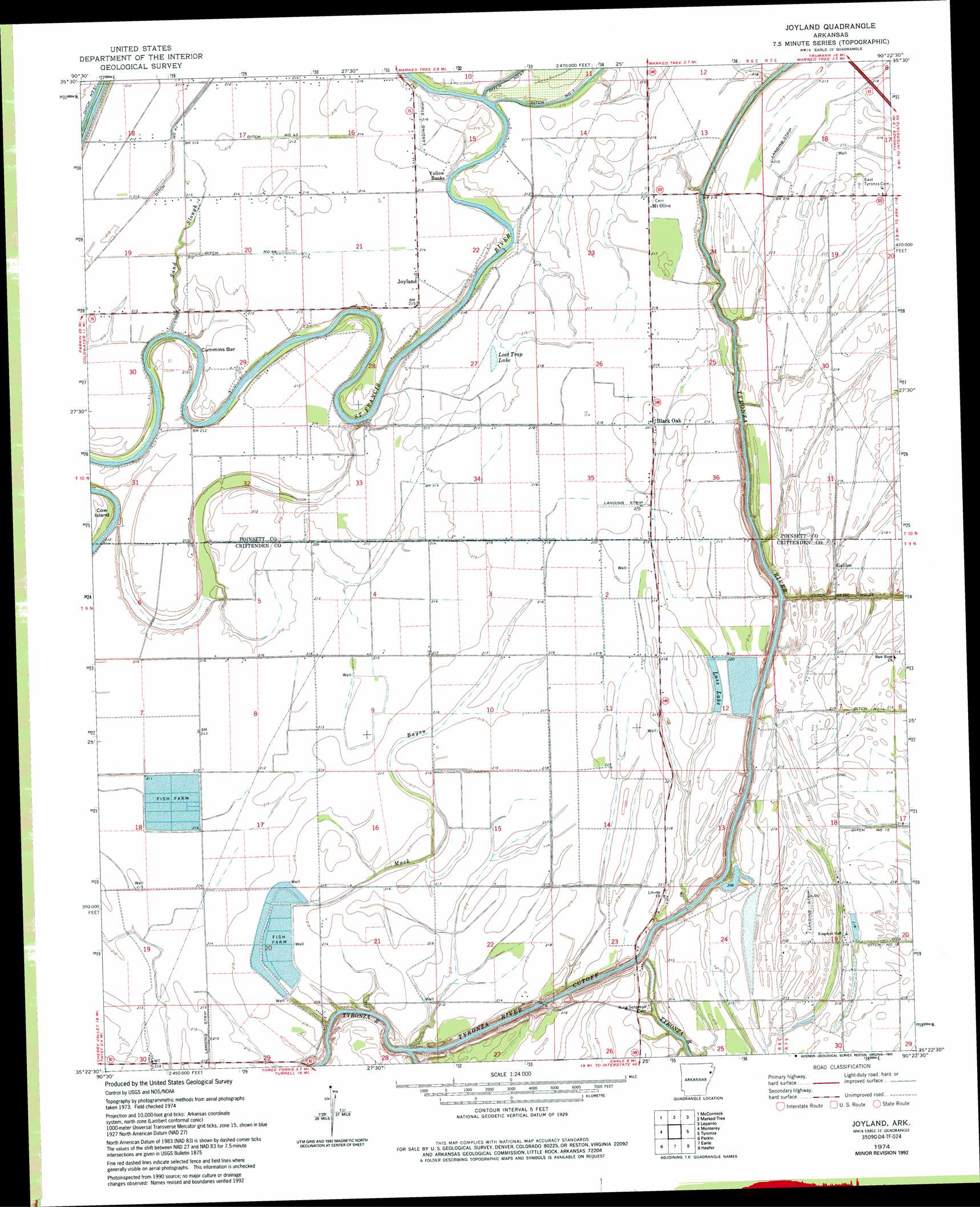
USGS Topo Quad 35090d4 - 1:24,000 scale
| Topo Map Name: | Joyland |
| USGS Topo Quad ID: | 35090d4 |
| Print Size: | ca. 21 1/4" wide x 27" high |
| Southeast Coordinates: | 35.375° N latitude / 90.375° W longitude |
| Map Center Coordinates: | 35.4375° N latitude / 90.4375° W longitude |
| U.S. State: | AR |
| Filename: | o35090d4.jpg |
| Download Map JPG Image: | Joyland topo map 1:24,000 scale |
| Map Type: | Topographic |
| Topo Series: | 7.5´ |
| Map Scale: | 1:24,000 |
| Source of Map Images: | United States Geological Survey (USGS) |
| Alternate Map Versions: |
Joyland AR 1974, updated 1976 Download PDF Buy paper map Joyland AR 1974, updated 1993 Download PDF Buy paper map Joyland AR 2011 Download PDF Buy paper map Joyland AR 2014 Download PDF Buy paper map |
1:24,000 Topo Quads surrounding Joyland
Greenfield |
Trumann |
Hatchie Coon |
Riverdale |
Etowah |
Harrisburg |
Mccormick |
Marked Tree |
Lepanto |
Joiner |
Cherry Valley East |
Monterey |
Joyland |
Tyronza |
Frenchmans Bayou |
Princedale |
Parkin |
Earle |
Heafer |
Jericho |
Wittsburg |
Gieseck |
Jeanette |
Crawfordsville |
West Memphis |
> Back to 35090a1 at 1:100,000 scale
> Back to 35090a1 at 1:250,000 scale
> Back to U.S. Topo Maps home
Joyland topo map: Gazetteer
Joyland: Bars
Cummins Bar elevation 64m 209′Joyland: Bends
Cow Island elevation 61m 200′Tyronza River Cutoff elevation 58m 190′
Joyland: Canals
Ditch Number 14 elevation 61m 200′Ditch Number 15 elevation 63m 206′
Ditch Number 18 elevation 63m 206′
Ditch Number 43 elevation 66m 216′
Ditch Number 44 elevation 64m 209′
Joyland: Lakes
Broad Mouth Lake (historical) elevation 58m 190′Lost Trap Lake elevation 63m 206′
Joyland: Populated Places
Black Oak elevation 67m 219′Galilee elevation 63m 206′
Joyland elevation 66m 216′
Mount Olive elevation 66m 216′
Yellow Banks elevation 68m 223′
Joyland: Reservoirs
Luss Lake elevation 61m 200′Joyland: Streams
Mack Bayou elevation 56m 183′Sand Slough elevation 61m 200′
Joyland digital topo map on disk
Buy this Joyland topo map showing relief, roads, GPS coordinates and other geographical features, as a high-resolution digital map file on DVD: