Cherry Valley East Topo Map Arkansas
To zoom in, hover over the map of Cherry Valley East
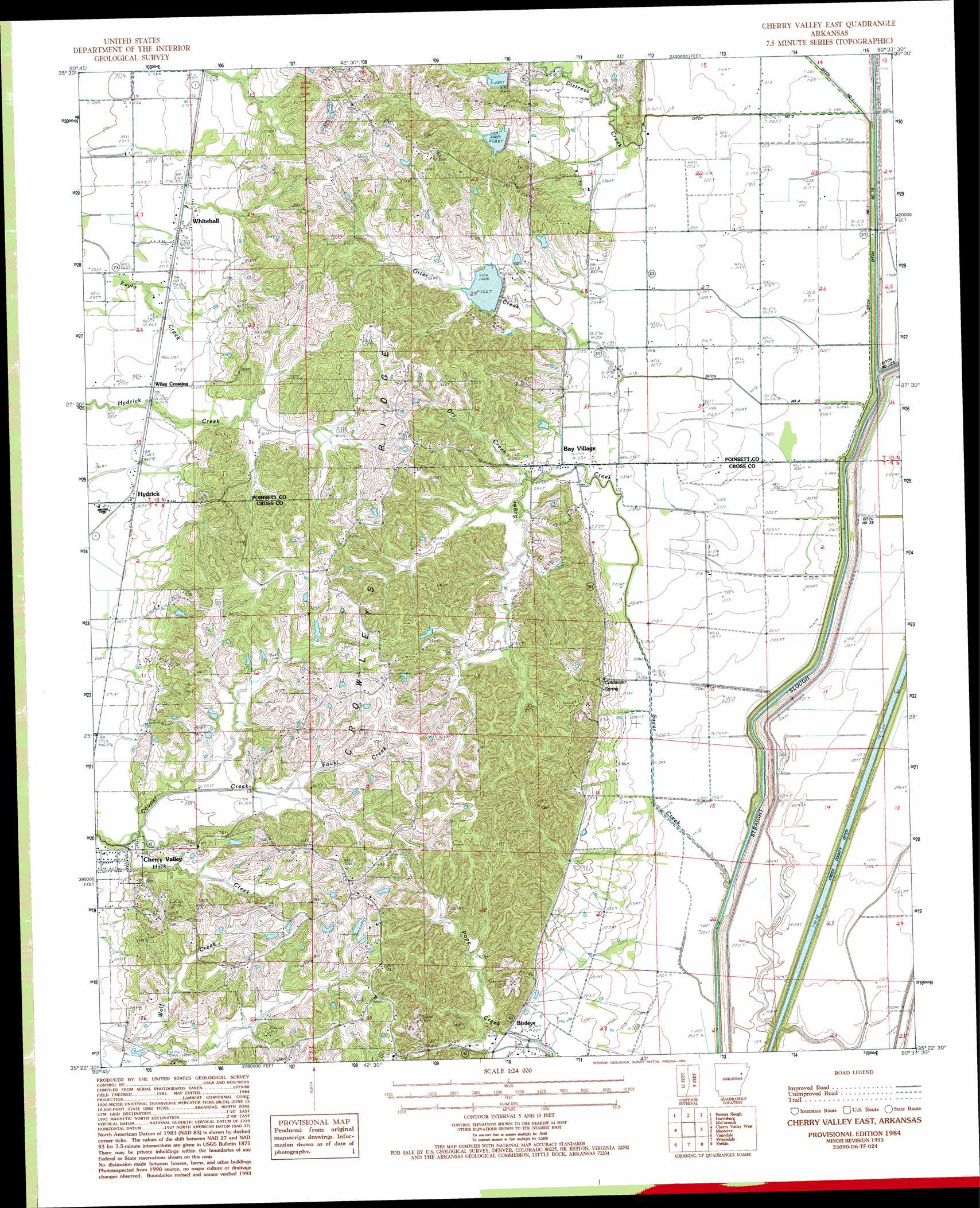
USGS Topo Quad 35090d6 - 1:24,000 scale
| Topo Map Name: | Cherry Valley East |
| USGS Topo Quad ID: | 35090d6 |
| Print Size: | ca. 21 1/4" wide x 27" high |
| Southeast Coordinates: | 35.375° N latitude / 90.625° W longitude |
| Map Center Coordinates: | 35.4375° N latitude / 90.6875° W longitude |
| U.S. State: | AR |
| Filename: | o35090d6.jpg |
| Download Map JPG Image: | Cherry Valley East topo map 1:24,000 scale |
| Map Type: | Topographic |
| Topo Series: | 7.5´ |
| Map Scale: | 1:24,000 |
| Source of Map Images: | United States Geological Survey (USGS) |
| Alternate Map Versions: |
Cherry Valley East AR 1984, updated 1985 Download PDF Buy paper map Cherry Valley East AR 1984, updated 1993 Download PDF Buy paper map Cherry Valley East AR 2011 Download PDF Buy paper map Cherry Valley East AR 2014 Download PDF Buy paper map |
1:24,000 Topo Quads surrounding Cherry Valley East
Risher |
Otwell |
Greenfield |
Trumann |
Hatchie Coon |
Weiner |
Powers Slough |
Harrisburg |
Mccormick |
Marked Tree |
Hickory Ridge |
Cherry Valley West |
Cherry Valley East |
Monterey |
Joyland |
Central |
Vanndale |
Princedale |
Parkin |
Earle |
Hamlin |
Wynne |
Wittsburg |
Gieseck |
Jeanette |
> Back to 35090a1 at 1:100,000 scale
> Back to 35090a1 at 1:250,000 scale
> Back to U.S. Topo Maps home
Cherry Valley East topo map: Gazetteer
Cherry Valley East: Canals
Ditch Number 3 elevation 67m 219′Ditch Number 4 elevation 65m 213′
Straight Slough elevation 54m 177′
Cherry Valley East: Dams
Poinsett Watershed Site 1 Dam elevation 88m 288′Poinsett Watershed Site 101 Dam elevation 81m 265′
Poinsett Watershed Site 102 Dam elevation 96m 314′
Poinsett Watershed Site 2 Dam elevation 95m 311′
Cherry Valley East: Populated Places
Bay Village elevation 74m 242′Birdeye elevation 77m 252′
Hydrick elevation 82m 269′
Whitehall elevation 82m 269′
Wiley Crossing elevation 85m 278′
Cherry Valley East: Post Offices
Birdeye Post Office elevation 73m 239′Cherry Valley East: Reservoirs
Poinsett Watershed Site 101 Reservoir elevation 81m 265′Poinsett Watershed Site 102 Reservoir elevation 96m 314′
Poinsett Watershed Site One Reservoir elevation 88m 288′
Poinsett Watershed Site Two Reservoir elevation 95m 311′
Cherry Valley East: Streams
Cherry Valley Creek elevation 82m 269′Coopey Creek elevation 86m 282′
Distress Creek elevation 68m 223′
Foust Creek elevation 94m 308′
Halk Creek elevation 83m 272′
Otter Creek elevation 72m 236′
Sugar Creek elevation 55m 180′
Cherry Valley East digital topo map on disk
Buy this Cherry Valley East topo map showing relief, roads, GPS coordinates and other geographical features, as a high-resolution digital map file on DVD: