Joiner Topo Map Arkansas
To zoom in, hover over the map of Joiner
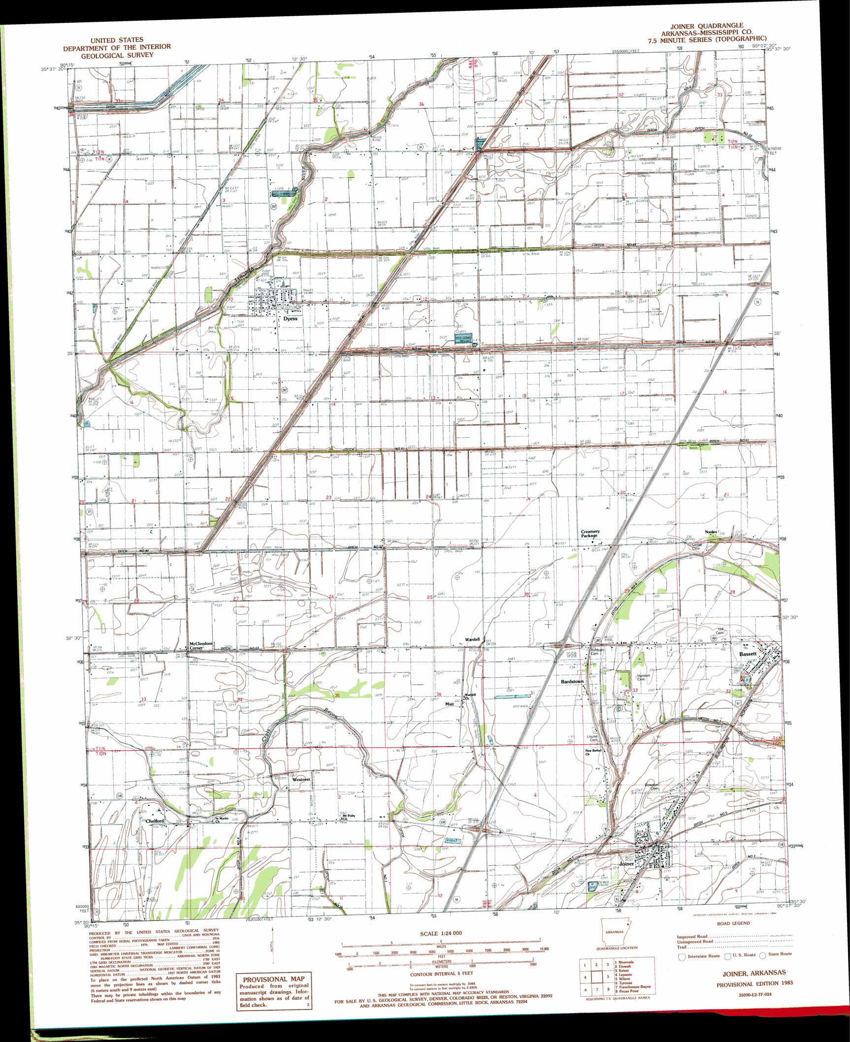
USGS Topo Quad 35090e2 - 1:24,000 scale
| Topo Map Name: | Joiner |
| USGS Topo Quad ID: | 35090e2 |
| Print Size: | ca. 21 1/4" wide x 27" high |
| Southeast Coordinates: | 35.5° N latitude / 90.125° W longitude |
| Map Center Coordinates: | 35.5625° N latitude / 90.1875° W longitude |
| U.S. State: | AR |
| Filename: | o35090e2.jpg |
| Download Map JPG Image: | Joiner topo map 1:24,000 scale |
| Map Type: | Topographic |
| Topo Series: | 7.5´ |
| Map Scale: | 1:24,000 |
| Source of Map Images: | United States Geological Survey (USGS) |
| Alternate Map Versions: |
Joiner AR 1983, updated 1984 Download PDF Buy paper map Joiner AR 2011 Download PDF Buy paper map Joiner AR 2014 Download PDF Buy paper map |
1:24,000 Topo Quads surrounding Joiner
Lake City |
Caraway |
Manila South |
Dell |
Luxora |
Hatchie Coon |
Riverdale |
Etowah |
Keiser |
Osceola |
Marked Tree |
Lepanto |
Joiner |
Wilson |
Nodena |
Joyland |
Tyronza |
Frenchmans Bayou |
Pecan Point |
Drummonds |
Earle |
Heafer |
Jericho |
Locke |
Millington |
> Back to 35090e1 at 1:100,000 scale
> Back to 35090a1 at 1:250,000 scale
> Back to U.S. Topo Maps home
Joiner topo map: Gazetteer
Joiner: Canals
Butler Lake Ditch elevation 65m 213′Ditch Number 13 elevation 66m 216′
Ditch Number 31 elevation 67m 219′
Ditch Number 38 elevation 68m 223′
Ditch Number 40-B elevation 66m 216′
Ditch Number 40-C elevation 63m 206′
Ditch Number 49 elevation 68m 223′
Ditch Number 5 elevation 67m 219′
Ditch Number 50 elevation 65m 213′
Ditch Number 51 elevation 67m 219′
Ditch Number 52 elevation 68m 223′
Ditch Number 53 elevation 67m 219′
Ditch Number 6 elevation 64m 209′
Ditch Number 6 elevation 68m 223′
Ditch Number 6A elevation 67m 219′
Ditch Number 7 elevation 69m 226′
Ditch Number 8 elevation 68m 223′
Joiner: Crossings
Interchange 34 elevation 70m 229′Interchange 36 elevation 71m 232′
Joiner: Populated Places
Bardstown elevation 70m 229′Bassett elevation 71m 232′
Chelford elevation 69m 226′
Dyess elevation 69m 226′
Joiner elevation 71m 232′
McClendons Corner elevation 68m 223′
Muir elevation 69m 226′
Norden elevation 69m 226′
Wardell elevation 67m 219′
Westover elevation 68m 223′
Joiner: Streams
Tyronza Bayou elevation 70m 229′Upper Sandy Bayou elevation 69m 226′
Joiner digital topo map on disk
Buy this Joiner topo map showing relief, roads, GPS coordinates and other geographical features, as a high-resolution digital map file on DVD: