Harrisburg Topo Map Arkansas
To zoom in, hover over the map of Harrisburg
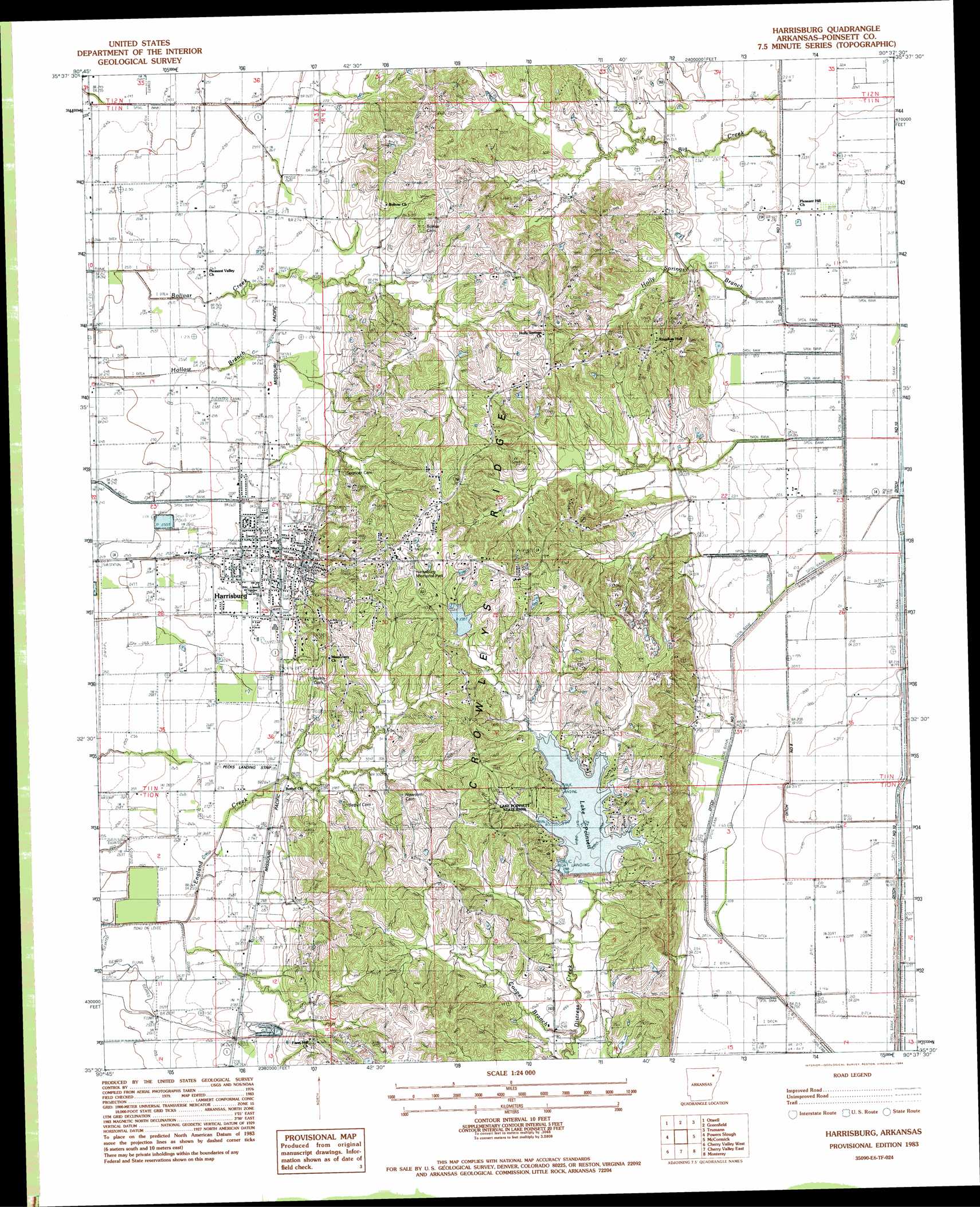
USGS Topo Quad 35090e6 - 1:24,000 scale
| Topo Map Name: | Harrisburg |
| USGS Topo Quad ID: | 35090e6 |
| Print Size: | ca. 21 1/4" wide x 27" high |
| Southeast Coordinates: | 35.5° N latitude / 90.625° W longitude |
| Map Center Coordinates: | 35.5625° N latitude / 90.6875° W longitude |
| U.S. State: | AR |
| Filename: | o35090e6.jpg |
| Download Map JPG Image: | Harrisburg topo map 1:24,000 scale |
| Map Type: | Topographic |
| Topo Series: | 7.5´ |
| Map Scale: | 1:24,000 |
| Source of Map Images: | United States Geological Survey (USGS) |
| Alternate Map Versions: |
Harrisburg AR 1983, updated 1984 Download PDF Buy paper map Harrisburg AR 2011 Download PDF Buy paper map Harrisburg AR 2014 Download PDF Buy paper map |
1:24,000 Topo Quads surrounding Harrisburg
Cash |
Herman |
Jonesboro |
Needham |
Lake City |
Risher |
Otwell |
Greenfield |
Trumann |
Hatchie Coon |
Weiner |
Powers Slough |
Harrisburg |
Mccormick |
Marked Tree |
Hickory Ridge |
Cherry Valley West |
Cherry Valley East |
Monterey |
Joyland |
Central |
Vanndale |
Princedale |
Parkin |
Earle |
> Back to 35090e1 at 1:100,000 scale
> Back to 35090a1 at 1:250,000 scale
> Back to U.S. Topo Maps home
Harrisburg topo map: Gazetteer
Harrisburg: Airports
Pecks Landing Strip elevation 83m 272′Harrisburg: Canals
Ditch Number 1 elevation 65m 213′Ditch Number 2 elevation 65m 213′
Ditch Number 2a elevation 65m 213′
Ditch Number 8 elevation 64m 209′
Ditch Number 83 elevation 65m 213′
Ditch Number 84 elevation 65m 213′
Harrisburg: Dams
Lake Poinsett Dam elevation 92m 301′Paul Senteny Lake Dam elevation 119m 390′
Poinsett Watershed Site 3 Dam elevation 86m 282′
Wayne Carter Lake Dam elevation 102m 334′
Harrisburg: Parks
Lake Poinsett State Park elevation 98m 321′Harrisburg: Populated Places
Harrisburg elevation 92m 301′Whitaker elevation 65m 213′
Harrisburg: Reservoirs
Lake Poinsett elevation 92m 301′Paul Senteny Lake elevation 119m 390′
Poinsett Watershed Site Three Reservoir elevation 86m 282′
Wayne Carter Lake elevation 102m 334′
Harrisburg: Streams
Big Creek elevation 69m 226′Cooper Branch elevation 76m 249′
Holly Springs Branch elevation 69m 226′
Harrisburg digital topo map on disk
Buy this Harrisburg topo map showing relief, roads, GPS coordinates and other geographical features, as a high-resolution digital map file on DVD: